File:CDO Barangays.svg
Jump to navigation
Jump to search

Size of this PNG preview of this SVG file: 616 × 600 pixels. Other resolutions: 247 × 240 pixels | 493 × 480 pixels | 789 × 768 pixels | 1,052 × 1,024 pixels | 2,104 × 2,048 pixels | 1,875 × 1,825 pixels.
Original file (SVG file, nominally 1,875 × 1,825 pixels, file size: 2.27 MB)
Captions
Captions
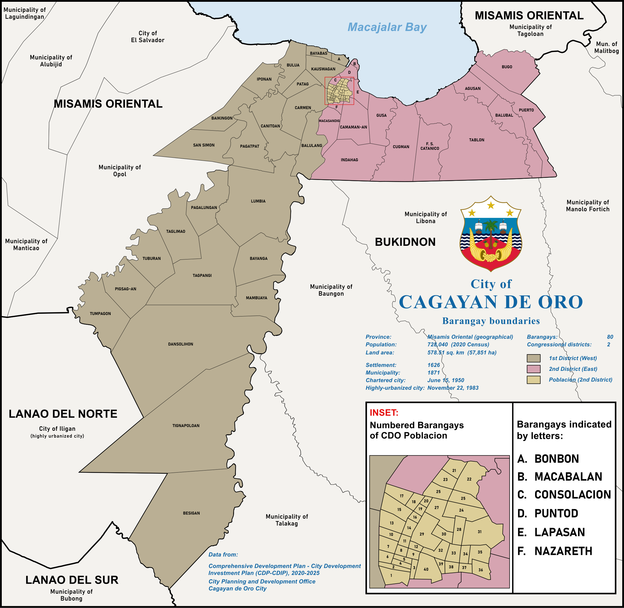
Map of Cagayan de Oro City and constituent Barangays
Summary[edit]
| Description |
English: Map of Cagayan de Oro City and constituent Barangays |
| Date | |
| Source | Derivative of Municipalities of the Philippines (Simplified).svg by User:Chlod. Borders of the City and barangays from Unified Land Information System by the City Planning and Development Office, Cagayan de Oro City |
| Author | Original map file by Chlod. Cagayan de Oro map by Benjiemar Trajan G. Dagala |
.svg)
Licensing[edit]
| This work is in the public domain in the Philippines and possibly other jurisdictions because it is a work created by an officer or employee of the Government of the Philippines or any of its subdivisions and instrumentalities, including government-owned and/or controlled corporations, as part of their regularly prescribed official duties; consequently, any work is ineligible for copyright under the terms of Part IV, Chapter I, Section 171.11 and Part IV, Chapter IV, Section 176 of Republic Act No. 8293 and Republic Act No. 10372, as amended, unless otherwise noted. However, in some instances, the use of this work in the Philippines or elsewhere may be regulated by this law or other laws.
|

|
| This work has been released into the public domain by its author, Trajano Cabrales. This applies worldwide. In some countries this may not be legally possible; if so: |
File history
Click on a date/time to view the file as it appeared at that time.
| Date/Time | Thumbnail | Dimensions | User | Comment | |
|---|---|---|---|---|---|
| current | 04:57, 29 June 2023 | | 1,875 × 1,825 (2.27 MB) | Trajano Cabrales (talk | contribs) | resized to 2000px |
| 17:55, 9 June 2023 |  | 435 × 424 (2.25 MB) | Trajano Cabrales (talk | contribs) | correction - Bonbon instead of Bayabas | |
| 21:01, 7 June 2023 |  | 435 × 424 (2.24 MB) | Trajano Cabrales (talk | contribs) | Uploaded a work by Original map file by Chlod. Cagayan de Oro map by Benjiemar Trajan G. Dagala from Derivative of [https://commons.wikimedia.org/wiki/File:Municipalities_of_the_Philippines_(simplified).svg Municipalities of the Philippines (Simplified).svg] by User:Chlod. Borders of the City and barangays from [https://ulis.cagayandeoro.gov.ph/launch-ulis Unified Land Information System] by the City Planning and Development Office, Cagayan de Oro... |
You cannot overwrite this file.
File usage on Commons
There are no pages that use this file.
File usage on other wikis
The following other wikis use this file:
- Usage on en.wikipedia.org