File:Burgruine Grub II.jpg
Original file (4,500 × 3,000 pixels, file size: 3.24 MB, MIME type: image/jpeg)
Captions
Summary
[edit]DescriptionBurgruine Grub II.jpg |
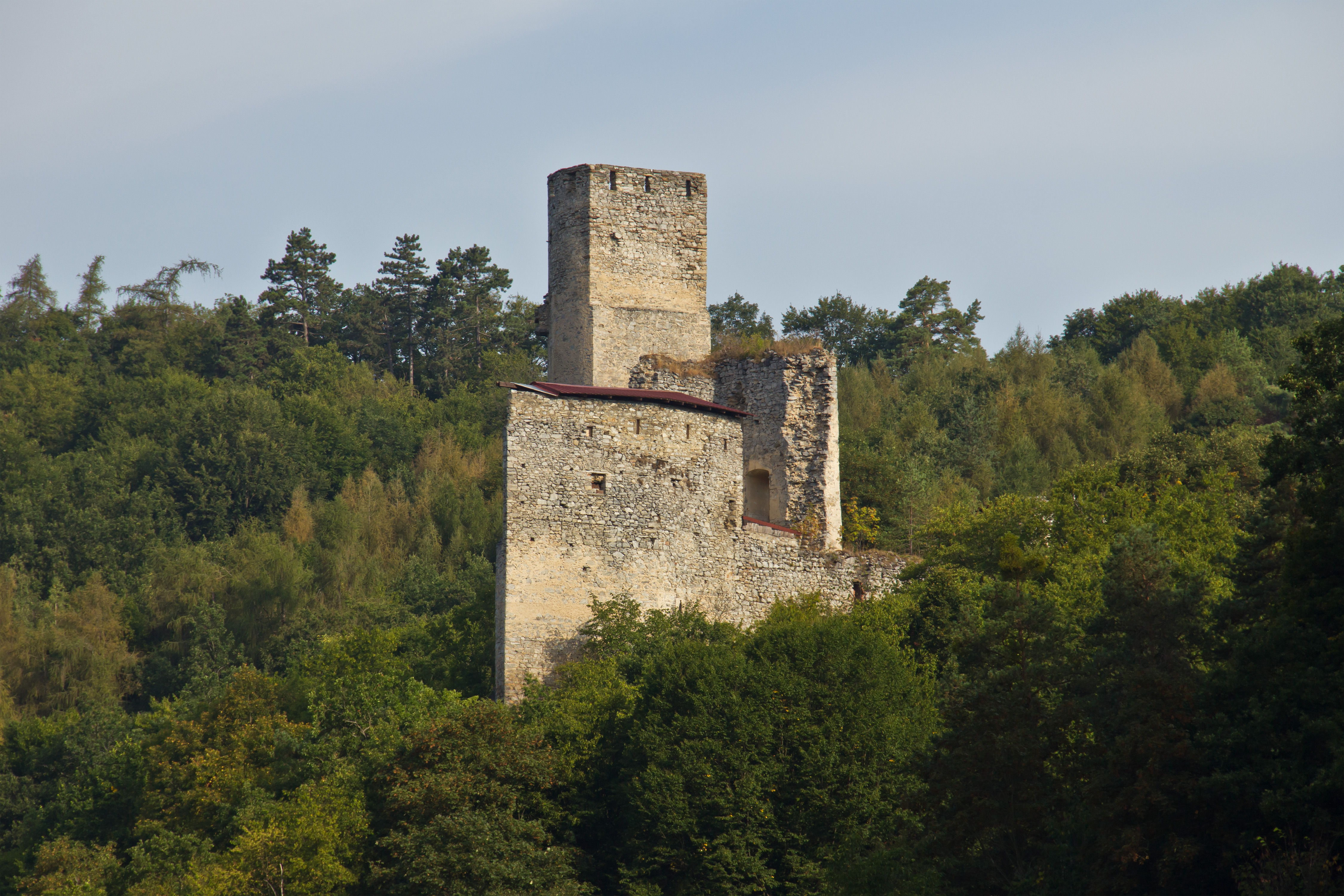
Deutsch: Die über den Tälern der Großen Taffa und des Farnbaches erhöht auf dem nach drei Seiten abfallenden Gelände gelegene Burg wurde 1767 zerstört. |
Date | |
Source | Own work |
Author | Duke of W4 |
Camera location | 48° 42′ 33.34″ N, 15° 30′ 29.72″ E | View this and other nearby images on: OpenStreetMap | 48.709260; 15.508256 |
---|
Object location | 48° 42′ 42.16″ N, 15° 30′ 21.2″ E | View this and other nearby images on: OpenStreetMap | 48.711710; 15.505890 |
---|
Licensing
[edit]- You are free:
- to share – to copy, distribute and transmit the work
- to remix – to adapt the work
- Under the following conditions:
- attribution – You must give appropriate credit, provide a link to the license, and indicate if changes were made. You may do so in any reasonable manner, but not in any way that suggests the licensor endorses you or your use.
- share alike – If you remix, transform, or build upon the material, you must distribute your contributions under the same or compatible license as the original.
This image was uploaded as part of Wiki Loves Monuments 2013.
Afrikaans ∙ Alemannisch ∙ azərbaycanca ∙ Bahasa Indonesia ∙ Bahasa Melayu ∙ Bikol Central ∙ bosanski ∙ brezhoneg ∙ català ∙ čeština ∙ Cymraeg ∙ dansk ∙ davvisámegiella ∙ Deutsch ∙ eesti ∙ English ∙ español ∙ Esperanto ∙ euskara ∙ français ∙ Frysk ∙ Gaeilge ∙ galego ∙ hrvatski ∙ Ido ∙ italiano ∙ latviešu ∙ Lëtzebuergesch ∙ Malagasy ∙ magyar ∙ Malti ∙ Nederlands ∙ norsk ∙ norsk nynorsk ∙ norsk bokmål ∙ polski ∙ português ∙ português do Brasil ∙ română ∙ shqip ∙ sicilianu ∙ slovenčina ∙ slovenščina ∙ suomi ∙ svenska ∙ Tagalog ∙ Türkçe ∙ Yorùbá ∙ Zazaki ∙ Ελληνικά ∙ беларуская ∙ беларуская (тарашкевіца) ∙ български ∙ кыргызча ∙ македонски ∙ русский ∙ српски / srpski ∙ українська ∙ ქართული ∙ հայերեն ∙ नेपाली ∙ हिन्दी ∙ বাংলা ∙ മലയാളം ∙ ไทย ∙ 한국어 ∙ +/− |
File history
Click on a date/time to view the file as it appeared at that time.
Date/Time | Thumbnail | Dimensions | User | Comment | |
---|---|---|---|---|---|
current | 13:54, 11 September 2013 | 4,500 × 3,000 (3.24 MB) | Duke of W4 (talk | contribs) | User created page with UploadWizard |
You cannot overwrite this file.
File usage on Commons
The following 3 pages use this file:
File usage on other wikis
The following other wikis use this file:
- Usage on cs.wikipedia.org
- Usage on de.wikipedia.org
- Usage on en.wikipedia.org
- Usage on www.wikidata.org
Metadata
This file contains additional information such as Exif metadata which may have been added by the digital camera, scanner, or software program used to create or digitize it. If the file has been modified from its original state, some details such as the timestamp may not fully reflect those of the original file. The timestamp is only as accurate as the clock in the camera, and it may be completely wrong.
Camera manufacturer | Canon |
---|---|
Camera model | Canon EOS 60D |
Author | Duke of W4 |
Exposure time | 1/250 sec (0.004) |
F-number | f/7.1 |
ISO speed rating | 100 |
Date and time of data generation | 08:51, 22 August 2013 |
Lens focal length | 113 mm |
Latitude | 48° 42′ 33.33″ N |
Longitude | 15° 30′ 29.72″ E |
Altitude | 433 meters above sea level |
Orientation | Normal |
Horizontal resolution | 240 dpi |
Vertical resolution | 240 dpi |
Software used | Adobe Photoshop Elements 8.0 Windows |
File change date and time | 16:55, 29 August 2013 |
Exposure Program | Normal program |
Exif version | 2.3 |
Date and time of digitizing | 08:51, 22 August 2013 |
APEX shutter speed | 7.965784 |
APEX aperture | 5.655638 |
APEX exposure bias | 0 |
Maximum land aperture | 5 APEX (f/5.66) |
Metering mode | Pattern |
Flash | Flash did not fire, compulsory flash suppression |
DateTime subseconds | 06 |
DateTimeOriginal subseconds | 06 |
DateTimeDigitized subseconds | 06 |
Color space | sRGB |
Focal plane X resolution | 5,728.1767955801 |
Focal plane Y resolution | 5,808.4033613445 |
Focal plane resolution unit | inches |
Custom image processing | Normal process |
Exposure mode | Auto exposure |
White balance | Manual white balance |
Scene capture type | Standard |
GPS time (atomic clock) | 06:49 |
Geodetic survey data used | WGS-84 |
GPS date | 22 August 2013 |
GPS tag version | 0.0.2.2 |
Lens used | EF-S18-135mm f/3.5-5.6 IS |
Serial number of camera | 1380948212 |
Image width | 4,500 px |
Image height | 3,000 px |
Subject distance | 4,294,967,295 meters |
Date metadata was last modified | 18:55, 29 August 2013 |
Unique ID of original document | xmp.did:5FC49887BA10E311AF45A88F2270CE3F |
IIM version | 47,264 |
Structured data
22 August 2013
48°42'33.33438"N, 15°30'29.72254"E
48°42'42.16"N, 15°30'21.20"E
image/jpeg
c855351b8f2d4ba3e521de8f053f2d65a23cc8c6
3,398,797 byte
3,000 pixel
4,500 pixel
- Cultural heritage monuments in Austria with known IDs
- CC-BY-SA-3.0-AT
- Self-published work
- Images from Wiki Loves Monuments 2013
- Images from Wiki Loves Monuments 2013 in Austria
- Cultural heritage monuments in Austria check done
- Uploaded via Campaign:wlm-at
- Austria photographs taken on 2013-08-22
- Pages with maps