File:BricktownBallparksatUSGS.png
Jump to navigation
Jump to search

Size of this preview: 800 × 527 pixels. Other resolutions: 320 × 211 pixels | 640 × 421 pixels | 992 × 653 pixels.
Original file (992 × 653 pixels, file size: 843 KB, MIME type: image/png)
Captions
Captions
Add a one-line explanation of what this file represents
Summary[edit]
| Description |
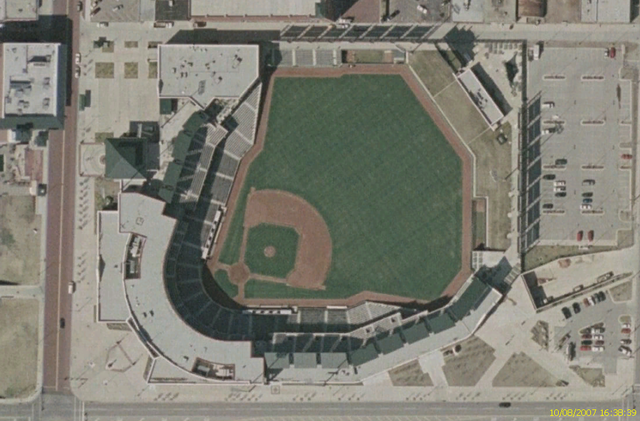
Image satellite USGS du Bricktown Park de Oklahoma City (année 2002) SourceImage satellite USGS Urban Area prise sur Nasa World Wind |
| Source | Satellite imagery taken from NASA World Wind software (by screenshot) |
| Author | Photograph: NASA |
Licensing[edit]
| This image is in the public domain because it is a screenshot from NASA’s globe software World Wind using a public domain layer, such as Blue Marble, MODIS, Landsat, SRTM, USGS or GLOBE.
|
 |
Original upload log[edit]
The original description page was here. All following user names refer to fr.wikipedia.
- 2007-08-10 15:04 Betp 992×653×8 (863142 bytes) Image satellite USGS du Bricktown Park de Oklahoma City (année 2002) ==Source== Image satellite USGS Urban Area prise sur Nasa World Wind ==Licence== {{Domaine public NASA}}
File history
Click on a date/time to view the file as it appeared at that time.
| Date/Time | Thumbnail | Dimensions | User | Comment | |
|---|---|---|---|---|---|
| current | 20:52, 11 August 2007 | | 992 × 653 (843 KB) | Poulos~commonswiki (talk | contribs) | {{Information |Description=Image satellite USGS du Bricktown Park de Oklahoma City (année 2002) ==Source== Image satellite USGS Urban Area prise sur Nasa World Wind |Source=Originally from [http://fr.wikipedia.org fr.wikipedia]; description page is/was |
You cannot overwrite this file.
File usage on Commons
There are no pages that use this file.
File usage on other wikis
The following other wikis use this file:
- Usage on fr.wikipedia.org