File:Bretagne.svg
Jump to navigation
Jump to search

Size of this PNG preview of this SVG file: 650 × 500 pixels. Other resolutions: 312 × 240 pixels | 624 × 480 pixels | 999 × 768 pixels | 1,280 × 985 pixels | 2,560 × 1,969 pixels.
Original file (SVG file, nominally 650 × 500 pixels, file size: 364 KB)
Captions
Captions
Add a one-line explanation of what this file represents
Summary[edit]
| Description |
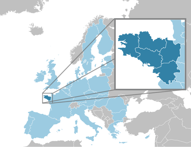
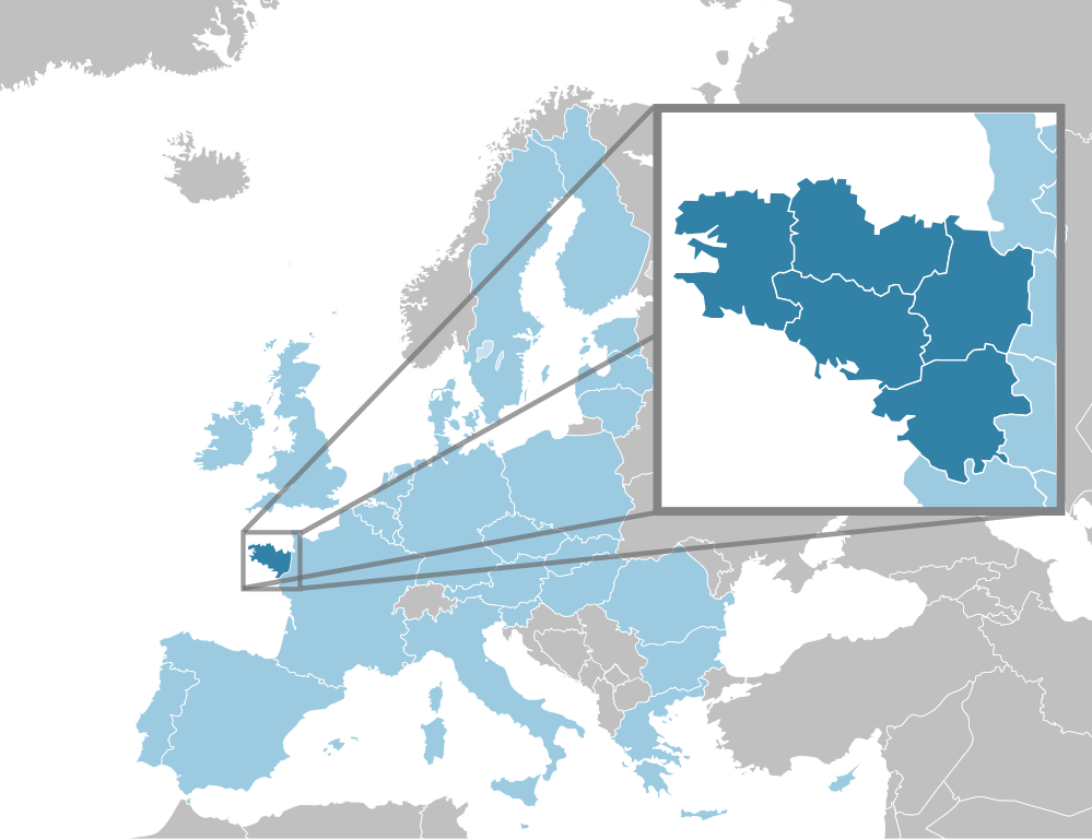
Français : Localisation de la Bretagne (région historique) en France |
|||||
| Date | ||||||
| Source | Own work | |||||
| Author |
|

File history
Click on a date/time to view the file as it appeared at that time.
| Date/Time | Thumbnail | Dimensions | User | Comment | |
|---|---|---|---|---|---|
| current | 13:19, 17 June 2010 | | 650 × 500 (364 KB) | GwenofGwened (talk | contribs) | couleurs |
| 00:00, 17 June 2010 |  | 650 × 500 (364 KB) | GwenofGwened (talk | contribs) | {{Information |Description={{fr|1=Localisation de la Bretagne (région historique) en France}} |Source={{own}} |Author=GwenofGwened |Date=16/06/2010 |Permission= |other_versions= }} Category:Maps of Bretagne |
You cannot overwrite this file.
File usage on Commons
The following page uses this file:
File usage on other wikis
The following other wikis use this file:
- Usage on eu.wikipedia.org
- Usage on fo.wikipedia.org
- Usage on fr.wikiversity.org
- Usage on gl.wikipedia.org
- Usage on ko.wikipedia.org
- Usage on la.wikipedia.org
- Usage on nds-nl.wikipedia.org
- Usage on pl.wikipedia.org
- Usage on wa.wikipedia.org
- Usage on zh.wikipedia.org