File:Bluegreen-shale-335x-scalebar.jpg
Jump to navigation
Jump to search

Size of this preview: 738 × 600 pixels. Other resolutions: 295 × 240 pixels | 591 × 480 pixels | 945 × 768 pixels | 1,260 × 1,024 pixels | 1,600 × 1,300 pixels.
Original file (1,600 × 1,300 pixels, file size: 1.14 MB, MIME type: image/jpeg)
Captions
Captions
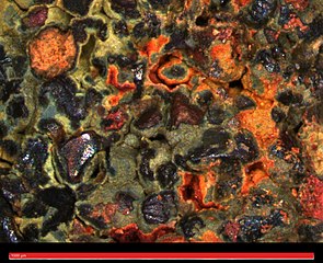
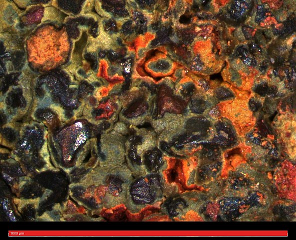
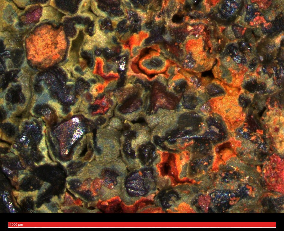
Blue-green shale from the Cretaceous period Coleraine formation in Minnesota.
Summary[edit]
| Description |
English: Blue-green shale from the Coleraine formation is a fine mixture of hematite and limonite in a greenish iron-clay matrix. The Coleraine formation is a Cretaceous period geological formation in Minnesota that contains sediments and fossils from the Western Interior Seaway approximately 90 million years ago. This layer was exposed by iron mining on the Mesabi Iron Range. This rock was found in Hill Annex Mine State Park in Calumet, MN. The image was taken with a ZEISS Smartzoom 5 microscope at 335X magnification using extended depth of field. |
| Date | |
| Source | Own work |
| Author | Rylan Bachman |
| Camera location | | View this and other nearby images on: OpenStreetMap |
|---|
Licensing[edit]
I, the copyright holder of this work, hereby publish it under the following license:
This file is licensed under the Creative Commons Attribution 4.0 International license.
- You are free:
- to share – to copy, distribute and transmit the work
- to remix – to adapt the work
- Under the following conditions:
- attribution – You must give appropriate credit, provide a link to the license, and indicate if changes were made. You may do so in any reasonable manner, but not in any way that suggests the licensor endorses you or your use.
| This image was uploaded as part of Wiki Science Competition 2019. |
File history
Click on a date/time to view the file as it appeared at that time.
| Date/Time | Thumbnail | Dimensions | User | Comment | |
|---|---|---|---|---|---|
| current | 22:25, 6 December 2019 | | 1,600 × 1,300 (1.14 MB) | Wi-kiry-lan (talk | contribs) | User created page with UploadWizard |
You cannot overwrite this file.
File usage on Commons
There are no pages that use this file.