File:Blank California Map TIGER2010.svg

From Wikimedia Commons, the free media repository
Jump to navigation Jump to search

Original file(SVG file, nominally 630 × 722 pixels, file size: 4.05 MB)

Captions

Captions

Add a one-line explanation of what this file represents

Summary[edit]

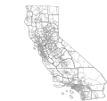
Description Blank political map of the US state of California. It includes the state boundaries, Metropolitan/Micropolitan Statistical Areas, Combined Statistical Areas, counties, county subdivisions, and incorporated and census designated places as recognized by the United States Census Bureau TIGER/Line for 2010. Uses a NAD83 California Teale Albers projection.
Date
Source United States Census Bureau TIGER/Line 2010
Author int21h
Permission
(Reusing this file)
This work is ineligible for copyright and therefore in the public domain because it consists entirely of information that is common property and contains no original authorship.
Public domain
This image or file is a work of a United States Census Bureau employee, taken or made as part of that person's official duties. As a work of the U.S. federal government, the image is in the public domain.

English  español  日本語  македонски  മലയാളം  português do Brasil  русский  українська  +/−

File history

Click on a date/time to view the file as it appeared at that time.

Date/TimeThumbnailDimensionsUserComment
current07:31, 20 August 2011Thumbnail for version as of 07:31, 20 August 2011630 × 722 (4.05 MB)Int21h (talk | contribs)Crop canvas with Inkscape.
05:25, 20 August 2011Thumbnail for version as of 05:25, 20 August 2011968 × 791 (7.45 MB)Int21h (talk | contribs)Repositioned with more SVG parameters.
05:09, 20 August 2011Thumbnail for version as of 05:09, 20 August 2011512 × 512 (7.51 MB)Int21h (talk | contribs)== {{int:filedesc}} == {{Information |Description=Blank political map of the US state of California. It includes the state boundaries, Metropolitan/Micropolitan Statistical Areas, Combined Statistical Areas, counties, county subdivisions, and incorporated

There are no pages that use this file.