File:Bishopric of Strasbourg 1547.png

Bishopric_of_Strasbourg_1547.png (536 × 522 pixels, file size: 599 KB, MIME type: image/png)
Captions
Captions
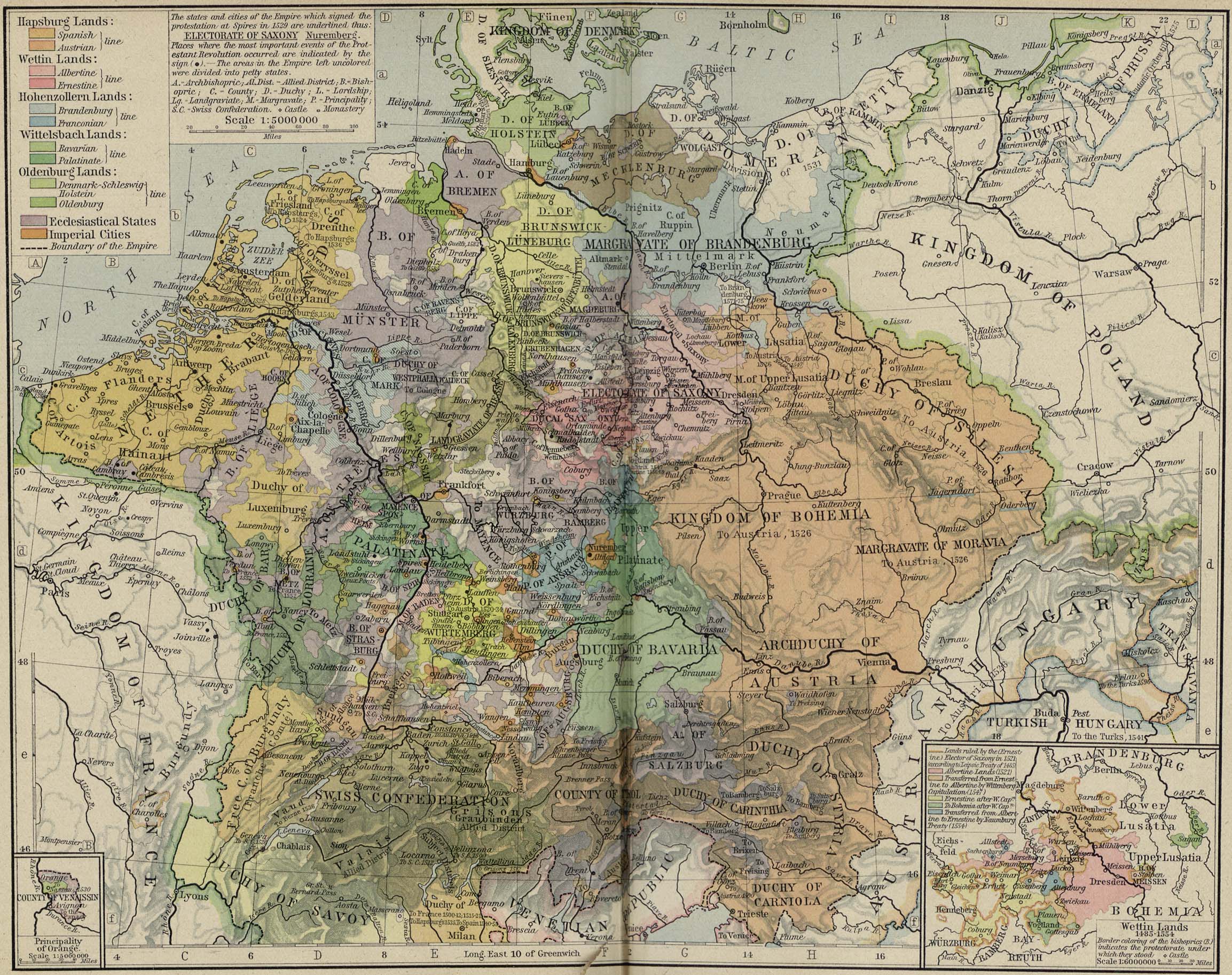
| Description | Modern map showing the Bishopric of Strasbourg and part of the Rhineland circa 1547 | ||||||
| Date | (UTC) | ||||||
| Source | Cropped from Central Europe about 1547, from The Historical Atlas by William R. Shepherd, 1923 | ||||||
| Author | OwenBlacker | ||||||
| Permission (Reusing this file) |
|
||||||
File history
Click on a date/time to view the file as it appeared at that time.
| Date/Time | Thumbnail | Dimensions | User | Comment | |
|---|---|---|---|---|---|
| current | 12:22, 16 September 2007 | | 536 × 522 (599 KB) | OwenBlacker (talk | contribs) | {{Information |Description=Map of the w:Bishopric of Strasbourg, circa 1547 |Source=Cropped from [http://www.lib.utexas.edu/maps/historical/shepherd/central_europe_1547.jpg Central Europe about 1547], from ''The Historical Atlas'' by William R. Sheph |
You cannot overwrite this file.
File usage on Commons
The following 2 pages use this file:
File usage on other wikis
The following other wikis use this file:
- Usage on ca.wikipedia.org
- Usage on cs.wikipedia.org
- Usage on de.wikipedia.org
- Usage on en.wikipedia.org
- Usage on es.wikipedia.org
- Usage on fr.wikipedia.org
- Usage on he.wikipedia.org
- Usage on it.wikipedia.org
- Usage on ru.wikipedia.org
- Usage on sh.wikipedia.org
- Usage on vi.wikipedia.org
- Usage on www.wikidata.org