File:BildFrankfurt-Ravenstein1861-Bl5-Crop-Hohenstauffenmauer.jpg
Original file (4,000 × 2,814 pixels, file size: 4.79 MB, MIME type: image/jpeg)
Captions
Captions
Summary[edit]
|
|

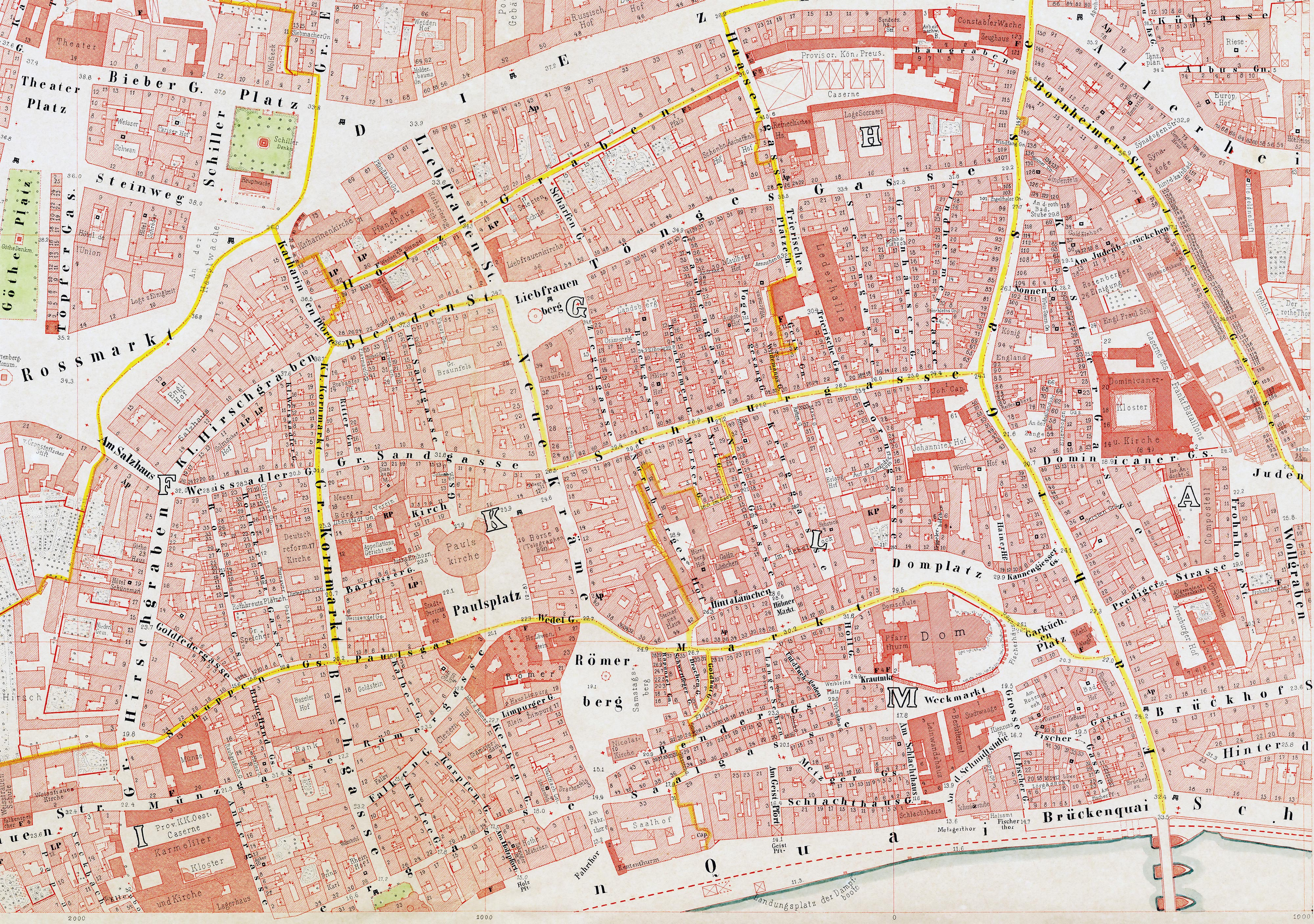
Historische Pläne von Frankfurt am Main · Historic maps of Frankfurt
Diese Darstellung stammt aus · This image is taken from
Ravenstein (1862)
Friedrich August Ravenstein: August Ravensteins Geometrischer Plan von Frankfurt am Main
| August Ravenstein
(1809–1881) |
|||
|---|---|---|---|
 |
|||
| Description | German cartographer and publisher | ||
| Date of birth/death |
4 December 1809 |
30 July 1881 | |
| Location of birth/death | Frankfurt | Frankfurt | |
| Work location | |||
| Authority file | |||
Licensing:[edit]
|
This is a faithful photographic reproduction of a two-dimensional, public domain work of art. The work of art itself is in the public domain for the following reason:
The official position taken by the Wikimedia Foundation is that "faithful reproductions of two-dimensional public domain works of art are public domain".
This photographic reproduction is therefore also considered to be in the public domain in the United States. In other jurisdictions, re-use of this content may be restricted; see Reuse of PD-Art photographs for details. | ||||
File history
Click on a date/time to view the file as it appeared at that time.
| Date/Time | Thumbnail | Dimensions | User | Comment | |
|---|---|---|---|---|---|
| current | 21:57, 21 April 2007 | | 4,000 × 2,814 (4.79 MB) | Mylius (talk | contribs) | |
| 21:01, 29 August 2006 |  | 4,000 × 2,828 (4.9 MB) | Mylius (talk | contribs) | == Beschreibung == {{User:Magadan/Text | BESCHR_DE = Wesentlicher Teil der ehemaligen Frankfurter Altstadt innerhalb des Bereichs der Hohenstauffenmauer. Die Kartengrundlage (Ravensteinplan, 1861) ist gemeinfrei. Neuer Scan des Plans |
You cannot overwrite this file.
File usage on Commons
The following 3 pages use this file:
File usage on other wikis
The following other wikis use this file:
- Usage on nl.wikipedia.org