File:Bellingshausen Sea shaded, with the BAT.svg
Jump to navigation
Jump to search

Size of this PNG preview of this SVG file: 486 × 484 pixels. Other resolutions: 241 × 240 pixels | 482 × 480 pixels | 771 × 768 pixels | 1,028 × 1,024 pixels | 2,056 × 2,048 pixels.
Original file (SVG file, nominally 486 × 484 pixels, file size: 4.77 MB)
Captions
Captions
Add a one-line explanation of what this file represents
Summary[edit]
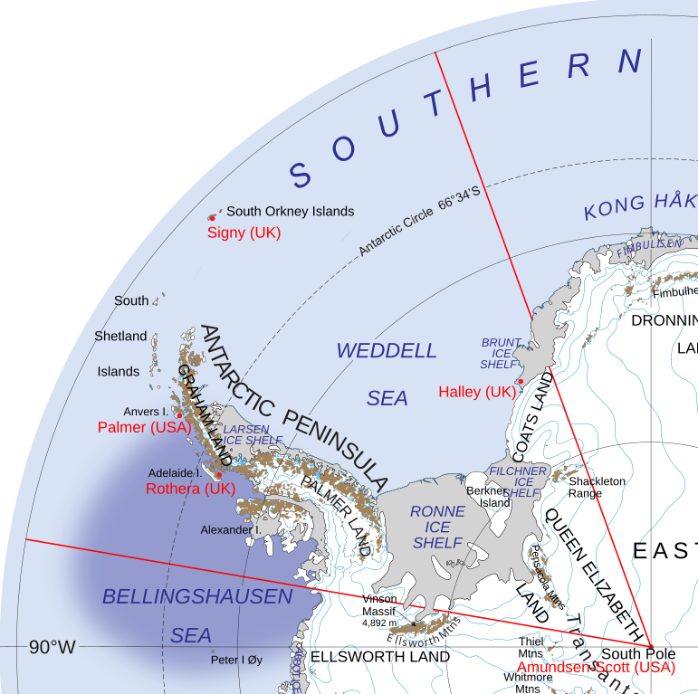
| Description | The Bellinghausen Sea, shaded and with draft limits of the IHO o a map of the British Antarctic Territory | |||||
| Date | ||||||
| Source |
Draft IHO limits of Bellingshausen Sea (page 13–14) File:Map of Queen Elizabeth Land, BAT.svg |
|||||
| Author | Hogweard | |||||
| Permission (Reusing this file) |
|

File history
Click on a date/time to view the file as it appeared at that time.
| Date/Time | Thumbnail | Dimensions | User | Comment | |
|---|---|---|---|---|---|
| current | 20:00, 25 January 2020 | | 486 × 484 (4.77 MB) | Hogweard (talk | contribs) | Typo |
| 22:56, 22 January 2020 |  | 486 × 484 (4.99 MB) | Hogweard (talk | contribs) | {{Information |description=The Bellinghausen Sea, shaded, showing the British Antarctic Territory |date=2020-01-22 |source={{f|Map of Queen Elizabeth Land, BAT.svg}} |author={{u|Hogweard}} |permission={{PD-USGov-NASA}} |other_versions= |other_fields= }} Category:Maps of the British Antarctic Territory Category:Bellingshausen Sea |
You cannot overwrite this file.
File usage on Commons
The following 3 pages use this file:
File usage on other wikis
The following other wikis use this file:
- Usage on frr.wikipedia.org