File:BelgiumGeography.png
Jump to navigation
Jump to search
No higher resolution available.
BelgiumGeography.png (330 × 275 pixels, file size: 148 KB, MIME type: image/png)
Captions
Captions
Add a one-line explanation of what this file represents
| Description |
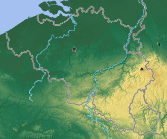
Deutsch: Reliefkarte von Belgien (Basis) English: Relief map of Belgium (base map) Français : Relief de la Belgique (carte de base) |
| Date | (UTC) |
| Source | |
| Author | derived by Knoppen |
| This is a retouched picture, which means that it has been digitally altered from its original version. Modifications: Merged both files to show the two main rivers (Schelde, Maas), the highest point (Botrange) and the capital Brussels. The original can be viewed here: BE-REDU-map.png:
|

|
Permission is granted to copy, distribute and/or modify this document under the terms of the GNU Free Documentation License, Version 1.2 or any later version published by the Free Software Foundation; with no Invariant Sections, no Front-Cover Texts, and no Back-Cover Texts. A copy of the license is included in the section entitled GNU Free Documentation License. |
| This file is licensed under the Creative Commons Attribution-Share Alike 3.0 Unported license. | ||
| ||
| This licensing tag was added to this file as part of the GFDL licensing update. |
Original upload log[edit]
This image is a derivative work of the following images:
- Image:Belgium_relief.png licensed with GFDL
- Image:Be-map.png licensed with PD-USGov-CIA-WF
Uploaded with derivativeFX
File history
Click on a date/time to view the file as it appeared at that time.
| Date/Time | Thumbnail | Dimensions | User | Comment | |
|---|---|---|---|---|---|
| current | 16:31, 19 October 2008 | | 330 × 275 (148 KB) | Knoppen~commonswiki (talk | contribs) | {{Information |Description= |Source= |Date= |Author= |Permission= |other_versions= }} |
| 16:23, 19 October 2008 |  | 768 × 640 (900 KB) | Knoppen~commonswiki (talk | contribs) | {{Information |Description={{en|Relief map of Belgium (base map)}} {{fr|Relief de la Belgique (carte de base) }} |Source=*Image:Belgium_relief.png *Image:Be-map.png |Date=2008-10-19 16:15 (UTC) |Author=*derivative work: ~~~~-- |Permission=see |
You cannot overwrite this file.
File usage on Commons
There are no pages that use this file.
File usage on other wikis
The following other wikis use this file:
- Usage on de.wikipedia.org
- Usage on de.wikibooks.org
- Usage on en.wikipedia.org
- Usage on it.wikipedia.org
- Usage on pl.wikipedia.org
- Usage on pt.wikipedia.org
- Subdivisões da Bélgica
- Geografia da Bélgica
- Comuna belga
- Fronteira Bélgica–França
- Fronteira Bélgica–Países Baixos
- Fronteira Bélgica–Luxemburgo
- Fronteira Alemanha–Bélgica
- Lista de municípios da Bélgica por população
- Pontos extremos da Bélgica
- NUTS da Bélgica
- Predefinição:Geografia da Bélgica
- Relevo da Bélgica
- Hidrografia da Bélgica
- Clima da Bélgica
- Vegetação da Bélgica