File:Bayonne, New Jersey and Staten Island, New York.jpg

Original file (4,000 × 3,000 pixels, file size: 2.3 MB, MIME type: image/jpeg)
Captions
Captions
| Description |
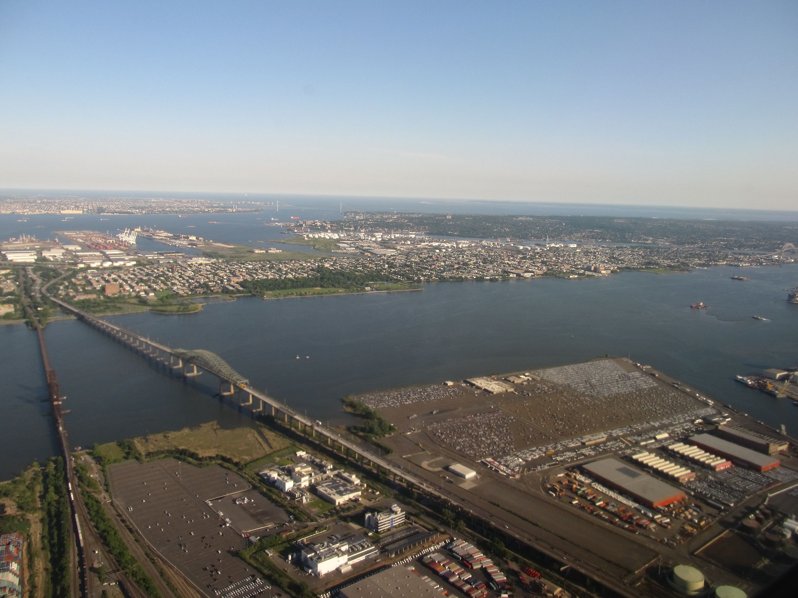
Bayonne is a city in Hudson County, New Jersey, United States. Located in the Gateway Region, Bayonne is a peninsula that is situated between Newark Bay to the west, the Kill van Kull to the south, and New York Bay to the east. As of the 2010 United States Census, the city's population was 63,024. Bayonne was originally formed as a township on April 1, 1861, from portions of Bergen Township. Bayonne was reincorporated as a city by an Act of the New Jersey Legislature on March 10, 1869, replacing Bayonne Township, subject to the results of a referendum held nine days later. At the time it was formed, Bayonne included the communities of Bergen Point, Constable Hook, Centreville, Pamrapo and Saltersville. The city lies at the heart of the Port of New York and New Jersey, east of Newark, the state's largest city, and west of Brooklyn. It shares a land border with Jersey City to the north and is connected to Staten Island by the Bayonne Bridge. While somewhat diminished, traditional manufacturing, distribution, and maritime activities remain important to the economy of the city. <a href="http://en.wikipedia.org/wiki/Bayonne,_NJ" rel="nofollow">en.wikipedia.org/wiki/Bayonne,_NJ</a> en.wikipedia.org/wiki/Wikipedia:Text_of_Creative_Commons_... |
||
| Date | |||
| Source | Flickr: Bayonne, New Jersey and Staten Island, New York | ||
| Author | Ken Lund | ||
| Permission (Reusing this file) |
This file is licensed under the Creative Commons Attribution-Share Alike 2.0 Generic license.
|
| Camera location | | View this and other nearby images on: OpenStreetMap |
|---|
File history
Click on a date/time to view the file as it appeared at that time.
| Date/Time | Thumbnail | Dimensions | User | Comment | |
|---|---|---|---|---|---|
| current | 20:09, 26 December 2012 | | 4,000 × 3,000 (2.3 MB) | Flickr upload bot (talk | contribs) | Uploaded from http://flickr.com/photo/75683070@N00/7238101964 using Flickr upload bot |
You cannot overwrite this file.
File usage on Commons
There are no pages that use this file.
File usage on other wikis
The following other wikis use this file:
- Usage on en.wikipedia.org
- Usage on et.wikipedia.org