File:Bauen-Kirchzugang.jpg
From Wikimedia Commons, the free media repository
Jump to navigation
Jump to search
Size of this preview: 400 × 600 pixels. Other resolutions: 160 × 240 pixels | 320 × 480 pixels | 512 × 768 pixels | 682 × 1,024 pixels | 1,365 × 2,048 pixels | 3,456 × 5,184 pixels.
Original file (3,456 × 5,184 pixels, file size: 5.44 MB, MIME type: image/jpeg)
File information
Structured data
Captions
Summary[edit]
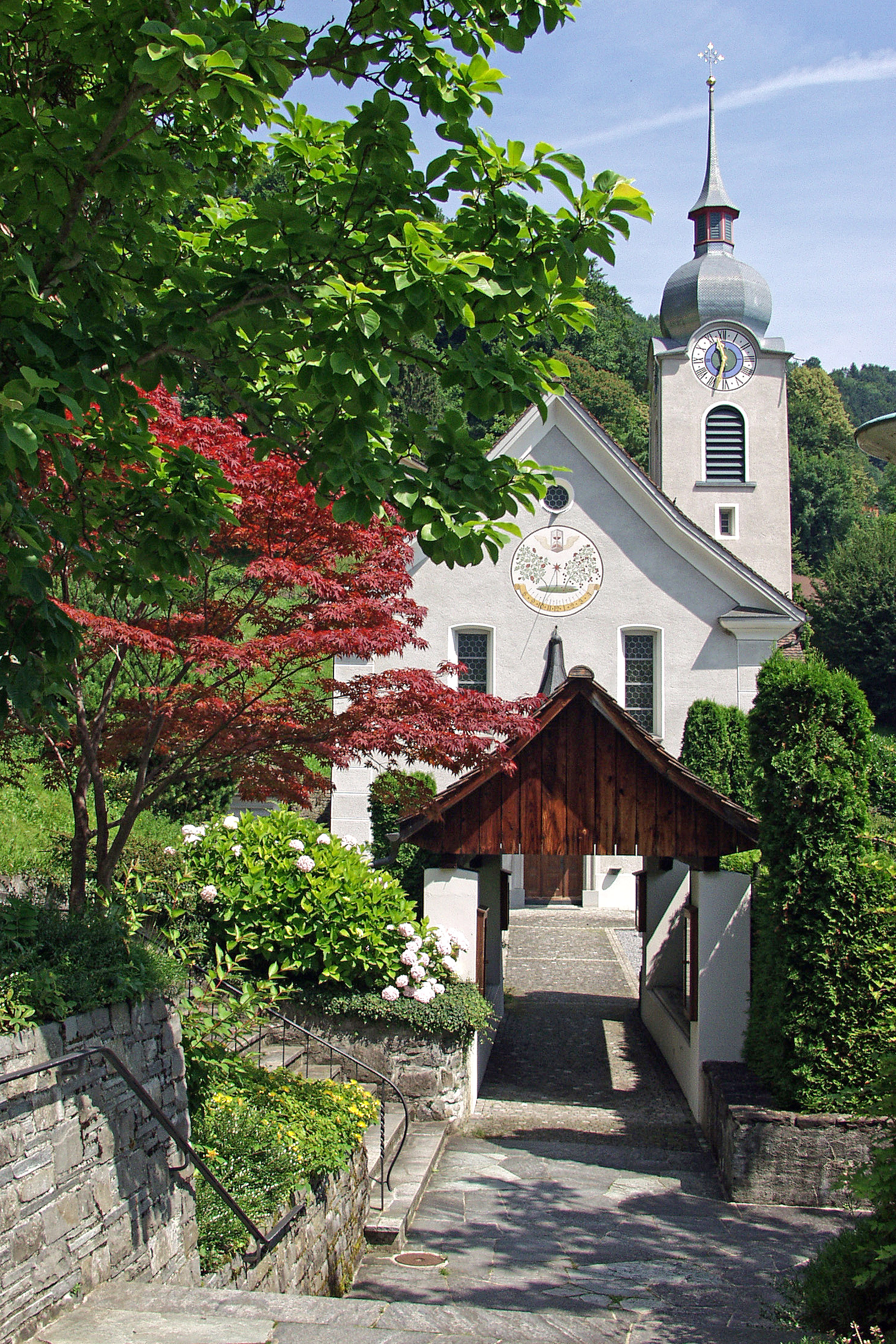
This is an image of a cultural property of regional significance in Switzerland with KGS number 5819
|
DescriptionBauen-Kirchzugang.jpg |
English: Entrance to the church of Bauen in Switzerland.
Deutsch: Unter dem Ploderdächlein hindurch gelangt man auf den Kirchhof von St. Idda in Bauen. |
Date | Taken on 1 July 2007, 10:54:42 |
Source | Fotografin (per Mail) mit deren Genehmigung vom 28. Oktober 2014 |
Author | Evelyscher, hochgeladen von FkMohr |
Camera location | 46° 56′ 09.39″ N, 8° 34′ 46.98″ E | View this and other nearby images on: OpenStreetMap | 46.935942; 8.579716 |
---|
UR {BA070701-1054} [ploder_P7012932b] / Info: plodärä ist Urnerdeutsch und heißt plaudern.
Licensing[edit]
Evelyne Scherer, the copyright holder of this work, hereby publishes it under the following license:
This file is licensed under the Creative Commons Attribution-ShareAlike 3.0 Switzerland license.
Attribution: Evelyne Scherer
- You are free:
- to share – to copy, distribute and transmit the work
- to remix – to adapt the work
- Under the following conditions:
- attribution – You must give appropriate credit, provide a link to the license, and indicate if changes were made. You may do so in any reasonable manner, but not in any way that suggests the licensor endorses you or your use.
- share alike – If you remix, transform, or build upon the material, you must distribute your contributions under the same or compatible license as the original.
File history
Click on a date/time to view the file as it appeared at that time.
Date/Time | Thumbnail | Dimensions | User | Comment | |
---|---|---|---|---|---|
current | 11:03, 29 October 2014 | 3,456 × 5,184 (5.44 MB) | FkMohr (talk | contribs) | User created page with UploadWizard |
You cannot overwrite this file.
File usage on Commons
The following page uses this file:
Metadata
This file contains additional information such as Exif metadata which may have been added by the digital camera, scanner, or software program used to create or digitize it. If the file has been modified from its original state, some details such as the timestamp may not fully reflect those of the original file. The timestamp is only as accurate as the clock in the camera, and it may be completely wrong.
Image title |
|
---|---|
Camera manufacturer | OLYMPUS OPTICAL CO.,LTD |
Camera model | E-10 |
Author | ploder_P7012932b;Scherer |
Copyright holder |
|
Exposure time | 1/640 sec (0.0015625) |
F-number | f/4.8 |
ISO speed rating | 80 |
Date and time of data generation | 10:54, 1 July 2007 |
Lens focal length | 10 mm |
Latitude | 46° 56′ 9.39″ N |
Longitude | 8° 34′ 46.98″ E |
Altitude | 439 meters above sea level |
Short title |
|
City shown | Bauen |
Width | 1,680 px |
Height | 2,240 px |
Bits per component |
|
Pixel composition | RGB |
Orientation | Normal |
Number of components | 3 |
Horizontal resolution | 300 dpi |
Vertical resolution | 300 dpi |
Software used | Adobe Photoshop Elements 11.0 Windows |
File change date and time | 10:54, 1 July 2007 |
Y and C positioning | Co-sited |
Exposure Program | Normal program |
Exif version | 2.1 |
Date and time of digitizing | 10:54, 1 July 2007 |
Meaning of each component |
|
APEX shutter speed | 9.321928 |
APEX aperture | 4.526069 |
APEX exposure bias | −0.3 |
Maximum land aperture | 2.06 APEX (f/2.04) |
Metering mode | Pattern |
Flash | Flash did not fire |
Supported Flashpix version | 1 |
Color space | sRGB |
File source | Digital still camera |
GPS time (atomic clock) | 08:54 |
Reference for direction of image | True direction |
Direction of image | 0 |
Geodetic survey data used | WGS-84 |
Latitude destination | 46° 56′ 14.25″ N |
Longitude of destination | 8° 34′ 46.98″ E |
GPS date | 1 July 2007 |
GPS tag version | 2.2.0.0 |
Date metadata was last modified | 23:33, 28 October 2014 |
Unique ID of original document | adobe:docid:photoshop:e7def266-27d5-11dc-88dc-cc533e8b4e0c |
Copyright status | Copyright status not set |
Code for country shown | CHE |
Sublocation of city shown | St. Idda |
Country shown | Schweiz |
Province or state shown | Uri |
IIM version | 2 |
Structured data
Items portrayed in this file
depicts
1 July 2007
46°56'9.391703982"N, 8°34'46.976268032"E
image/jpeg
567035fbc4765ccc3f71ff3f58cc75d7961ab09c
5,700,784 byte
5,184 pixel
3,456 pixel
Hidden categories:
- Cultural properties of regional significance in Switzerland with known IDs
- Cultural properties of regional significance in Switzerland missing SDC location of creation
- Switzerland photographs taken on 2007-07-01
- Files with coordinates missing SDC location of creation
- CC-BY-SA-3.0-CH
- Self-published work
- Files by User:FkMohr/Bauwerk
- Taken with Olympus E-10
- Pages with maps