File:Battery Rock cleft.jpg
Jump to navigation
Jump to search

Size of this preview: 800 × 532 pixels. Other resolutions: 320 × 213 pixels | 640 × 426 pixels | 1,024 × 681 pixels | 1,280 × 851 pixels | 2,560 × 1,702 pixels | 6,016 × 4,000 pixels.
Original file (6,016 × 4,000 pixels, file size: 6.34 MB, MIME type: image/jpeg)
Captions
Captions
Add a one-line explanation of what this file represents
| Camera location | | View this and other nearby images on: OpenStreetMap |
|---|
| Description |
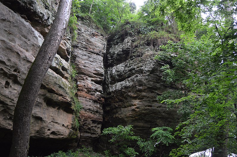
English: A cleft on the side of Battery Rock, located at a landing on the Ohio River in Hardin County, Illinois, United States. The site is listed on the National Register of Historic Places, partly because of its longstanding importance in river history, and partly because of a Civil War skirmish that was fought here.
|
||
| Date | Taken on 4 June 2016 | ||
| Source | Own work | ||
| Author | Nyttend | ||
| Permission (Reusing this file) |
|
File history
Click on a date/time to view the file as it appeared at that time.
| Date/Time | Thumbnail | Dimensions | User | Comment | |
|---|---|---|---|---|---|
| current | 03:51, 3 August 2017 | | 6,016 × 4,000 (6.34 MB) | Nyttend (talk | contribs) | {{Location|37|31|47|N|88|4|46|W}} {{Information |Description={{en|A cleft on the side of {{w|Battery Rock}}, located at a landing on the {{w|Ohio River}} in {{w|Hardin County, Illinois|Hardin County}}, {{w|Illinois}}, {{w|United States}}. The site is... |
You cannot overwrite this file.
File usage on Commons
There are no pages that use this file.
File usage on other wikis
The following other wikis use this file:
- Usage on de.wikipedia.org
- Usage on en.wikipedia.org