File:Barth 1858 Plan Timbuktu without key.jpg
Jump to navigation
Jump to search
Size of this preview: 690 × 600 pixels. Other resolutions: 276 × 240 pixels | 552 × 480 pixels | 884 × 768 pixels | 1,178 × 1,024 pixels | 1,974 × 1,716 pixels.
Original file (1,974 × 1,716 pixels, file size: 396 KB, MIME type: image/jpeg)
Captions
Captions
Add a one-line explanation of what this file represents
Summary[edit]
| Description |
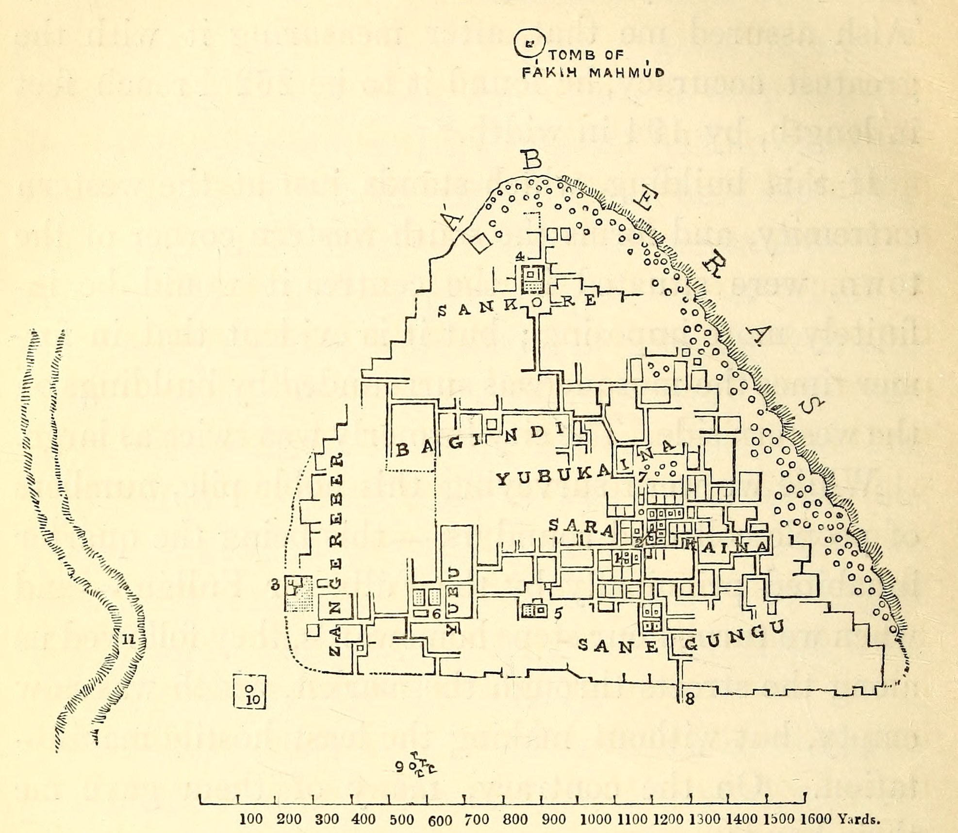
English: Plan of Timbuktu in 1853, Heinrich Barth. Key: |
| Date | |
| Source | Barth, Heinrich (1858), Travels and Discoveries in North and Central Africa: being a Journal of an Expedition undertaken under the Auspices of H.B.M.’s Government, in the Years 1849–1855 (Volume 4), London: Longman, Brown, Green, Longmans and Roberts. The woodcut print is on page 478. It is image 562 in the jp2 zip archive. |
| Author | Heinrich Barth (1821-1865) |
Licensing[edit]
|
This work is in the public domain in its country of origin and other countries and areas where the copyright term is the author's life plus 100 years or fewer. This work is in the public domain in the United States because it was published (or registered with the U.S. Copyright Office) before January 1, 1929. | |
| This file has been identified as being free of known restrictions under copyright law, including all related and neighboring rights. | |
File history
Click on a date/time to view the file as it appeared at that time.
| Date/Time | Thumbnail | Dimensions | User | Comment | |
|---|---|---|---|---|---|
| current | 11:13, 26 October 2015 | | 1,974 × 1,716 (396 KB) | Aa77zz (talk | contribs) | == {{int:filedesc}} == {{Information |Description={{en|Map of Timbuktu in 1853, Heinrich Barth.<br/> Key:<br/> 1. House of Sheik Ahmed al-Bakkay<br/> 2. House where Barth stayed<br/> 3. Djinguereber Mosque<br/> 4. Sankore Mosque<br/> 5. Sidi Yahya Mosq... |
You cannot overwrite this file.
File usage on Commons
There are no pages that use this file.