File:Barrack Street jetty area, c.1900.png
Jump to navigation
Jump to search
Size of this preview: 800 × 548 pixels. Other resolutions: 320 × 219 pixels | 640 × 439 pixels | 1,024 × 702 pixels | 1,280 × 877 pixels | 2,067 × 1,417 pixels.
Original file (2,067 × 1,417 pixels, file size: 4.07 MB, MIME type: image/png)
Captions
Captions
Add a one-line explanation of what this file represents
Summary
[edit]
| Description |
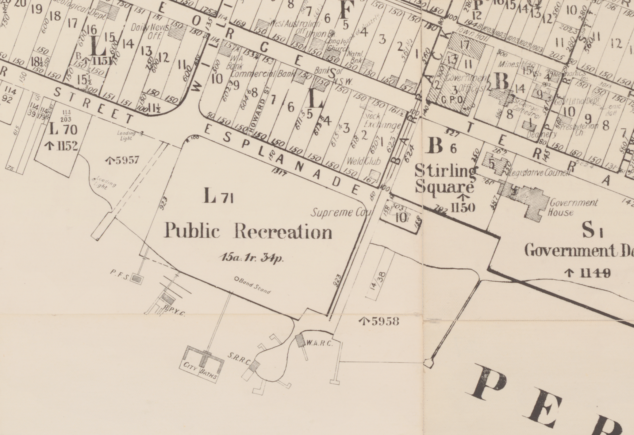
English: A section of the map at https://nla.gov.au/nla.obj-232132852/ with the fabric strips removed for easier rectification and tracing with Warper. See also Data:Barrack Street jetty area, c.1900.map. |
|||||||||
| Date | circa 1900 | |||||||||
| Source | https://nla.gov.au/nla.obj-232132852/ | |||||||||
| Creator |
Department of Lands and Surveys |
|||||||||
| Geotemporal data | ||||||||||
| Bounding box |
|
|||||||||
| Georeferencing | ||||||||||
Licensing
[edit]
This work is in the public domain in the United States because it was published (or registered with the U.S. Copyright Office) before January 1, 1929.
Public domain works must be out of copyright in both the United States and in the source country of the work in order to be hosted on the Commons. If the work is not a U.S. work, the file must have an additional copyright tag indicating the copyright status in the source country.
Note: This tag should not be used for sound recordings. |
File history
Click on a date/time to view the file as it appeared at that time.
| Date/Time | Thumbnail | Dimensions | User | Comment | |
|---|---|---|---|---|---|
| current | 11:26, 6 October 2018 | | 2,067 × 1,417 (4.07 MB) | Samwilson (talk | contribs) | User created page with UploadWizard |
You cannot overwrite this file.
File usage on Commons
There are no pages that use this file.
File usage on other wikis
The following other wikis use this file:
- Usage on en.wikipedia.org