File:Barèges 64 Vue GR10 Tourmalet 2011.jpg
Jump to navigation
Jump to search

Size of this preview: 800 × 250 pixels. Other resolutions: 320 × 100 pixels | 640 × 200 pixels | 1,024 × 320 pixels | 1,280 × 400 pixels | 5,843 × 1,826 pixels.
Original file (5,843 × 1,826 pixels, file size: 10.86 MB, MIME type: image/jpeg)
Captions
Captions
Add a one-line explanation of what this file represents
Summary[edit]
| Description |
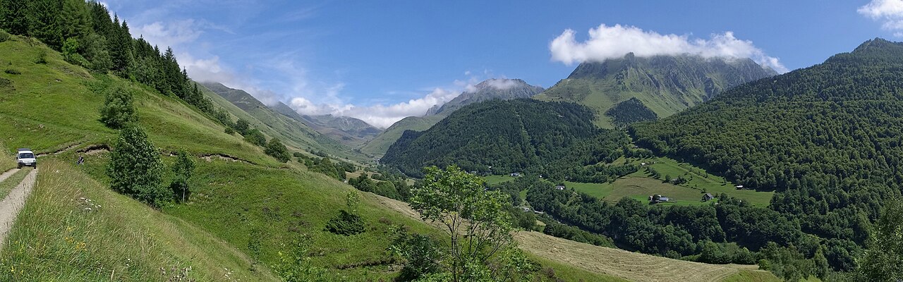
Français : Vue du GR 10, près de Souriche, en direction du tourmalet et de la forêt domaniale de Layré. Vallée de Barèges, Hautes-Pyrénées, France.
English: View from GR 10, near Souriche, looking towards the Tourmalet, valley of Barèges, France. |
| Date | |
| Source | Own work |
| Author | |
| Attribution (required by the license) | Photo: JLPC / Wikimedia Commons / |
| Permission (Reusing this file) |
I, the copyright holder of this work, hereby publish it under the following license: This file is licensed under the Creative Commons Attribution-Share Alike 3.0 Unported license.
|
| Other versions |
| Camera location | | View this and other nearby images on: OpenStreetMap |
|---|
This image has been assessed using the Quality image guidelines and is considered a Quality image.
|
| Annotations | This image is annotated: View the annotations at Commons |

|
This image has been assessed under the valued image criteria and is considered the most valued image on Commons within the scope: GR 10, looking towards the Tourmalet, near Barèges, Hautes-Pyrénées, France. You can see its nomination here. |
File history
Click on a date/time to view the file as it appeared at that time.
| Date/Time | Thumbnail | Dimensions | User | Comment | |
|---|---|---|---|---|---|
| current | 18:02, 5 February 2013 | 5,843 × 1,826 (10.86 MB) | JLPC (talk | contribs) |
You cannot overwrite this file.
File usage on Commons
The following 11 pages use this file:
- User:JLPC
- User:JLPC/gallery
- User talk:JLPC/Archive 10
- User talk:JLPC/Archive 5
- Commons:Quality images/Subject/Places/Natural structures/Panorama/Archive 2008 to 2015
- Commons:Quality images candidates/Archives February 2013
- Commons:Valued image candidates/Barèges 64 Vue GR10 Tourmalet 2011.jpg
- Commons:Valued images by topic/Places/Natural/Mountain sites
- File:Barèges 64 Vue Grt10 Tourmalet 2011.jpg (file redirect)
- File:GR 10 WV banner.jpg
- File:Haute-Pyrénées banner.jpg
File usage on other wikis
The following other wikis use this file:
- Usage on ca.wikipedia.org
- Usage on en.wikipedia.org