File:Bangladesh location map-Rangpur Division.svg
Jump to navigation
Jump to search

Size of this PNG preview of this SVG file: 441 × 599 pixels. Other resolutions: 177 × 240 pixels | 353 × 480 pixels | 565 × 768 pixels | 754 × 1,024 pixels | 1,507 × 2,048 pixels | 1,205 × 1,637 pixels.
Original file (SVG file, nominally 1,205 × 1,637 pixels, file size: 554 KB)
Captions
Captions
Add a one-line explanation of what this file represents
| Description |
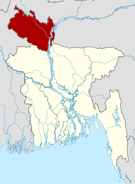
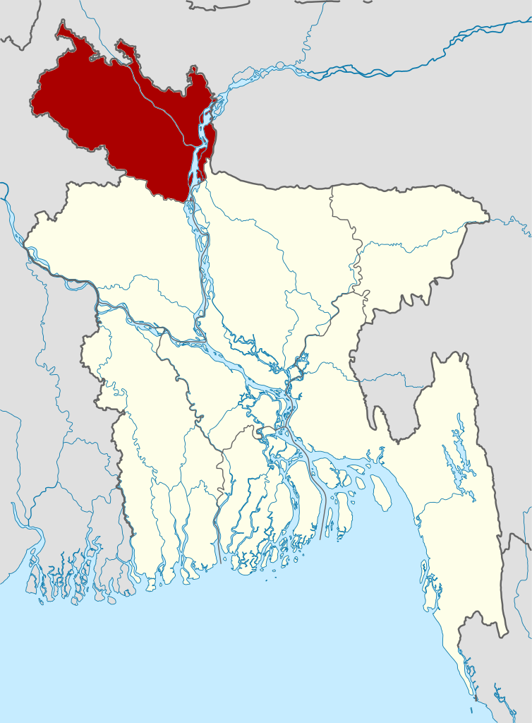
বাংলা: বাংলাদেশের অবস্থান মানচিত্র
সমদূরবর্তী সিলিন্ডারের আকৃতিবিশিষ্ট অভিক্ষেপণ, উত্তর/দক্ষিণ বিস্তৃতকরণ ১১০ %। মানচিত্রের ভৌগোলিক সীমা:
Deutsch: Positionskarte von Bangladesch Quadratische Plattkarte, N-S-Streckung 110 %. Geographische Begrenzung der Karte: * N: 26.8° N * S: 20.5° N * W: 87.8° O * O: 92.9° O English: Location map of Bangladesh Equirectangular projection, N/S stretching 110 %. Geographic limits of the map: * N: 26.8° N * S: 20.5° N * W: 87.8° E * E: 92.9° E
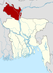
== Rangpur Division (Bangladesh) as proclaimed on January 25, 2010 |
| Date | (UTC) |
| Source | |
| Author |
|
| This is a retouched picture, which means that it has been digitally altered from its original version. The original can be viewed here: Bangladesh divisions english.png:
|
This file is licensed under the Creative Commons Attribution-Share Alike 3.0 Unported license.
- You are free:
- to share – to copy, distribute and transmit the work
- to remix – to adapt the work
- Under the following conditions:
- attribution – You must give appropriate credit, provide a link to the license, and indicate if changes were made. You may do so in any reasonable manner, but not in any way that suggests the licensor endorses you or your use.
- share alike – If you remix, transform, or build upon the material, you must distribute your contributions under the same or compatible license as the original.
Original upload log[edit]
This image is a derivative work of the following images:
- File:Bangladesh_location_map.svg licensed with Cc-by-sa-3.0
- 2010-01-27T18:46:31Z NordNordWest 1205x1637 (705768 Bytes) update
- 2009-12-03T10:49:53Z NordNordWest 1205x1637 (832897 Bytes) corr
- 2009-12-03T10:18:35Z NordNordWest 1205x1637 (831415 Bytes) =={{int:filedesc}}== {{Information |Description= {{de|Positionskarte von [[:de:Bangladesch|Bangladesch]]}} Quadratische Plattkarte, N-S-Streckung 110 %. Geographische Begrenzung der Karte: * N: 26.8° N * S: 20.5° N * W: 87.
- File:Bangladesh_divisions_english.png licensed with Cc-by-2.5, Cc-by-sa-3.0-migrated, GFDL
- 2010-01-27T19:40:08Z NordNordWest 500x682 (19273 Bytes) update Rangpur
- 2009-03-01T00:28:07Z Mahahahaneapneap 500x682 (19811 Bytes) Compressed
- 2005-12-31T02:52:09Z Golbez 500x682 (20726 Bytes) Map of the divisions of Bangladesh in English. Made by [[User:Golbez]].
Uploaded with derivativeFX
File history
Click on a date/time to view the file as it appeared at that time.
| Date/Time | Thumbnail | Dimensions | User | Comment | |
|---|---|---|---|---|---|
| current | 17:53, 4 August 2010 | | 1,205 × 1,637 (554 KB) | Kmusser (talk | contribs) | Switched to red to match other division maps |
| 12:13, 27 July 2010 |  | 1,205 × 1,637 (552 KB) | MarsInSVG (talk | contribs) | {{Information |Description={{de|Positionskarte von Bangladesch}} Quadratische Plattkarte, N-S-Streckung 110 %. Geographische Begrenzung der Karte: * N: 26.8° N * S: 20.5° N * W: 87.8° O * O: 92.9° O {{en|Location map of [[:en:Bangl |
You cannot overwrite this file.
File usage on Commons
There are no pages that use this file.
File usage on other wikis
The following other wikis use this file:
- Usage on en.wikipedia.org
- Usage on lt.wikipedia.org
- Usage on no.wikipedia.org
- Usage on pl.wikipedia.org
- Usage on pnb.wikipedia.org
- Usage on ps.wikipedia.org
- Usage on sco.wikipedia.org
- Usage on simple.wikipedia.org
- Usage on su.wikipedia.org
- Usage on ur.wikipedia.org
- Usage on vi.wikipedia.org