File:Bandra-Worli Sea Link Map.png
Jump to navigation
Jump to search

Size of this preview: 619 × 600 pixels. Other resolutions: 248 × 240 pixels | 495 × 480 pixels | 770 × 746 pixels.
Original file (770 × 746 pixels, file size: 252 KB, MIME type: image/png)
Captions
Captions
Add a one-line explanation of what this file represents
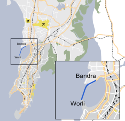
| Description | Map of Bandra-Worli Sea Link in Mumbai, India |
| Date | (UTC) |
| Source | |
| Author |
|
| This is a retouched picture, which means that it has been digitally altered from its original version. The original can be viewed here: Mumbai area locator map.svg:
|
I, the copyright holder of this work, hereby publish it under the following licenses:
This file is licensed under the Creative Commons Attribution-Share Alike 2.5 Generic, 2.0 Generic and 1.0 Generic license.
- You are free:
- to share – to copy, distribute and transmit the work
- to remix – to adapt the work
- Under the following conditions:
- attribution – You must give appropriate credit, provide a link to the license, and indicate if changes were made. You may do so in any reasonable manner, but not in any way that suggests the licensor endorses you or your use.
- share alike – If you remix, transform, or build upon the material, you must distribute your contributions under the same or compatible license as the original.

|
Permission is granted to copy, distribute and/or modify this document under the terms of the GNU Free Documentation License, Version 1.2 or any later version published by the Free Software Foundation; with no Invariant Sections, no Front-Cover Texts, and no Back-Cover Texts. A copy of the license is included in the section entitled GNU Free Documentation License. |
| This file is licensed under the Creative Commons Attribution-Share Alike 3.0 Unported license. | ||
| ||
| This licensing tag was added to this file as part of the GFDL licensing update. |
You may select the license of your choice.
Original upload log[edit]
This image is a derivative work of the following images:
- File:Mumbai_area_locator_map.svg licensed with Cc-by-sa-2.5,2.0,1.0, GFDL
- 2007-01-28T14:51:58Z PlaneMad 1344x1808 (255614 Bytes) {{WikiProject India City Maps |Title=Mumbai locator map |Description=Map of Mumbai city district and Mumbai suburban district, with major roads, railways and water bodies. |Source= Google maps |Date=28 Jan 07 |Author=[[w:use
Uploaded with derivativeFX
File history
Click on a date/time to view the file as it appeared at that time.
| Date/Time | Thumbnail | Dimensions | User | Comment | |
|---|---|---|---|---|---|
| current | 02:26, 30 June 2009 | | 770 × 746 (252 KB) | Abhijitsathe (talk | contribs) | {{Information |Description=Map of Bandra-Worli Sea Link in Mumbai, India |Source=*File:Mumbai_area_locator_map.svg |Date=2009-06-30 03:26 (UTC) |Author=*File:Mumbai_area_locator_map.svg: '''cc-by-sa-2.5''' *derivative work: ~~~ |Permission=see |
You cannot overwrite this file.
File usage on Commons
There are no pages that use this file.
File usage on other wikis
The following other wikis use this file:
- Usage on gu.wikipedia.org
- Usage on kn.wikipedia.org
- Usage on mai.wikipedia.org
- Usage on mr.wikipedia.org
- Usage on ru.wikipedia.org