File:Bandeau CHGeo part2.png

Original file (1,000 × 707 pixels, file size: 623 KB, MIME type: image/png)
Captions
Captions
| Description |
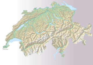
Français : Carte géographique de la Suisse (grand format) pour le bandeau du fr:portail:Géographie de la Suisse |
| Date | |
| Source | http://www.swisstopo.ch/fr/digital/over.htm |
| Author | Romano1246, dérivé du fichier fr:Fichier:Suisse geographique.png |
| Permission (Reusing this file) |
Source : http://www.swisstopo.ch/fr/digital/over.htm |
Licensing[edit]
The data made publicly available by swisstopo may be used, distributed and made accessible. Furthermore, they may be enriched and processed and also used commercially. A reference to the source is mandatory. In the case of digital or analogue representations and publications, as well as in the case of dissemination, one of the following source references must be attached in any case:
Terms of use for free geodata and geoservices (OGD) from swisstopo
|
.svg) |
File history
Click on a date/time to view the file as it appeared at that time.
| Date/Time | Thumbnail | Dimensions | User | Comment | |
|---|---|---|---|---|---|
| current | 22:42, 30 October 2009 | | 1,000 × 707 (623 KB) | Romano1246 (talk | contribs) | {{Information |Description={{fr|1=Carte géographique de la Suisse (grand format) pour le bandeau du fr:portail:Géographie de la Suisse}} |Source=http://www.swisstopo.ch/fr/digital/over.htm |Author=Romano1246, dérivé du fichier |
You cannot overwrite this file.
File usage on Commons
There are no pages that use this file.
File usage on other wikis
The following other wikis use this file:
- Usage on cs.wikipedia.org
- Usage on fr.wikipedia.org
- Usage on uk.wikipedia.org