File:Baltic Sea Borderlines 1939 german-it2.png
Jump to navigation
Jump to search

Size of this preview: 771 × 599 pixels. Other resolutions: 309 × 240 pixels | 618 × 480 pixels | 988 × 768 pixels | 1,280 × 995 pixels | 2,528 × 1,965 pixels.
Original file (2,528 × 1,965 pixels, file size: 348 KB, MIME type: image/png)
Captions
Captions
Add a one-line explanation of what this file represents
| Description |
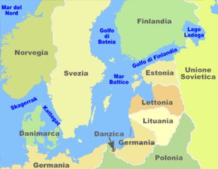
Italiano: mappa del Mar Baltico nel Settembre 1939 English: map of the Baltic Sea in September 1939 Deutsch: karte der Ostsee mit den Grenzen von September 1939 |
| Date | (UTC) |
| Source | |
| Author |
|
| This is a retouched picture, which means that it has been digitally altered from its original version. Modifications: Cambio dei colori. The original can be viewed here: Baltic Sea Borderlines 1939 german-it.png:
|
I, the copyright holder of this work, hereby publish it under the following licenses:
| This file is licensed under the Creative Commons Attribution-Share Alike 3.0 Unported license. | ||
| ||
| This licensing tag was added to this file as part of the GFDL licensing update. |

|
Permission is granted to copy, distribute and/or modify this document under the terms of the GNU Free Documentation License, Version 1.2 or any later version published by the Free Software Foundation; with no Invariant Sections, no Front-Cover Texts, and no Back-Cover Texts. A copy of the license is included in the section entitled GNU Free Documentation License. |
You may select the license of your choice.
Original upload log[edit]
This image is a derivative work of the following images:
- File:Baltic_Sea_Borderlines_1939_german-it.png licensed with Cc-by-sa-3.0-migrated, GFDL
- 2011-06-01T13:06:46Z Gigillo83 2528x1965 (468967 Bytes) {{it|Mappa del [[:itMar Baltico|Mar Baltico]] nel Settembre 1939.}} {{en|Map of the [[:en:Baltic Sea|Baltic Sea]] in September 1939.}} {{de|Karte der [[:de:Ostsee|Ostsee]] mit den Grenzen von September 1939.}} {{Self|GF
Uploaded with derivativeFX
File history
Click on a date/time to view the file as it appeared at that time.
| Date/Time | Thumbnail | Dimensions | User | Comment | |
|---|---|---|---|---|---|
| current | 10:24, 25 July 2011 | | 2,528 × 1,965 (348 KB) | Adert (talk | contribs) | {{Information |Description={{it|mappa del Mar Baltico nel Settembre 1939}} {{en|map of the Baltic Sea in September 1939}} {{de|karte der Ostsee mit den Grenzen von September 1939}} |Source=*[[:File:Bal |
You cannot overwrite this file.
File usage on Commons
There are no pages that use this file.
File usage on other wikis
The following other wikis use this file:
- Usage on en.wikipedia.org
- Usage on fr.wikipedia.org
- Usage on it.wikipedia.org
- Usage on uk.wikipedia.org
Categories:
- 1939 maps of Europe
- Historical regions
- Maps of Nazi Germany
- Maps of the Baltic Sea
- Maps of the Eastern Front in World War II
- Maps of the Free City of Danzig
- Maps of borders of the Soviet Union
- Maps of the history of Denmark
- Maps of Estonia (1918-1940)
- Maps of the history of Finland
- Free City of Danzig-Germany border
- Free City of Danzig-Poland border