File:Baltic Entente.png
Jump to navigation
Jump to search

Size of this preview: 592 × 600 pixels. Other resolutions: 237 × 240 pixels | 474 × 480 pixels | 900 × 912 pixels.
Original file (900 × 912 pixels, file size: 129 KB, MIME type: image/png)
Captions
Captions
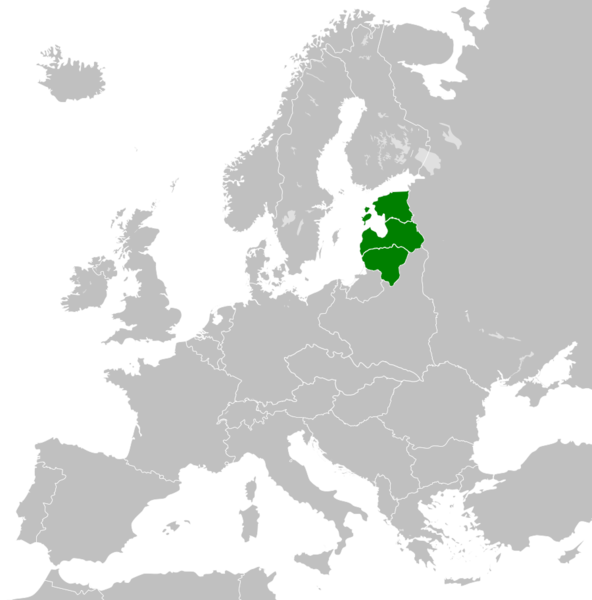
Map of the members of the Baltic Entente (
Summary[edit]
| Description |
English: The Baltic Entente was first established in 1934 in Geneva. It comprised the countries of Estonia, Latvia and Lithuania. All three nations were annexed by the Soviet Union in 1940. |
| Date | |
| Source | Own work |
| Author | GalaxMaps |
Licensing[edit]
I, the copyright holder of this work, hereby publish it under the following license:
This file is licensed under the Creative Commons Attribution-Share Alike 4.0 International license.
- You are free:
- to share – to copy, distribute and transmit the work
- to remix – to adapt the work
- Under the following conditions:
- attribution – You must give appropriate credit, provide a link to the license, and indicate if changes were made. You may do so in any reasonable manner, but not in any way that suggests the licensor endorses you or your use.
- share alike – If you remix, transform, or build upon the material, you must distribute your contributions under the same or compatible license as the original.
File history
Click on a date/time to view the file as it appeared at that time.
| Date/Time | Thumbnail | Dimensions | User | Comment | |
|---|---|---|---|---|---|
| current | 21:19, 8 July 2020 | | 900 × 912 (129 KB) | GalaxMaps (talk | contribs) | Made it a map of europe instead |
| 21:11, 8 July 2020 |  | 600 × 600 (87 KB) | GalaxMaps (talk | contribs) | Uploaded own work with UploadWizard |
You cannot overwrite this file.
File usage on Commons
There are no pages that use this file.
File usage on other wikis
The following other wikis use this file:
- Usage on cs.wikipedia.org
- Usage on en.wikipedia.org
- Usage on fr.wikipedia.org
- Usage on it.wikipedia.org
- Usage on ru.wikipedia.org