File:BalticSea.A2004093.1120.250m.jpg
Jump to navigation
Jump to search

Size of this preview: 466 × 599 pixels. Other resolutions: 187 × 240 pixels | 373 × 480 pixels | 597 × 768 pixels | 796 × 1,024 pixels | 1,593 × 2,048 pixels | 5,600 × 7,200 pixels.
Original file (5,600 × 7,200 pixels, file size: 7.24 MB, MIME type: image/jpeg)
Captions
Captions
Add a one-line explanation of what this file represents
Summary[edit]
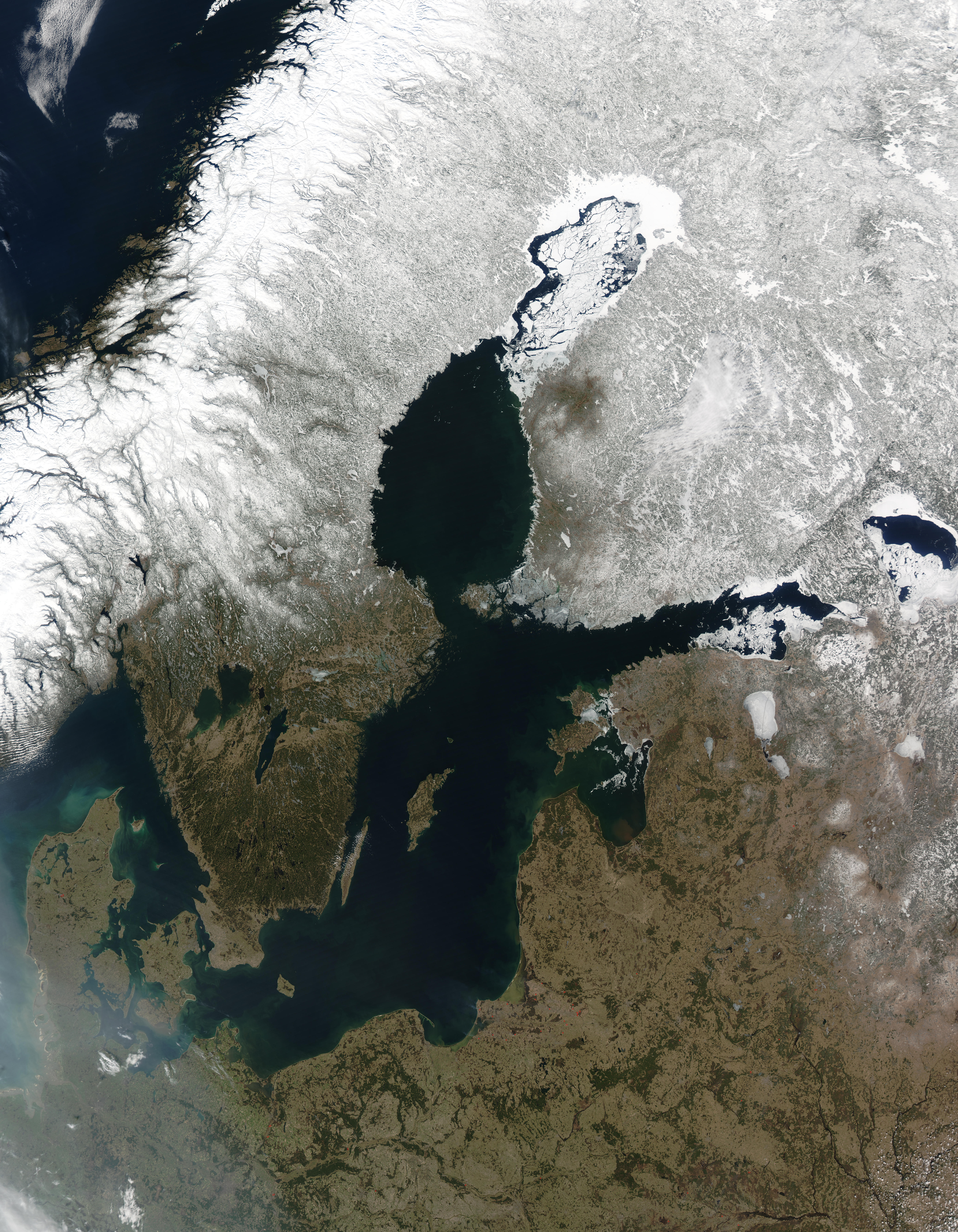
| Description |
Deutsch: Ostseeregion vom Weltall. Die roten Punkt markieren Brände.
English: Satellite image of the Baltic Sea. Red dots mark the locations of fires burning in countries south and east of the Baltic Sea. |
|||||
| Date | ||||||
| Source | https://www.visibleearth.nasa.gov/view.php?id=70636 → jpg | |||||
| Author |
|
|||||
| Permission (Reusing this file) |
|
|||||
| Other versions |
|

File history
Click on a date/time to view the file as it appeared at that time.
| Date/Time | Thumbnail | Dimensions | User | Comment | |
|---|---|---|---|---|---|
| current | 13:06, 10 February 2011 | | 5,600 × 7,200 (7.24 MB) | Saibo (talk | contribs) | == {{int:filedesc}} == {{Information| |Description= {{de|Ostseeregion vom Weltall. Die roten Punkt markieren Brände.}} {{en|Satellite image of the Baltic Sea. Red dots mark the locations of fires burning in countries south and east of the Baltic Sea.}} | |
You cannot overwrite this file.
File usage on Commons
The following 2 pages use this file:
.jpg)
File usage on other wikis
The following other wikis use this file:
- Usage on pl.wikipedia.org
- Usage on sv.wikipedia.org
Metadata
Categories:
- NASA MODIS images of Europe
- Satellite pictures of the Baltic Sea
- 2004 satellite pictures
- April 2004 in Finland
- April 2004 in Latvia
- April 2004 in Lithuania
- April 2004 in Poland
- April 2004 Germany photographs
- Satellite pictures of Lithuania
- Satellite pictures of Sweden
- Satellite pictures of Finland
- Satellite pictures of Poland
- Satellite pictures of Germany
- Satellite pictures of Russia
- April 2004 in Russia
- Winter 2003-2004 in Finland
- Winter 2003-2004 in Sweden
- Winter 2003-2004 in Norway
- Winter 2003-2004 in Russia