File:BORDENTOWN HISTORIC DISTRICT.jpg
Jump to navigation
Jump to search

Size of this preview: 800 × 530 pixels. Other resolutions: 320 × 212 pixels | 640 × 424 pixels | 1,024 × 679 pixels | 1,280 × 849 pixels | 2,560 × 1,697 pixels | 5,229 × 3,467 pixels.
Original file (5,229 × 3,467 pixels, file size: 4.13 MB, MIME type: image/jpeg)
Captions
Captions
Add a one-line explanation of what this file represents
Summary[edit]
| Description |
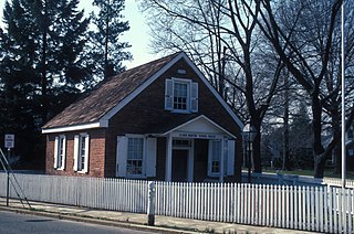
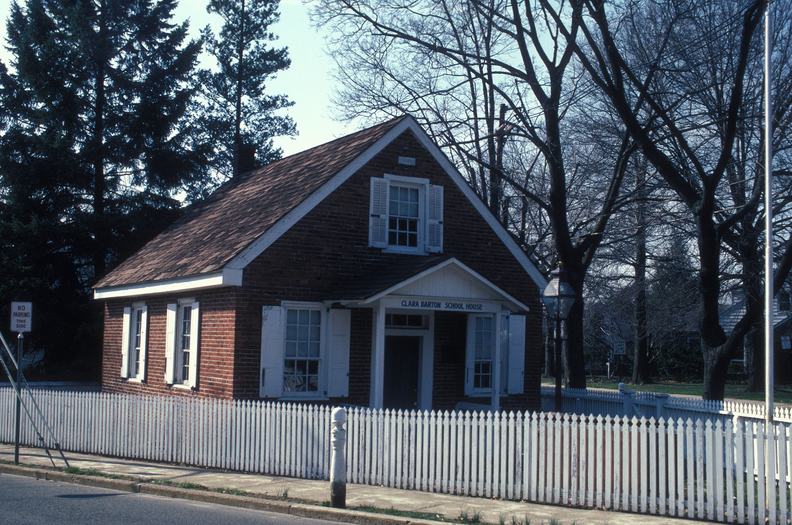
English: CLARA BARTON SCHOOL IN BORDENTOWN; ONE OF THE EARLIEST FREE SCHOOLS IN NEW JERSEY ESTABLISHED IN 1852 BY CLARA BARTON. THIS IS ONE THE CENTERPIECES OF THE HISTORIC DISTRICT
|
||
| Date | |||
| Source | Own work | ||
| Author | JERRYE & ROY KLOTZ MD |
| Object location | | View this and other nearby images on: OpenStreetMap |
|---|
Licensing[edit]
I, the copyright holder of this work, hereby publish it under the following license:
This file is licensed under the Creative Commons Attribution-Share Alike 3.0 Unported license.
- You are free:
- to share – to copy, distribute and transmit the work
- to remix – to adapt the work
- Under the following conditions:
- attribution – You must give appropriate credit, provide a link to the license, and indicate if changes were made. You may do so in any reasonable manner, but not in any way that suggests the licensor endorses you or your use.
- share alike – If you remix, transform, or build upon the material, you must distribute your contributions under the same or compatible license as the original.
File history
Click on a date/time to view the file as it appeared at that time.
| Date/Time | Thumbnail | Dimensions | User | Comment | |
|---|---|---|---|---|---|
| current | 19:01, 4 February 2013 | | 5,229 × 3,467 (4.13 MB) | Cropbot (talk | contribs) | upload cropped version, operated by User:Ruhrfisch. Summary: cropped |
| 01:12, 16 December 2012 |  | 5,782 × 3,946 (2.23 MB) | KLOTZ (talk | contribs) | User created page with UploadWizard |
You cannot overwrite this file.
File usage on Commons
There are no pages that use this file.