File:B26056036F - Descripcion de las Indias del Poniente 14.jpg
Jump to navigation
Jump to search
Size of this preview: 800 × 598 pixels. Other resolutions: 320 × 239 pixels | 640 × 478 pixels | 1,024 × 765 pixels | 1,280 × 957 pixels | 2,560 × 1,913 pixels | 6,091 × 4,552 pixels.
Original file (6,091 × 4,552 pixels, file size: 5.28 MB, MIME type: image/jpeg)
Captions
Captions
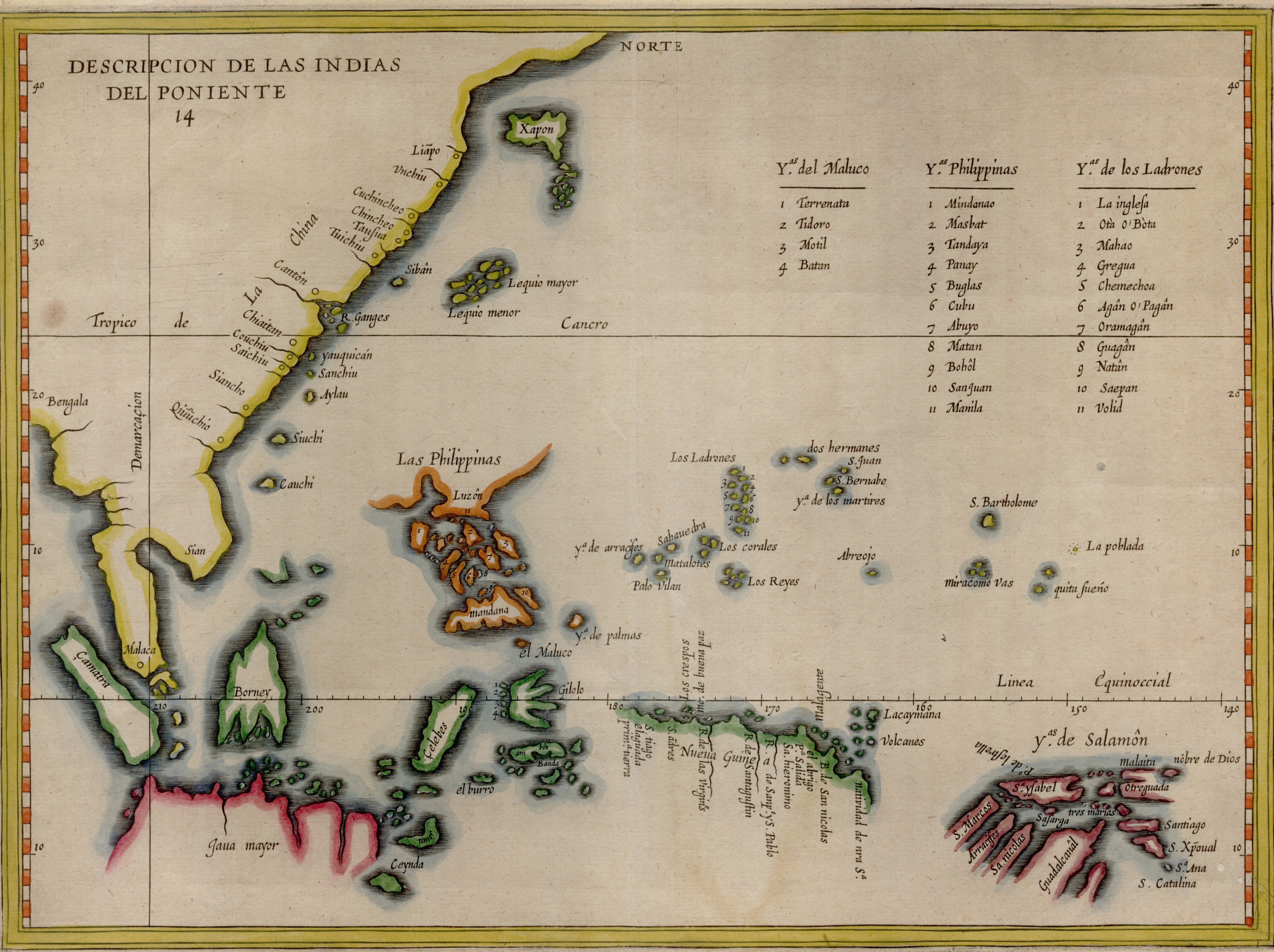
Map depicting the line of demarcation between Spanish and Portuguese interests in the East as well as tabulate the Molucca, Philippine and Mariana island groups
Summary
[edit]
| Description |
English: Map depicting the line of demarcation between Spanish and Portuguese interests in the East as well as tabulate the Molucca, Philippine and Mariana island groups. Based on Lopez de Velasco's manuscript map of circa 1575, the map was first published by Herrera y Todesillas in his history of Spain in 1601. The current map originates from De Bry's Petits voyages |
| Date | |
| Source | NLB Singapore, David Parry Southeast Asian Map Collection. Available on BookSG https://eresources.nlb.gov.sg/printheritage/detail/57be68af-977a-448a-997c-3ba708f1163d.aspx |
| Author | Herrera y Tordesillas, Antonio de, -1625; LoÌpez de Velasco, Juan, active 16th century; Bry, Theodor de, 1528-1598 |
Licensing
[edit]
| This file is made available under the Creative Commons CC0 1.0 Universal Public Domain Dedication. | |
| The person who associated a work with this deed has dedicated the work to the public domain by waiving all of their rights to the work worldwide under copyright law, including all related and neighboring rights, to the extent allowed by law. You can copy, modify, distribute and perform the work, even for commercial purposes, all without asking permission.
|
File history
Click on a date/time to view the file as it appeared at that time.
| Date/Time | Thumbnail | Dimensions | User | Comment | |
|---|---|---|---|---|---|
| current | 08:34, 30 December 2021 | | 6,091 × 4,552 (5.28 MB) | NLSingapore (talk | contribs) | Uploaded a work by Herrera y Tordesillas, Antonio de, -1625; LoÌpez de Velasco, Juan, active 16th century; Bry, Theodor de, 1528-1598 from NLB Singapore, David Parry Southeast Asian Map Collection. Available on BookSG https://eresources.nlb.gov.sg/printheritage/detail/57be68af-977a-448a-997c-3ba708f1163d.aspx with UploadWizard |
You cannot overwrite this file.
File usage on Commons
There are no pages that use this file.
File usage on other wikis
The following other wikis use this file:
- Usage on ca.wikipedia.org
- Usage on eu.wikipedia.org