File:Ausschliessliche Wirtschaftszonen Schwarzes Meer.svg
Jump to navigation
Jump to search

Size of this PNG preview of this SVG file: 532 × 331 pixels. Other resolutions: 320 × 199 pixels | 640 × 398 pixels | 1,024 × 637 pixels | 1,280 × 796 pixels | 2,560 × 1,593 pixels.
Original file (SVG file, nominally 532 × 331 pixels, file size: 178 KB)
Captions
Captions
Add a one-line explanation of what this file represents
Summary[edit]
| Description |
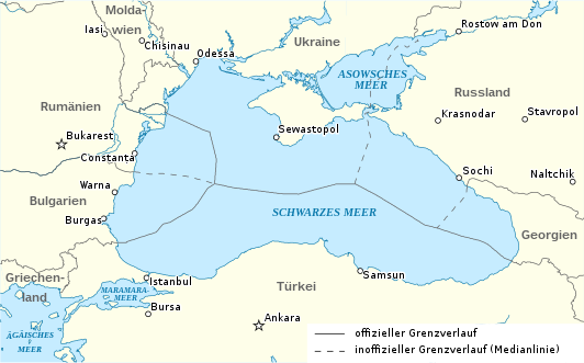
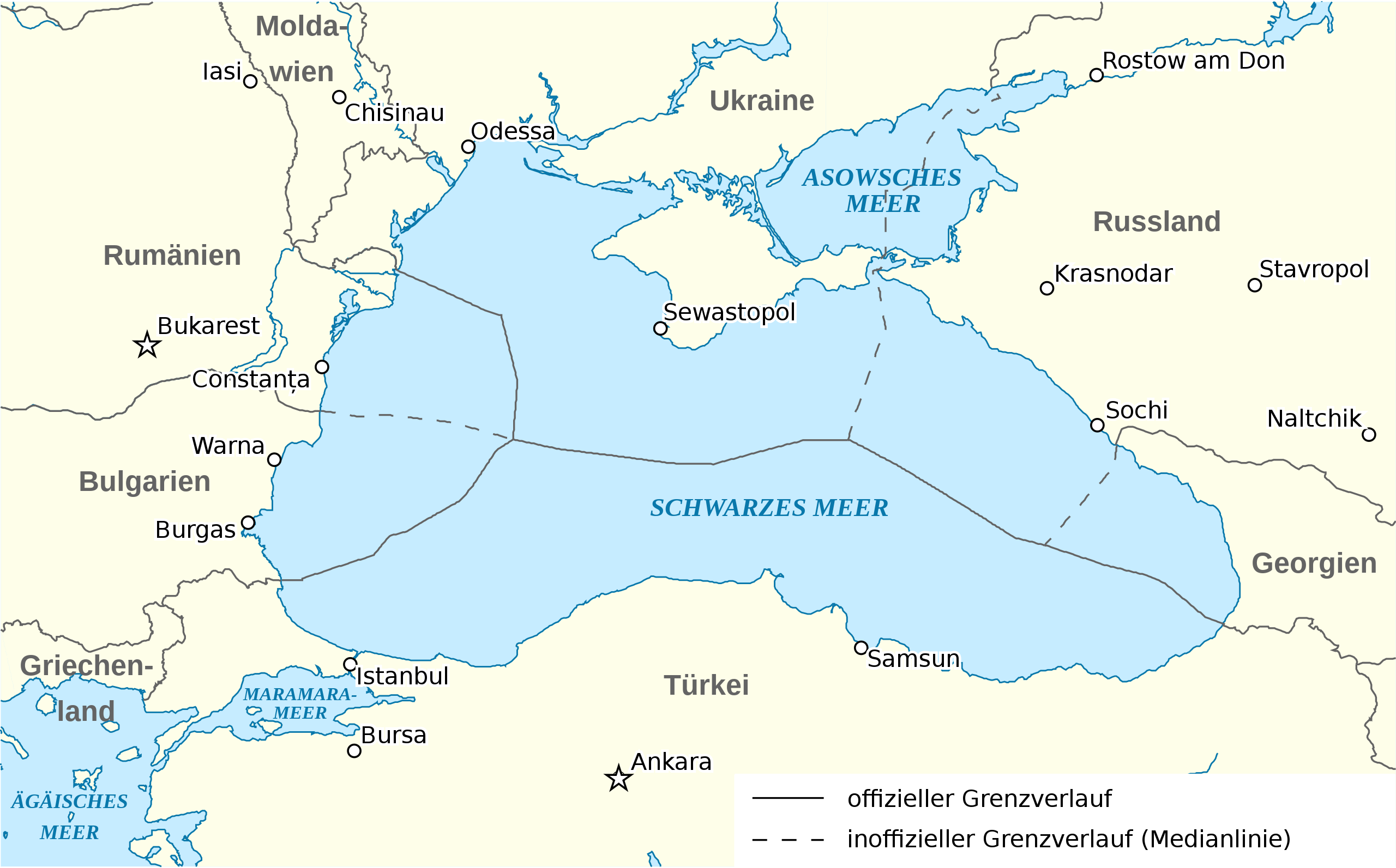
Українська: Ексклюзивні економічні зони держав у Чорному морі
Deutsch: Karte der ausschließlichen Wirtschaftszonen im Schwarzen Meer
Durchgezogen: Vereinbarte Grenzverläufe. Gestrichelt: Inoffizielle Grenzverläufe
|
| Date | |
| Source | Own work |
| Author | Tentotwo |
| Other versions |
[]
|
.svg)


|
This SVG file contains embedded text that can be translated into your language, using any capable SVG editor, text editor or the SVG Translate tool. For more information see: About translating SVG files. |
Licensing[edit]
I, the copyright holder of this work, hereby publish it under the following license:
This file is licensed under the Creative Commons Attribution-Share Alike 3.0 Unported license.
- You are free:
- to share – to copy, distribute and transmit the work
- to remix – to adapt the work
- Under the following conditions:
- attribution – You must give appropriate credit, provide a link to the license, and indicate if changes were made. You may do so in any reasonable manner, but not in any way that suggests the licensor endorses you or your use.
- share alike – If you remix, transform, or build upon the material, you must distribute your contributions under the same or compatible license as the original.
File history
Click on a date/time to view the file as it appeared at that time.
| Date/Time | Thumbnail | Dimensions | User | Comment | |
|---|---|---|---|---|---|
| current | 00:49, 20 March 2012 | | 532 × 331 (178 KB) | Tentotwo (talk | contribs) | Added two Warna and Burgas |
| 04:28, 24 February 2012 |  | 532 × 331 (174 KB) | Tentotwo (talk | contribs) | Added labels for waterbodies | |
| 19:59, 16 February 2012 |  | 532 × 331 (176 KB) | Tentotwo (talk | contribs) | Corrected legend | |
| 19:43, 16 February 2012 |  | 532 × 331 (176 KB) | Tentotwo (talk | contribs) | Added legend | |
| 14:18, 15 February 2012 |  | 532 × 331 (173 KB) | Tentotwo (talk | contribs) | Improved label placement | |
| 14:02, 15 February 2012 |  | 532 × 331 (164 KB) | Tentotwo (talk | contribs) |
You cannot overwrite this file.
File usage on Commons
The following 5 pages use this file:
- File:Ausschliessliche Wirtschaftszonen Schwarzes Meer-uk.svg
- File:Ausschliessliche Wirtschaftszonen Schwarzes Meer.svg
- File:Ausschliessliche Wirtschaftszonen Schwarzes Meer (Reliefkarte)-uk.svg
- File:Ausschliessliche Wirtschaftszonen Schwarzes Meer (Reliefkarte).svg
- Template:Other versions/Ausschliessliche Wirtschaftszonen Schwarzes Meer
-uk.svg)
File usage on other wikis
The following other wikis use this file:
- Usage on de.wikipedia.org