File:Attila in Gaul 451CE-it.svg

Original file (SVG file, nominally 1,283 × 981 pixels, file size: 392 KB)
Captions
Captions
Summary[edit]
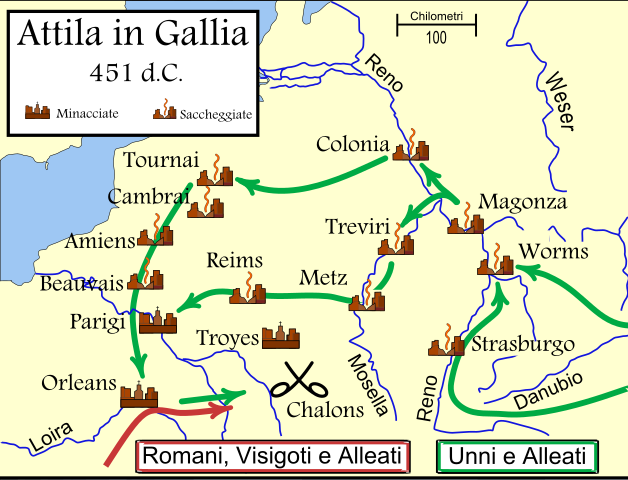
de: Dies ist die deutschsprachige Diagrammversion, andere sind unten angegeben. Das Diagramm zeigt die wahrscheinlichen Wege, die von den Hunnen bei ihrer Invasion Galliens 451 benutzt wurden, und die Schicksale der Städte auf ihrem Weg. Die verschiedenen Quellen ergeben widersprüchliche Information darüber, ob Städte geplündert wurden, insbesondere Trier. Es wird auch gesagt, daß einige Städte südöstlich von Troyes einschließlich Auxerre, Besancon und Langres geplündert wurden.
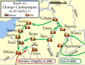
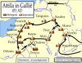
en: An historical map showing the Hun invasion of Gaul in 451 CE (AD), leading to the Battle of Chalons. The generally accepted routes are shown, along with the larger cities threatened or sacked by the Huns.
fr: Une carte historique montrant l'invasion des Huns de la Gaule en 451 Ap J-C, et la bataille des champs Catalauniques. Les itinéraires probables sont montrés, avec les villes plus grandes menacées ou pillées par les huns.
it:Carta storica che descrive l'invasione della Gallia da parte degli Unni nel 451 d.C., e la battaglia dei Campi Catalaunici. Sono mostrati i probabili itinerari, e le città conquistate o risparmiate dagli Unni.
Other versions or similar maps[edit]
[]
-
 German
 -
 English
 -
 Spanish
 -
 French
 -
 Hungarian
 -
 Italian
 -
 Luxembourgish
 -
 Dutch
Dutch -
 Portuguese
 -
 Russian
 -
 Chinese


References[edit]
- Fuller, J.F.C., "The Battle Of Chalons," A Military History of the Western World: From he Earliest Times To The Battle of Lepanto, Da Capo Press, New York, vol. 1. pp. 282-301 ISBN 0-306-80304-6. archive copy at the Wayback Machine
- Attila the Hun and the Battle of Chalons by Arther Ferrill archive copy at the Wayback Machine
- Various other sources including the Catholic Encyclopedia articles on the various cities.
Various sources give conflicting information on whether some cities were sacked, in particular Trier. Man says "no", while Ferrill says "yes". Most other sources agree with Ferrill. There are also several cities southeast of Troyes which were said to have been sacked, including Auxerre, Besancon, and Langres.
In order to be as understandable as possible to the average reader, I have used the modern-day names of the towns, rather than the names used in 451 CE.
Licensing[edit]
Original image created by Mapmaster

|
Permission is granted to copy, distribute and/or modify this document under the terms of the GNU Free Documentation License, Version 1.2 or any later version published by the Free Software Foundation; with no Invariant Sections, no Front-Cover Texts, and no Back-Cover Texts. A copy of the license is included in the section entitled GNU Free Documentation License. |
| This file is licensed under the Creative Commons Attribution-Share Alike 3.0 Unported license. | ||
| ||
| This licensing tag was added to this file as part of the GFDL licensing update. |
File history
Click on a date/time to view the file as it appeared at that time.
| Date/Time | Thumbnail | Dimensions | User | Comment | |
|---|---|---|---|---|---|
| current | 04:17, 23 February 2007 | | 1,283 × 981 (392 KB) | MapMaster (talk | contribs) | Changed font for better looking map |
| 04:10, 23 February 2007 |  | 1,283 × 981 (165 KB) | MapMaster (talk | contribs) | Changed font for better looking map. | |
| 22:32, 22 February 2007 |  | 1,283 × 981 (168 KB) | Triph (talk | contribs) | Carta storica che descrive l'invasione della Gallia da parte degli Unni nel 451 d.C., e la battaglia dei Campi Catalaunici. Sono mostrati i probabili itinerari, e le città conquistate o risparmiate dagli Unni. |
You cannot overwrite this file.
File usage on Commons
The following 27 pages use this file:
- Battle of Chalons
- File:Attila in Gallia 451dC.svg (file redirect)
- File:Attila in Gaul 451CE.svg
- File:Attila in Gaul 451CE-fr.svg
- File:Attila in Gaul 451CE-de.svg
- File:Attila in Gaul 451CE-it.svg
- Battle of Chalons
- File:Attila in Gaul 451CE-nl.svg
- File:Attila in Gaul 451CE-es.svg
- File:Attila in Gaul 451CE-pt.svg
- File:Attila in Gaul 451CE-hu.svg
- Template:Other versions/Attila in Gaul 451CE
- File:Attila in Gaul 451CE-ru.png
- File:Attila in Gaul 451CE-lb.svg
- File:Attila in Gaul 451CE-zh.svg
- File:Attila in Gaul 451CE-de.svg
- File:Attila in Gaul 451CE-es.svg
- File:Attila in Gaul 451CE-fr.svg
- File:Attila in Gaul 451CE-hu.svg
- File:Attila in Gaul 451CE-it.svg
- File:Attila in Gaul 451CE-lb.svg
- File:Attila in Gaul 451CE-nl.svg
- File:Attila in Gaul 451CE-pt.svg
- File:Attila in Gaul 451CE-ru.png
- File:Attila in Gaul 451CE-zh.svg
- File:Attila in Gaul 451CE.svg
- Template:Other versions/Attila in Gaul 451CE
File usage on other wikis
The following other wikis use this file:
- Usage on fa.wikipedia.org
- Usage on fi.wikipedia.org
- Usage on it.wikipedia.org