File:Atalaya (Peru) Rios Tambo+Ucayali.jpg
Jump to navigation
Jump to search
Size of this preview: 800 × 600 pixels. Other resolutions: 320 × 240 pixels | 640 × 480 pixels | 1,024 × 768 pixels | 1,280 × 960 pixels | 2,560 × 1,920 pixels | 4,416 × 3,312 pixels.
Original file (4,416 × 3,312 pixels, file size: 1.76 MB, MIME type: image/jpeg)
Captions
Captions
Add a one-line explanation of what this file represents
Summary[edit]
_Rios_Tambo%2BUcayali.jpg&action=edit§ion=1)
| Description |
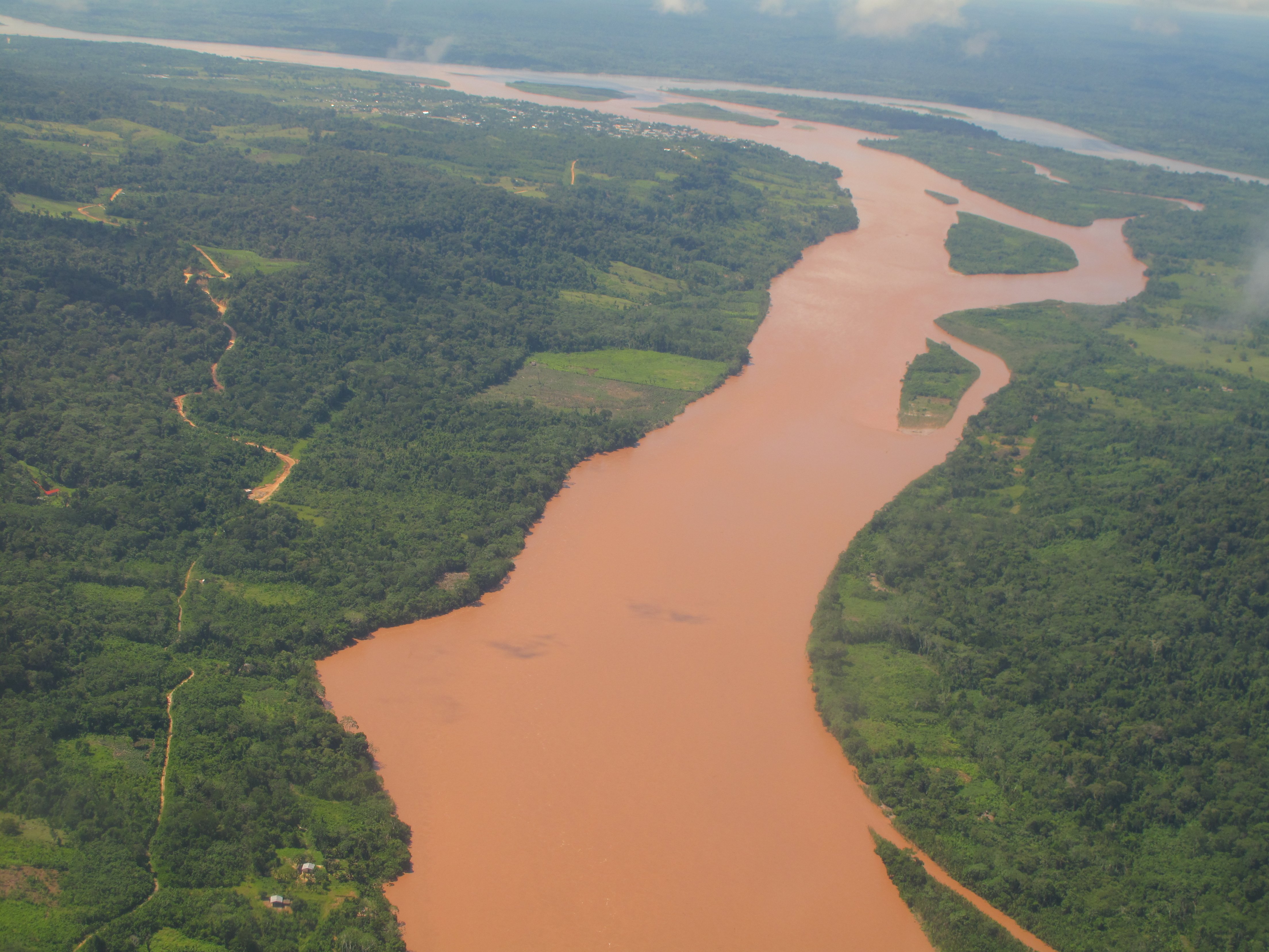
English: Aerial view of the confluence of the Río Tambo (from bottom to top) and the Río Urubamba (in the background, from right to left) forming the Río Ucayali (left). The city at the confluence is Atalaya in the Peruvian Region of Ucayali.
Deutsch: Luftbild des Zusammenflusses des Río Tambo (im Bild von vorne nach hinten fliessend) und des Río Urubamba (von rechts nach links) bei Atalaya (Ucayali, Peru). Der vereinte Fluss heisst von hier weg Ucayali (nach links fliessend).
Español: Vista aérea de la confluencia de los Ríos Tambo (delante) y Urubamba (derecha, al fondo) cerca de la ciudad de Atalaya (Región Ucayali, Perú), formando el Río Ucayali. |
| Date | |
| Source | Own work |
| Author | Maurice Chédel |
Licensing[edit]
_Rios_Tambo%2BUcayali.jpg&action=edit§ion=2)
| I, the copyright holder of this work, release this work into the public domain. This applies worldwide. In some countries this may not be legally possible; if so: I grant anyone the right to use this work for any purpose, without any conditions, unless such conditions are required by law. |
File history
Click on a date/time to view the file as it appeared at that time.
| Date/Time | Thumbnail | Dimensions | User | Comment | |
|---|---|---|---|---|---|
| current | 12:19, 12 April 2010 | | 4,416 × 3,312 (1.76 MB) | Altiplano (talk | contribs) | {{Information |Description={{en|1=Aerial view of the confluence of the Río Tambo (from bottom to top) and the Río Urubamba (in the background, from right to left) forming the Río Ucayali (left). The city at the confluence is Atalaya in the Peruvian Reg |
You cannot overwrite this file.
File usage on Commons
The following 4 pages use this file:
File usage on other wikis
The following other wikis use this file:
- Usage on af.wikipedia.org
- Usage on ar.wikipedia.org
- Usage on arz.wikipedia.org
- Usage on ast.wikipedia.org
- Usage on ay.wikipedia.org
- Usage on be.wikipedia.org
- Usage on bg.wikipedia.org
- Usage on bn.wikipedia.org
- Usage on bs.wikipedia.org
- Usage on ca.wikipedia.org
- Usage on ceb.wikipedia.org
- Usage on cv.wikipedia.org
- Usage on de.wikipedia.org
- Usage on en.wikipedia.org
- Usage on eo.wikipedia.org
- Usage on es.wikipedia.org
- Usage on eu.wikipedia.org
- Usage on fa.wikipedia.org
- Usage on fr.wikipedia.org
- Usage on fr.wikivoyage.org
- Usage on gl.wikipedia.org
- Usage on he.wikipedia.org
- Usage on hr.wikipedia.org
- Usage on hu.wikipedia.org
- Usage on hy.wikipedia.org
- Usage on id.wikipedia.org
- Usage on it.wikipedia.org
- Usage on ja.wikipedia.org
- Usage on kk.wikipedia.org
- Usage on lt.wikipedia.org
- Usage on ml.wikipedia.org
View more global usage of this file.
_Rios_Tambo%2BUcayali.jpg)
_Rios_Tambo%2BUcayali.jpg&oldid=806049818)