File:Assiette avec décor de scène de palestre - Musée du Louvre AGER LP 2574 ; N 3488 ; G 7.jpg
Jump to navigation
Jump to search
Size of this preview: 600 × 600 pixels. Other resolutions: 240 × 240 pixels | 480 × 480 pixels | 768 × 768 pixels | 1,024 × 1,024 pixels | 2,480 × 2,480 pixels.
Original file (2,480 × 2,480 pixels, file size: 1.95 MB, MIME type: image/jpeg)
Captions
Captions
Add a one-line explanation of what this file represents
Summary
Object
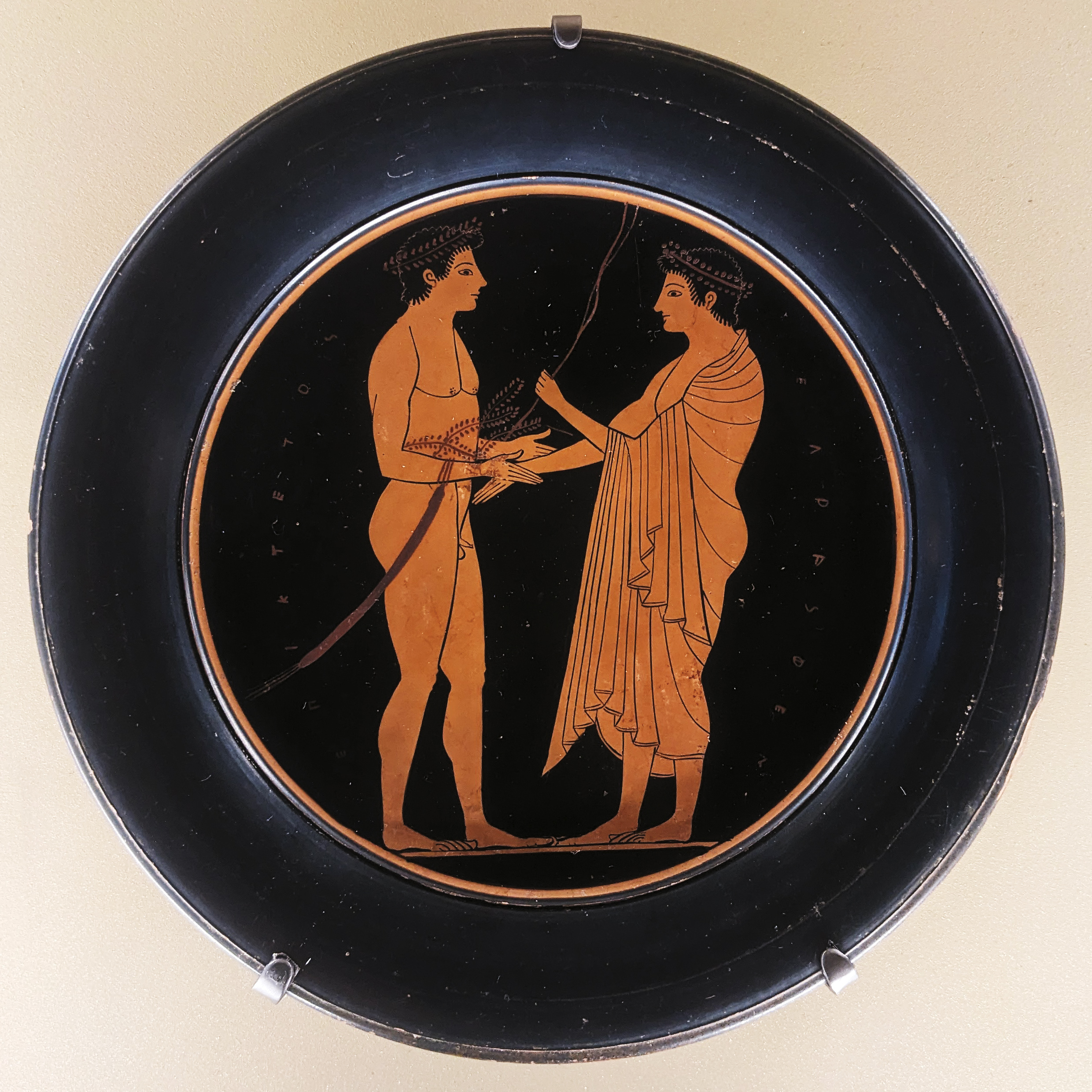
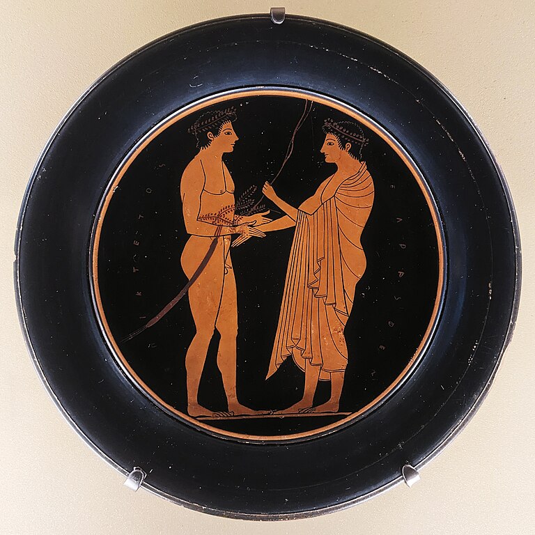
| Plate with palaestra scene
|
||||||||||||||||||||||||
|---|---|---|---|---|---|---|---|---|---|---|---|---|---|---|---|---|---|---|---|---|---|---|---|---|
| Artist |
|
 | ||||||||||||||||||||||
| Title |
Plate with palaestra scene |
|||||||||||||||||||||||
| Object type |
tondo / plate |
|||||||||||||||||||||||
| Date |
between 520 and 510 BC |
|||||||||||||||||||||||
| Medium |
clay, paint, incising and highlight |
|||||||||||||||||||||||
| Dimensions |
height: 2 cm (0.7 in) |
|||||||||||||||||||||||
| Collection |
|
|||||||||||||||||||||||
| Current location | ||||||||||||||||||||||||
| Accession number |
G 7, LP 2574 and N 3488 (Department of Greek, Etruscan, and Roman Antiquities of the Louvre) |
|||||||||||||||||||||||
| Place of creation |
Classical Athens |
|||||||||||||||||||||||
| Place of discovery |
Vulci |
|||||||||||||||||||||||
| Object history |
|
|||||||||||||||||||||||
| References |
Louvre Museum ARK ID: 010270503 |
|||||||||||||||||||||||
| Authority file | ||||||||||||||||||||||||

Photograph
| Date | ||||
| Source | Shonagon | |||
| Author | Shonagon | |||
| Permission (Reusing this file) |
I, the copyright holder of this work, hereby publish it under the following license:
|
| Camera location | | View this and other nearby images on: OpenStreetMap |
|---|
Licensing
I, the copyright holder of this work, hereby publish it under the following license:
| This file is made available under the Creative Commons CC0 1.0 Universal Public Domain Dedication. | |
| The person who associated a work with this deed has dedicated the work to the public domain by waiving all of their rights to the work worldwide under copyright law, including all related and neighboring rights, to the extent allowed by law. You can copy, modify, distribute and perform the work, even for commercial purposes, all without asking permission.
|
File history
Click on a date/time to view the file as it appeared at that time.
| Date/Time | Thumbnail | Dimensions | User | Comment | |
|---|---|---|---|---|---|
| current | 13:09, 25 November 2023 | | 2,480 × 2,480 (1.95 MB) | Shonagon (talk | contribs) | Uploaded own work with UploadWizard |
You cannot overwrite this file.
File usage on Commons
The following 3 pages use this file:
File usage on other wikis
The following other wikis use this file:
- Usage on it.wikipedia.org
- Usage on www.wikidata.org