File:Assam in India.png
Jump to navigation
Jump to search
No higher resolution available.
Assam_in_India.png (350 × 426 pixels, file size: 76 KB, MIME type: image/png)
Captions
Captions
Add a one-line explanation of what this file represents
Summary[edit]
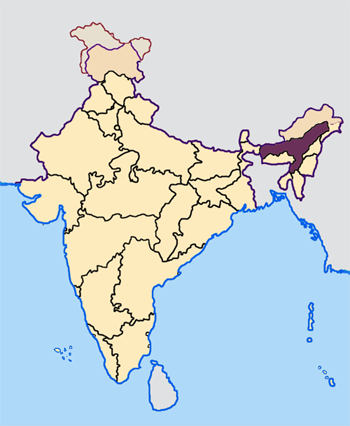
| Description | Note: The Indian state of w:Jammu and Kashmir is claimed by w:India, w:Pakistan and the w:People's Republic of China. This map depicts the boundaries of the state as it was in 1947. Areas administered by India is coloured as per the rest of the states, and the area administered by Pakistan and China are coloured in a neutral colour. See the map of Jammu and Kashmir. The Indian state of w:Arunachal Pradesh is claimed by China as a part of w:South Tibet. The claimed region is depicted in a pale shade of pink. See the map of Arunachal Pradesh. The Indian territorial waters extend to a distance of twelve nautical miles. |
| Date | 1947. |
| Source | Own work by the original uploader |
| Author | Map made by me, Nichalp |
Licensing[edit]

|
Permission is granted to copy, distribute and/or modify this document under the terms of the GNU Free Documentation License, Version 1.2 or any later version published by the Free Software Foundation; with no Invariant Sections, no Front-Cover Texts, and no Back-Cover Texts. A copy of the license is included in the section entitled GNU Free Documentation License. |
| This file is licensed under the Creative Commons Attribution-Share Alike 3.0 Unported license. | ||
| ||
| This licensing tag was added to this file as part of the GFDL licensing update. |
File history
Click on a date/time to view the file as it appeared at that time.
| Date/Time | Thumbnail | Dimensions | User | Comment | |
|---|---|---|---|---|---|
| current | 07:27, 23 April 2005 | | 350 × 426 (76 KB) | Nichalp (talk | contribs) | NPOV map |
| 07:21, 23 April 2005 |  | 200 × 231 (22 KB) | Kerpal (talk | contribs) | Reverted to earlier revision | |
| 06:16, 23 April 2005 |  | 500 × 608 (121 KB) | Nichalp (talk | contribs) | Reverted to earlier revision | |
| 04:59, 23 April 2005 |  | 200 × 231 (22 KB) | Kerpal (talk | contribs) | Reverted to earlier revision | |
| 04:50, 23 April 2005 |  | 500 × 608 (121 KB) | Nichalp (talk | contribs) | Reverted to earlier revision | |
| 21:04, 22 April 2005 |  | 200 × 231 (22 KB) | Kerpal (talk | contribs) | Reverted to earlier revision | |
| 13:39, 22 April 2005 |  | 500 × 608 (121 KB) | Nichalp (talk | contribs) | Reverted to earlier revision | |
| 13:35, 22 April 2005 |  | 500 × 608 (121 KB) | Nichalp (talk | contribs) | Reverted to earlier revision | |
| 09:55, 22 April 2005 |  | 200 × 231 (22 KB) | Kerpal (talk | contribs) | originally by en:User:Morwen | |
| 17:49, 21 April 2005 |  | 500 × 608 (121 KB) | Nichalp (talk | contribs) | Map made by me, ~~~ Note: The Indian state of w:Jammu and Kashmir is claimed by w:India, w:Pakistan and the w:People's Republic of China. This map depicts the boundaries of the state as it was in 1947. Areas administered by India is colo |
You cannot overwrite this file.
File usage on Commons
The following page uses this file:
- File:IndiaAssam.png (file redirect)
File usage on other wikis
The following other wikis use this file:
- Usage on as.wikipedia.org
- Usage on bn.wikipedia.org
- Usage on bs.wikipedia.org
- Usage on bxr.wikipedia.org
- Usage on en.wikipedia.org
- Kamarupa
- History of Assam
- Danava dynasty
- Kamata Kingdom
- Timeline of history of Assam
- Dimasa Kingdom
- Assam Movement
- Bhauma dynasty
- Ahom kingdom
- Colonial Assam
- Template:History of Assam
- 2008 Assam bombings
- Chutia Kingdom
- 2009 Guwahati bombings
- 2009 Assam bombings
- 2004 Indian general election in Assam
- 2009 Indian general election in Assam
- Assam separatist movements
- Dark Age of the Assamese language
- 2012 Assam violence
- Koch–Ahom relations
- 2014 Indian general election in Assam
- Asura Kingdom
- Operation Bajrang
- Usage on en.wikinews.org
- Usage on hi.wikipedia.org
- Usage on ka.wikipedia.org
- Usage on pl.wikipedia.org
View more global usage of this file.