File:Aspangberg-St. Peter - Wetterkoglerhaus (3).JPG
Jump to navigation
Jump to search
Size of this preview: 800 × 533 pixels. Other resolutions: 320 × 213 pixels | 640 × 427 pixels | 1,024 × 682 pixels | 1,280 × 853 pixels | 2,560 × 1,706 pixels | 4,087 × 2,724 pixels.
Original file (4,087 × 2,724 pixels, file size: 9.93 MB, MIME type: image/jpeg)
Captions
Captions
Add a one-line explanation of what this file represents
Summary[edit]
| Description |
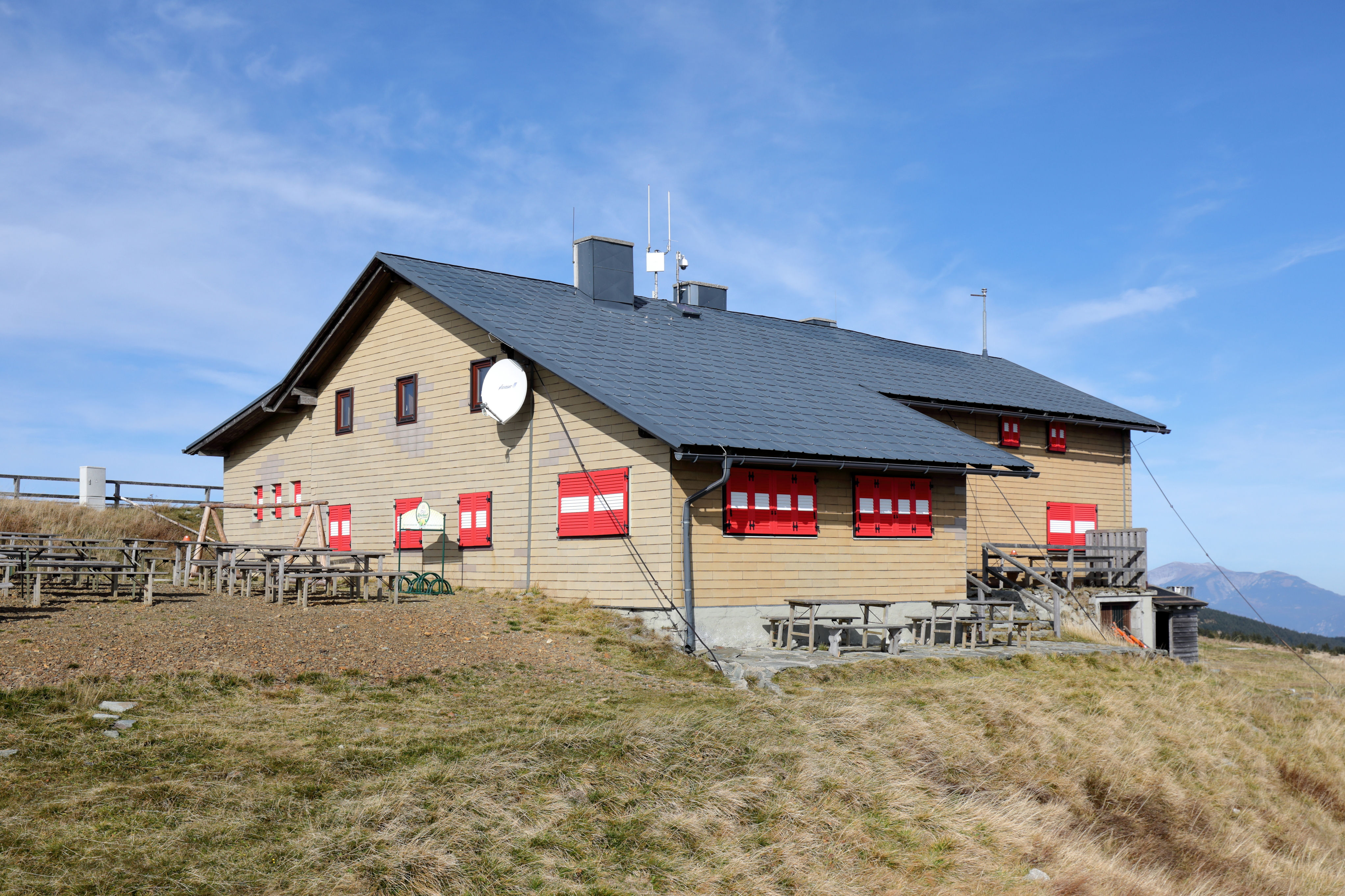
Deutsch: Südostansicht des Wetterkoglerhauses auf dem Gipfel des 1743 m hohen Wechsel und rechts im Hintergrund der Schneeberg. Es ist eine Alpenvereinshütte des Österreichischen Gebirgsvereins und befindet sich auf dem Gemeindegebiet der niederösterreichischen Gemeinde Aspangberg-St. Peter, direkt an der Landesgrenze zur Steiermark. Die 1. Hütte wurde von der Alpinen Gesellschaft „Wetterkogler“ errichtet, am 20. August 1899 feierlich eröffnet und 1905 aufgestockt. 1912 wurde rechtwinkelig zur bestehenden Hütte eine größerer Anbau und eine Veranda errichtet. Am 21. Nov. 1915 brannte das Schutzhaus bis zur Grundmauer ab. 1923 wurde ein neues Wetterkoglerhaus errichtet. Dieses wurde 1930 durch einen Zubau für einen zweiten Gastraum sowie neue Schlafräume erweitert und 1934 erfolgte noch ein Anbau für einen Schiraum. |
| Date | |
| Source | Own work |
| Author | C.Stadler/Bwag |
| Permission (Reusing this file) |
Deutsch: Hallo, du darfst mein Foto kostenlos nutzen, aber nenne mich bitte als Fotograf, beispielsweise „Foto: C.Stadler/Bwag“ oder © C.Stadler/Bwag; CC-BY-SA-4.0. Auf mehr Angaben bestehe ich nicht - im Gegensatz zu manch anderen, die die Vorgaben der unten angeführten Lizenzierung auf Punkt und Beistrich einfordern. English: Feel free to use my photos, but please mention me as the author like © C.Stadler/Bwag or © C.Stadler/Bwag; CC-BY-SA-4.0 (that's good enough) and if you want send me a message: bwag@gmx.net. |
| Other versions |
|
.JPG)
.JPG)
.JPG&action=edit§ion=1)
| Object location | | View this and other nearby images on: OpenStreetMap |
|---|
.JPG¶ms=047.530440_N_0015.914530_E_globe:Earth_class:object_type:object__&language=en)
| Camera location | | View this and other nearby images on: OpenStreetMap |
|---|
.JPG¶ms=047.530240_N_0015.914830_E_globe:Earth_type:camera_heading:315.00&language=en)
Licensing[edit]
.JPG&action=edit§ion=2)
I, the copyright holder of this work, hereby publish it under the following license:
This file is licensed under the Creative Commons Attribution-Share Alike 4.0 International license.
- You are free:
- to share – to copy, distribute and transmit the work
- to remix – to adapt the work
- Under the following conditions:
- attribution – You must give appropriate credit, provide a link to the license, and indicate if changes were made. You may do so in any reasonable manner, but not in any way that suggests the licensor endorses you or your use.
- share alike – If you remix, transform, or build upon the material, you must distribute your contributions under the same or compatible license as the original.
File history
Click on a date/time to view the file as it appeared at that time.
| Date/Time | Thumbnail | Dimensions | User | Comment | |
|---|---|---|---|---|---|
| current | 20:30, 17 October 2019 | | 4,087 × 2,724 (9.93 MB) | Bwag (talk | contribs) | {{Information |Description= {{de|1= Südostansicht des Wetterkoglerhauses auf dem Gipfel des 1743 m hohen Wechsel und rechts im Hintergrund der Schneeberg. Das Schutzhaus befindet sich auf dem Gemeindegebiet der niederösterreichischen Gemeinde Aspangberg-St. Peter und direkt an der Landesgrenze zur Steiermark.<br/>Die 1. Hütte wurde von der Alpinen Gesells... |
You cannot overwrite this file.
File usage on Commons
The following 3 pages use this file:
File usage on other wikis
The following other wikis use this file:
- Usage on de.wikipedia.org
- Usage on en.wikipedia.org
- Usage on fr.wikipedia.org
- Usage on www.wikidata.org
.JPG&oldid=805321121)