File:Arrowhead near Wingina.jpg
Original file (6,016 × 4,000 pixels, file size: 7.25 MB, MIME type: image/jpeg)
Captions
This is an image of a place or building that is listed on the National Register of Historic Places in the United States of America. Its reference number is 100003613. |
Camera location | 37° 38′ 32″ N, 78° 44′ 59″ W | View this and other nearby images on: OpenStreetMap | 37.642222; -78.749722 |
---|
DescriptionArrowhead near Wingina.jpg |
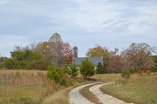
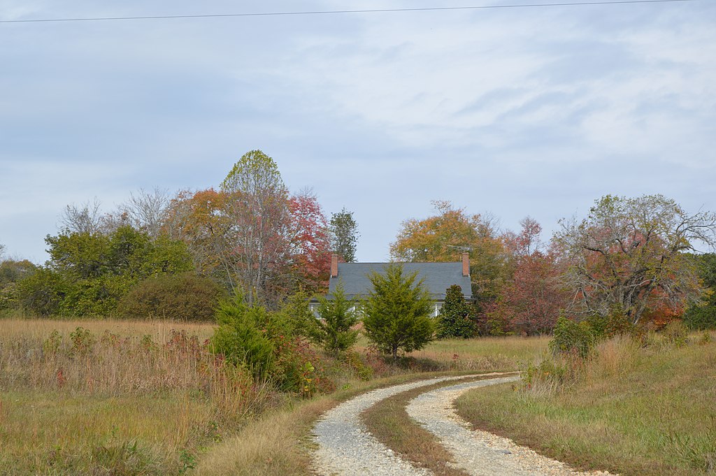
English: Roadside view of Arrowhead, located along Norwood Road just west of Wingina in Nelson County, Virginia, United States. Built in 1922, it is listed on the National Register of Historic Places. |
|||
Date | Taken on 26 October 2019 | |||
Source | Self-photographed | |||
Author | Nyttend | |||
Permission (Reusing this file) |
|
|||
Other versions | None |
File history
Click on a date/time to view the file as it appeared at that time.
Date/Time | Thumbnail | Dimensions | User | Comment | |
---|---|---|---|---|---|
current | 05:17, 27 February 2020 | 6,016 × 4,000 (7.25 MB) | Nyttend (talk | contribs) |
You cannot overwrite this file.
File usage on Commons
There are no pages that use this file.
File usage on other wikis
The following other wikis use this file:
- Usage on en.wikipedia.org
Metadata
This file contains additional information such as Exif metadata which may have been added by the digital camera, scanner, or software program used to create or digitize it. If the file has been modified from its original state, some details such as the timestamp may not fully reflect those of the original file. The timestamp is only as accurate as the clock in the camera, and it may be completely wrong.
Camera manufacturer | NIKON CORPORATION |
---|---|
Camera model | NIKON D3200 |
Exposure time | 1/320 sec (0.003125) |
F-number | f/9 |
ISO speed rating | 100 |
Date and time of data generation | 14:01, 26 October 2019 |
Lens focal length | 55 mm |
Orientation | Normal |
Horizontal resolution | 300 dpi |
Vertical resolution | 300 dpi |
Software used | Ver.1.03 |
File change date and time | 14:01, 26 October 2019 |
Y and C positioning | Co-sited |
Exposure Program | Not defined |
Exif version | 2.3 |
Date and time of digitizing | 14:01, 26 October 2019 |
Meaning of each component |
|
Image compression mode | 2 |
APEX exposure bias | 0 |
Maximum land aperture | 5 APEX (f/5.66) |
Metering mode | Pattern |
Light source | Unknown |
Flash | Flash did not fire, compulsory flash suppression |
DateTime subseconds | 90 |
DateTimeOriginal subseconds | 90 |
DateTimeDigitized subseconds | 90 |
Supported Flashpix version | 1 |
Color space | sRGB |
Sensing method | One-chip color area sensor |
File source | Digital still camera |
Scene type | A directly photographed image |
Custom image processing | Normal process |
Exposure mode | Auto exposure |
White balance | Auto white balance |
Digital zoom ratio | 1 |
Focal length in 35 mm film | 82 mm |
Scene capture type | Standard |
Scene control | None |
Contrast | Normal |
Saturation | Normal |
Sharpness | Normal |
Subject distance range | Unknown |
GPS tag version | 2.3.0.0 |
Structured data
Items portrayed in this file
depicts
26 October 2019
37°38'31.999"N, 78°44'58.999"W
0.003125 second
55 millimetre
100
image/jpeg
c79bcf0febea2e08a139ce02a1cc2afac9238354
7,601,881 byte
4,000 pixel
6,016 pixel
- National Register of Historic Places with known IDs
- National Register of Historic Places missing SDC depicts
- National Register of Historic Places missing SDC location of creation
- Files with coordinates missing SDC location of creation
- United States photographs taken on 2019-10-26
- Self-published work
- PD-self
- Building-centered pictures by User:Nyttend
- Pages with maps