File:Arkansas-fourth-congressional-district.svg
Jump to navigation
Jump to search

Size of this PNG preview of this SVG file: 554 × 491 pixels. Other resolutions: 271 × 240 pixels | 542 × 480 pixels | 867 × 768 pixels | 1,155 × 1,024 pixels | 2,311 × 2,048 pixels.
Original file (SVG file, nominally 554 × 491 pixels, file size: 278 KB)
Captions
Captions
Add a one-line explanation of what this file represents
Summary[edit]
| Description |
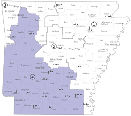
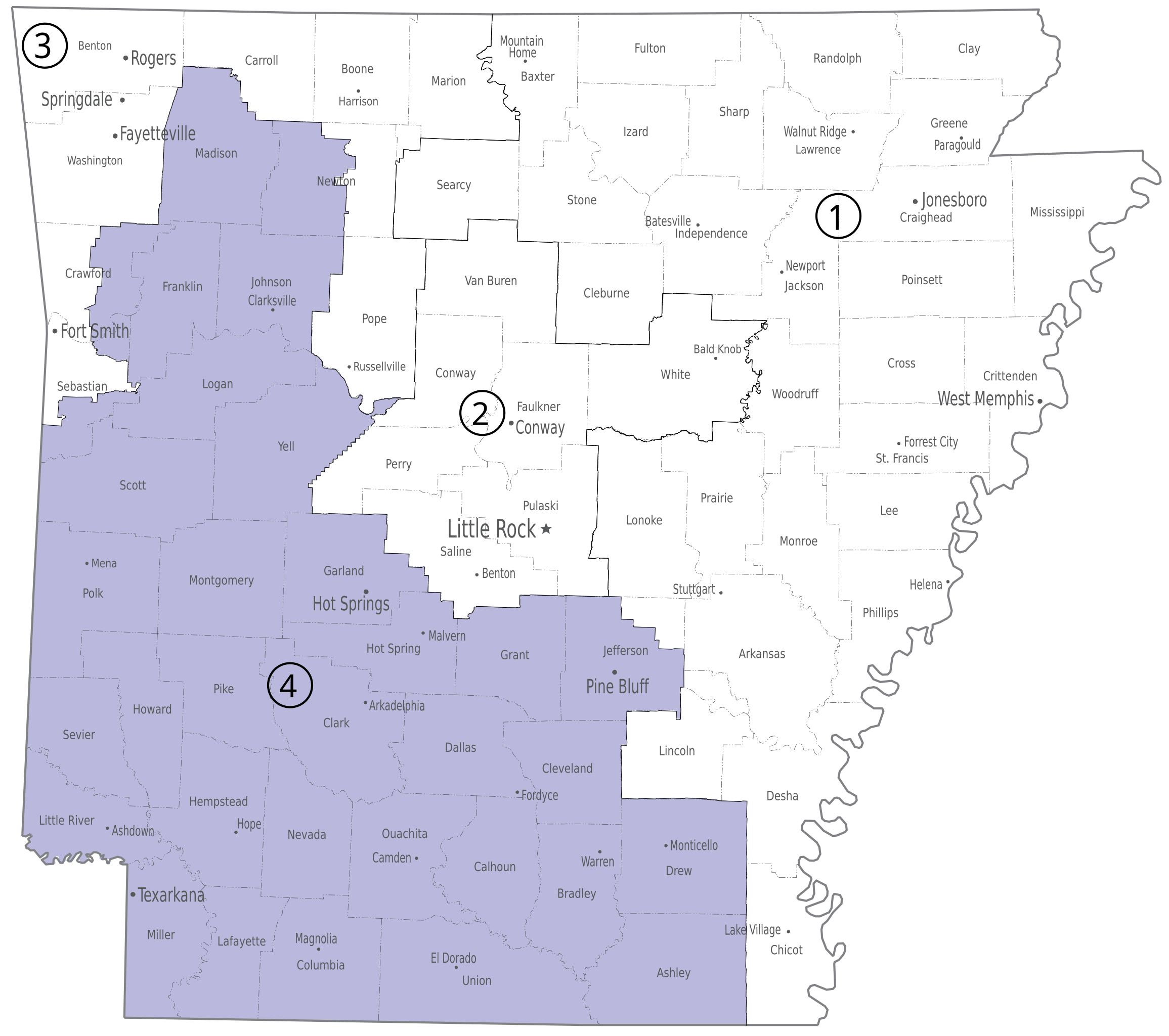
English: Fourth congressional district of the U.S. state of Arkansas. |
| Date | |
| Source | U.S. National Atlas, http://www.nationalatlas.gov/printable/images/pdf/congdist/pagecgd113_ar.pdf |
| Author | U.S. Government |
Licensing[edit]
This map was obtained from an edition of the National Atlas of the United States. Like almost all works of the U.S. federal government, works from the National Atlas are in the public domain in the United States.
Online access: NationalAtlas.gov | 1970 print edition: Library of Congress, Perry-Castañeda Library
|
File history
Click on a date/time to view the file as it appeared at that time.
| Date/Time | Thumbnail | Dimensions | User | Comment | |
|---|---|---|---|---|---|
| current | 21:11, 12 April 2014 | | 554 × 491 (278 KB) | Granttchart (talk | contribs) | Save without Illustrator metadata, fix some drawing issues |
| 16:39, 12 April 2014 |  | 554 × 491 (2.73 MB) | Granttchart (talk | contribs) | User created page with UploadWizard |
You cannot overwrite this file.
File usage on Commons
The following 2 pages use this file:
File usage on other wikis
The following other wikis use this file:
- Usage on fr.wikipedia.org
- Usage on nl.wikipedia.org
- Usage on pt.wikipedia.org
- Usage on simple.wikipedia.org
- Usage on www.wikidata.org