File:Argentina Río Negro location map.svg
Jump to navigation
Jump to search

Size of this PNG preview of this SVG file: 798 × 600 pixels. Other resolutions: 319 × 240 pixels | 639 × 480 pixels | 1,022 × 768 pixels | 1,280 × 962 pixels | 2,560 × 1,924 pixels | 1,095 × 823 pixels.
Original file (SVG file, nominally 1,095 × 823 pixels, file size: 352 KB)
Captions
Captions
Add a one-line explanation of what this file represents
Summary[edit]
| Description |
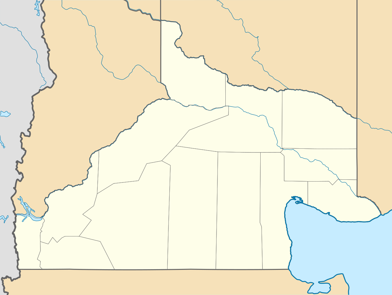
Deutsch: Positionskarte von Río Negro (Argentinien) English: Location map of Río Negro province (Argentina) Español: Mapa de localización de la Provincia de Río Negro.
Equirectangular projection, N/S stretching 130 %. Geographic limits of the map:
|
| Date | (UTC) |
| Source |
This file was derived from: |
| Author |
|
| Other versions |
|

Licensing[edit]
This file is licensed under the Creative Commons Attribution-Share Alike 3.0 Unported license.
- You are free:
- to share – to copy, distribute and transmit the work
- to remix – to adapt the work
- Under the following conditions:
- attribution – You must give appropriate credit, provide a link to the license, and indicate if changes were made. You may do so in any reasonable manner, but not in any way that suggests the licensor endorses you or your use.
- share alike – If you remix, transform, or build upon the material, you must distribute your contributions under the same or compatible license as the original.
Original upload log[edit]
This image is a derivative work of the following images:
- File:Argentina_location_map.svg licensed with Cc-by-sa-3.0, GFDL
- File:Map_of_Río_Negro_Province.svg licensed with Cc-by-sa-3.0,2.5,2.0,1.0, GFDL
Uploaded with derivativeFX
File history
Click on a date/time to view the file as it appeared at that time.
| Date/Time | Thumbnail | Dimensions | User | Comment | |
|---|---|---|---|---|---|
| current | 23:41, 26 December 2022 | | 1,095 × 823 (352 KB) | GrandEscogriffe (talk | contribs) | restretching, former one was incorrect due to incorrect documentation |
| 22:55, 23 November 2022 |  | 1,095 × 796 (353 KB) | GrandEscogriffe (talk | contribs) | more correct north-south stretching | |
| 20:30, 22 October 2017 |  | 1,095 × 692 (356 KB) | Janitoalevic (talk | contribs) | Límites más precisos. | |
| 09:34, 10 September 2017 |  | 1,095 × 692 (352 KB) | Milenioscuro (talk | contribs) | capas | |
| 18:40, 25 September 2012 |  | 1,095 × 692 (496 KB) | Milenioscuro (talk | contribs) | {{Information |Description ={{en|1=Location map of Río Negro province}} |Source ={{own}} |Author =Shadowxfox |Date = |Permission = |other_versions = }} |
You cannot overwrite this file.
File usage on Commons
The following 13 pages use this file:
- File:Argentina Río Negro topographic location map.png
- Category:Cities in Río Negro Province
- Category:Dams in Rio Negro Province
- Category:Departments of Río Negro Province
- Category:Geography of Río Negro Province
- Category:Lighthouses in Río Negro Province
- Category:Maps of Río Negro Province
- Category:People of Río Negro Province
- Category:Populated places in Río Negro Province
- Category:Río Negro Province
- Category:Sports in Río Negro Province
- Category:Train stations in Río Negro Province
- Category:Transport in Río Negro Province
File usage on other wikis
The following other wikis use this file:
- Usage on ar.wikipedia.org
- Usage on bg.wikipedia.org
- Usage on ceb.wikipedia.org
- Usage on da.wikipedia.org
- Usage on de.wikipedia.org
- Usage on en.wikipedia.org
- Usage on eo.wikipedia.org
- Usage on es.wikipedia.org
- El Bolsón
- Viedma
- Cipolletti
- General Roca (Río Negro)
- San Antonio Oeste
- Las Grutas
- San Antonio Este
- Cinco Saltos
- Choele Choel
- Maquinchao
- Pilcaniyeu
- Sierra Grande
- General Enrique Godoy
- Villa Regina
- El Cuy
- Sierra Colorada
- Ñorquincó
- Río Colorado (Río Negro)
- Ingeniero Jacobacci
- General Conesa (Río Negro)
- Valcheta
- Aeropuerto Internacional Teniente Luis Candelaria
- Chimpay
- Allen
- El Cóndor (Río Negro)
- General Fernández Oro
- Dina Huapi
- Los Menucos
- Catriel (Río Negro)
- Lamarque (Río Negro)
- Playas Doradas
- Ingeniero Luis A. Huergo
- Villa Cerro Catedral
View more global usage of this file.