File:Map of UNESCO Regions to localize World Heritage Sites.jpg
(Redirected from File:Areas WHS.jpg)

Size of this preview: 800 × 352 pixels. Other resolutions: 320 × 141 pixels | 640 × 282 pixels | 1,427 × 628 pixels.
Original file (1,427 × 628 pixels, file size: 306 KB, MIME type: image/jpeg)
Captions
Captions
Add a one-line explanation of what this file represents
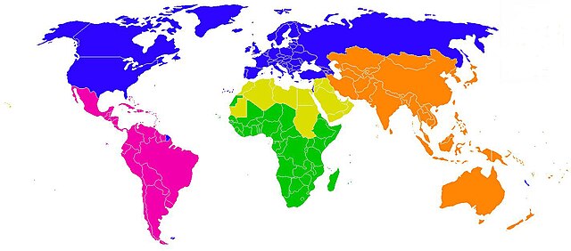
| Description | Map of UNESCO Regions in order to localize World Heritage Sites. |
| Date | (UTC) |
| Source | |
| Author |
|
| This is a retouched picture, which means that it has been digitally altered from its original version. Modifications: Remove legend. The original can be viewed here: Map of UNESCO Regions to localize World Heritage Sites - Hebrew.jpg:
|
I, the copyright holder of this work, hereby publish it under the following licenses:
| This file is licensed under the Creative Commons Attribution-Share Alike 3.0 Unported license. | ||
| ||
| This licensing tag was added to this file as part of the GFDL licensing update. |

|
Permission is granted to copy, distribute and/or modify this document under the terms of the GNU Free Documentation License, Version 1.2 or any later version published by the Free Software Foundation; with no Invariant Sections, no Front-Cover Texts, and no Back-Cover Texts. A copy of the license is included in the section entitled GNU Free Documentation License. |
You may select the license of your choice.
Original upload log[edit]
This image is a derivative work of the following images:
- File:Map of UNESCO Regions to localize World Heritage Sites - Hebrew.jpg licensed with Cc-by-sa-3.0-migrated, GFDL
- 2008-09-09T19:38:40Z Ori~ 1427x628 (108158 Bytes) Base: http://commons.wikimedia.org/wiki/Image:Areas_WHS_(italian).png == Summary == {{Information |Description=Image that shows the areas used by UNESCO in order to localize World Heritage Sites. |Source=self-made modifying
Uploaded with derivativeFX
File history
Click on a date/time to view the file as it appeared at that time.
| Date/Time | Thumbnail | Dimensions | User | Comment | |
|---|---|---|---|---|---|
| current | 19:24, 19 July 2020 | | 1,427 × 628 (306 KB) | Naouk (talk | contribs) | Reverted to version as of 05:27, 27 January 2011 (UTC) see http://whc.unesco.org/en/list/&order=region |
| 21:31, 6 March 2018 |  | 1,427 × 628 (187 KB) | Maphobbyist (talk | contribs) | South Sudan | |
| 05:27, 27 January 2011 |  | 1,427 × 628 (306 KB) | Kolossus~commonswiki (talk | contribs) | Some errors fixed | |
| 20:13, 14 March 2010 |  | 1,427 × 628 (301 KB) | Kolossus~commonswiki (talk | contribs) | {{Information |Description=Image that shows the areas used by UNESCO in order to localize World Heritage Sites. |Source=*File:Areas_WHS_HEB.jpg |Date=2010-03-14 20:11 (UTC) |Author=*File:Areas_WHS_HEB.jpg: Jalo *derivative work: |
You cannot overwrite this file.
File usage on Commons
The following page uses this file:
- File:Areas WHS.jpg (file redirect)
File usage on other wikis
The following other wikis use this file:
- Usage on ar.wikipedia.org
- Usage on bg.wikipedia.org
- Usage on br.wikipedia.org
- Usage on cs.wikipedia.org
- Usage on eo.wikipedia.org
- Usage on fr.wikipedia.org
- Usage on io.wikipedia.org
- Usage on ja.wikipedia.org
- Usage on nl.wikipedia.org
- Usage on pt.wikipedia.org
- Usage on uk.wikipedia.org