File:Appalachians and Appalachia Map TEST.jpg
Jump to navigation
Jump to search
Size of this preview: 349 × 600 pixels. Other resolutions: 139 × 240 pixels | 429 × 737 pixels.
Original file (429 × 737 pixels, file size: 104 KB, MIME type: image/jpeg)
Captions
Captions
Add a one-line explanation of what this file represents
Summary[edit]
| Description |
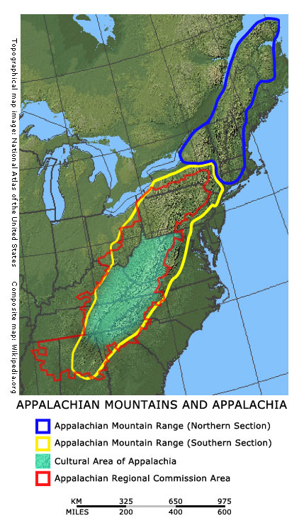
English: Appalacian area of the United States |
| Date | |
| Source | "I created this composite map for public domain use, incorporating a map image from the National Atlas of the United States, a U.S. Government publication, thus in the public domain." |
| Author | Appachianeditor at English Wikipedia |
Licensing[edit]
| I, the copyright holder of this work, release this work into the public domain. This applies worldwide. In some countries this may not be legally possible; if so: I grant anyone the right to use this work for any purpose, without any conditions, unless such conditions are required by law. |
File history
Click on a date/time to view the file as it appeared at that time.
| Date/Time | Thumbnail | Dimensions | User | Comment | |
|---|---|---|---|---|---|
| current | 11:37, 10 February 2007 | | 429 × 737 (104 KB) | Appachianeditor (talk | contribs) | I created this composite map for public domain use, incorporating a map image from the National Atlas of the United States, a U.S. Government publication, thus in the public domain. |
You cannot overwrite this file.
File usage on Commons
There are no pages that use this file.
File usage on other wikis
The following other wikis use this file:
- Usage on en.wikipedia.org