File:Antarctica map indicating Antarctic Peninsula.JPG
Jump to navigation
Jump to search
Size of this preview: 660 × 600 pixels. Other resolutions: 264 × 240 pixels | 528 × 480 pixels | 845 × 768 pixels | 1,074 × 976 pixels.
Original file (1,074 × 976 pixels, file size: 222 KB, MIME type: image/jpeg)
Captions
Captions
Add a one-line explanation of what this file represents


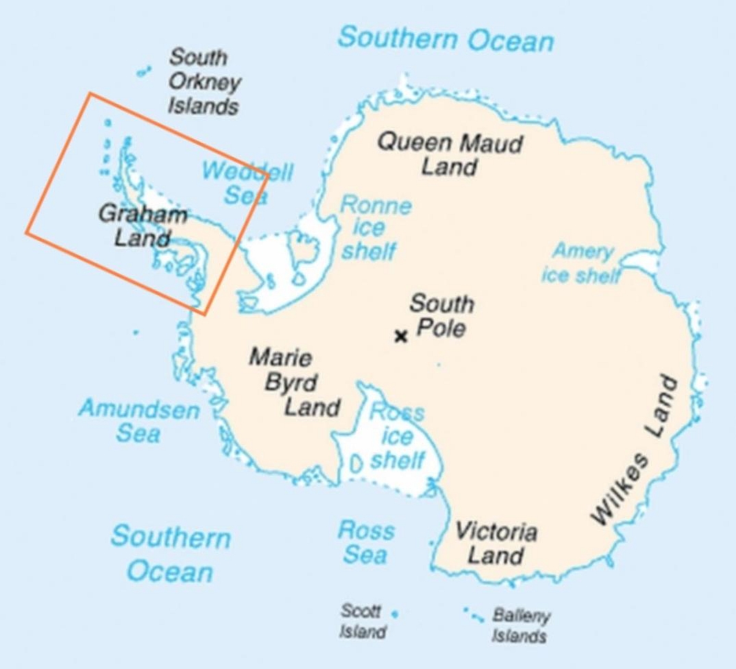
| Description | Map of Antarctica indicating location of Antarctic Peninsula. |
| Date | (UTC) |
| Source | |
| Author |
|
| Other versions | العربيَّة |
| This is a retouched picture, which means that it has been digitally altered from its original version. Modifications: Added frame indicating location of Antarctic Peninsula. The original can be viewed here: Map-antarctica-ross-ice-shelf-red-x.png:
|
This image is in the public domain because it contains materials that originally came from the United States Central Intelligence Agency's World Factbook.
|
 |
Original upload log[edit]
This image is a derivative work of the following images:
- File:Map-antarctica-ross-ice-shelf-red-x.png licensed with PD-USGov-CIA-WF
- 2009-02-16T17:22:04Z Jeandré du Toit 316x313 (26247 Bytes) {{Information |Description=*Map of Antarctica with a red X on the Ross ice shelf. |Source=*[[:File:Antarctica_Map.png|]] |Date=2009-02-16 17:20 (UTC) |Author=*[[:File:Antarctica_Map.png|]] *derivative work: ~~~ |Permission=se
Uploaded with derivativeFX
File history
Click on a date/time to view the file as it appeared at that time.
| Date/Time | Thumbnail | Dimensions | User | Comment | |
|---|---|---|---|---|---|
| current | 06:30, 6 April 2009 | | 1,074 × 976 (222 KB) | Anna Frodesiak (talk | contribs) | Removed red X indicating location of Ross Ice Shelf. Sharpened image slightly. |
| 23:08, 5 April 2009 |  | 1,074 × 976 (225 KB) | Anna Frodesiak (talk | contribs) | {{Information |Description=Map of Antarctica indicating location of Antarctic Peninsula. |Source=*File:Map-antarctica-ross-ice-shelf-red-x.png |Date=2009-04-06 00:04 (UTC) |Author=*File:Map-antarctica-ross-ice-shelf-red-x.png: *[[:File:Antarct |
You cannot overwrite this file.
File usage on Commons
There are no pages that use this file.
File usage on other wikis
The following other wikis use this file:
- Usage on af.wikipedia.org
- Usage on ang.wikipedia.org
- Usage on ar.wikipedia.org
- Usage on be.wikipedia.org
- Usage on bn.wikipedia.org
- Usage on bs.wikipedia.org
- Usage on da.wikipedia.org
- Usage on el.wikipedia.org
- Usage on en.wikipedia.org
- Usage on fi.wikipedia.org
- Usage on ga.wikipedia.org
- Usage on hi.wikipedia.org
- Usage on hr.wikipedia.org
- Usage on hu.wikipedia.org
- Usage on hy.wikipedia.org
- Usage on it.wikipedia.org
- Usage on ja.wikipedia.org
- Usage on kk.wikipedia.org
- Usage on ko.wikipedia.org
- Usage on la.wikipedia.org
- Usage on mk.wikipedia.org
- Usage on ms.wikipedia.org
- Usage on nn.wikipedia.org
- Usage on pa.wikipedia.org
- Usage on pnb.wikipedia.org
- Usage on ro.wikipedia.org
- Usage on ru.wikipedia.org
- Usage on simple.wikipedia.org
- Usage on sk.wikipedia.org
- Usage on sw.wikipedia.org
- Usage on ta.wikipedia.org
- Usage on uk.wikipedia.org
- Usage on ur.wikipedia.org
- Usage on vi.wikipedia.org
- Usage on war.wikipedia.org
View more global usage of this file.