File:Antarctica-east2-en.jpg
Jump to navigation
Jump to search
No higher resolution available.
Antarctica-east2-en.jpg (619 × 310 pixels, file size: 135 KB, MIME type: image/jpeg)
Captions
Captions
Add a one-line explanation of what this file represents

|
This map image could be re-created using vector graphics as an SVG file. This has several advantages; see Commons:Media for cleanup for more information. If an SVG form of this image is available, please upload it and afterwards replace this template with
{{vector version available|new image name}}.
It is recommended to name the SVG file “Antarctica-east2-en.svg”—then the template Vector version available (or Vva) does not need the new image name parameter. |


Summary[edit]
| Description |
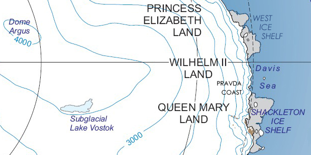
English: Princess Elizabeth Land, Wilhelm II Land and Queen Mary Land on East Antarctica map (in English)
Русский: Земля Принцессы Елизаветы, Земля Вильгельма II и Земля Королевы Мэри на карте Восточной Антарктиды (на английском языке) |
||
| Date | 30 October 2014 (upload date) | ||
| Source | Own work | ||
| Author | Nickpo | ||
| Permission (Reusing this file) |
|
||
| Other versions |
This file was derived from: Antarctica major geographical features.jpg:  |
File history
Click on a date/time to view the file as it appeared at that time.
| Date/Time | Thumbnail | Dimensions | User | Comment | |
|---|---|---|---|---|---|
| current | 14:04, 30 October 2014 | | 619 × 310 (135 KB) | Nickpo (talk | contribs) | {{Information |Description={{en|1=Princess Elizabeth Land, Wilhelm II Land and Queen Mary Land on East Antarctica map (in English)}} {{ru|1=Земля Принцессы Елизаветы, [[:ru... |
You cannot overwrite this file.
File usage on Commons
The following page uses this file:
File usage on other wikis
The following other wikis use this file:
- Usage on az.wikipedia.org
- Usage on bg.wikipedia.org
- Usage on ca.wikipedia.org
- Usage on ceb.wikipedia.org
- Polarårboken Glacier
- Philippi Glacier (suba sa yelo sa Antartika)
- Polar Record Glacier
- Polar Times Glacier
- Polarforschung Glacier
- Posadowsky Glacier (suba sa yelo sa Antartika)
- Ranvik Glacier
- Rogers Glacier (suba sa yelo sa Antartika)
- Stevenson Glacier (suba sa yelo sa Antartika)
- Browns Glacier
- Burton Island Glacier
- Chaos Glacier (suba sa yelo sa Antartika)
- Dålk Glacier
- Hovde Glacier
- Il Polo Glacier
- Jones Glacier (suba sa yelo sa Antartika)
- Kreitzer Glacier
- Usage on de.wikipedia.org
- Usage on en.wikipedia.org
- Usage on es.wikipedia.org
- Usage on eu.wikipedia.org
- Usage on fr.wikipedia.org
- Usage on he.wikipedia.org
View more global usage of this file.