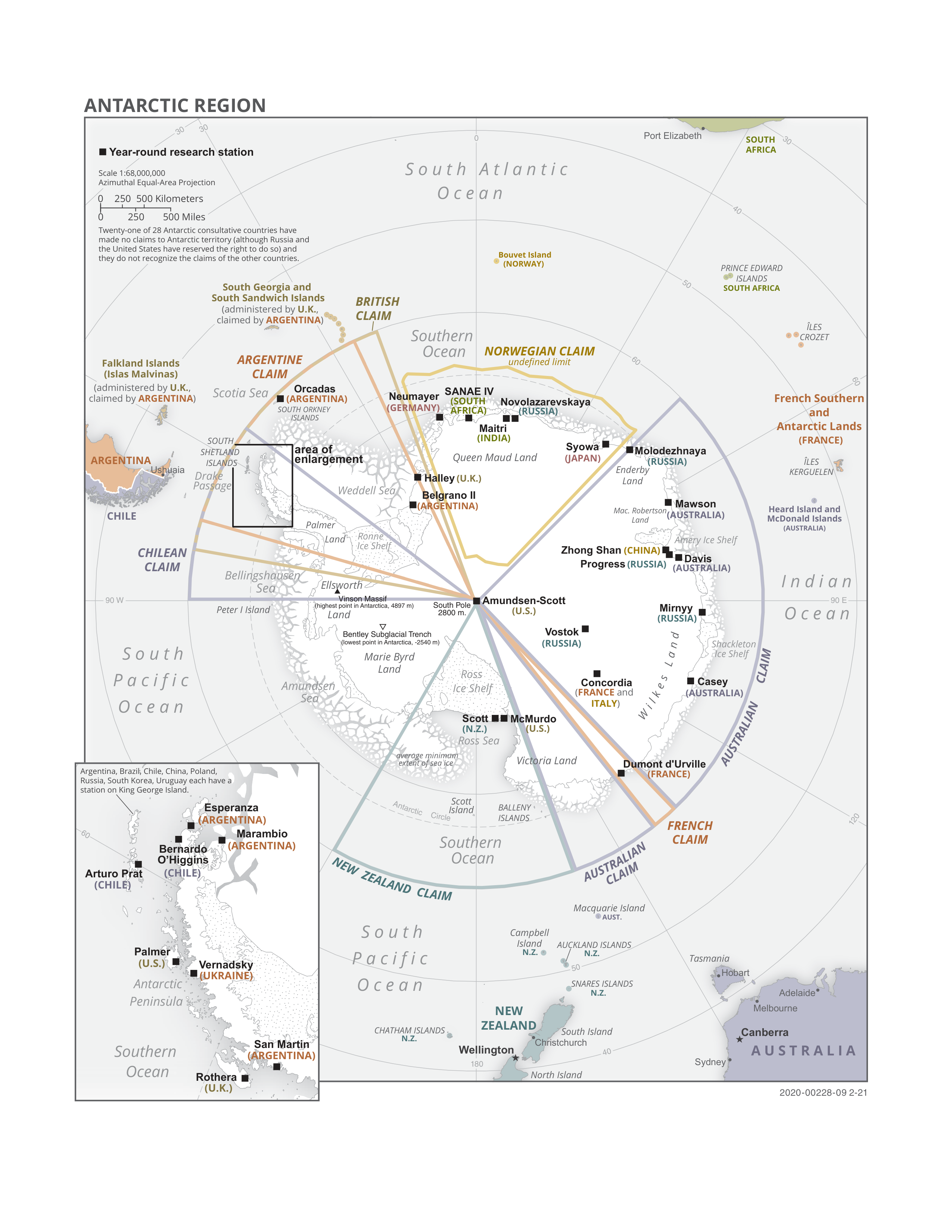
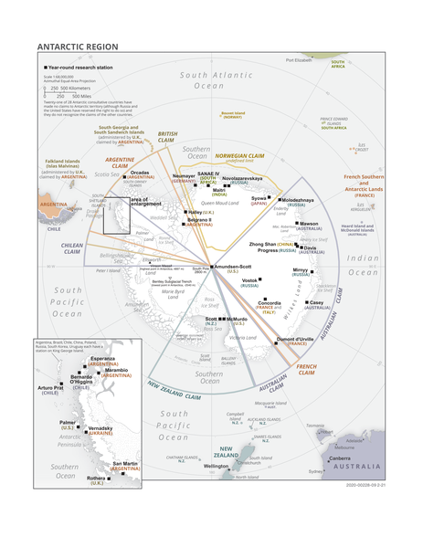
File:Antarctic political map.png
Jump to navigation
Jump to search
Size of this preview: 463 × 599 pixels. Other resolutions: 185 × 240 pixels | 371 × 480 pixels | 593 × 768 pixels | 791 × 1,024 pixels | 2,550 × 3,300 pixels.
Original file (2,550 × 3,300 pixels, file size: 1.6 MB, MIME type: image/png)
Captions
Captions
Politcal map of the Antarctic region

|
This map image could be re-created using vector graphics as an SVG file. This has several advantages; see Commons:Media for cleanup for more information. If an SVG form of this image is available, please upload it and afterwards replace this template with
{{vector version available|new image name}}.
It is recommended to name the SVG file “Antarctic political map.svg”—then the template Vector version available (or Vva) does not need the new image name parameter. |
Summary[edit]
| Description |
English: Politcal map of the Antarctic region |
| Date | |
| Source | https://www.cia.gov/the-world-factbook/static/5891ad778f8f6ca2babc96f4bc18e3ea/antarctic_pol.pdf |
| Author | Unknown author |
Licensing[edit]
This image is in the public domain because it contains materials that originally came from the United States Central Intelligence Agency's World Factbook.
|
 |
File history
Click on a date/time to view the file as it appeared at that time.
| Date/Time | Thumbnail | Dimensions | User | Comment | |
|---|---|---|---|---|---|
| current | 17:27, 9 November 2022 | | 2,550 × 3,300 (1.6 MB) | Randoperson1 (talk | contribs) | Uploaded a work by Unknown from https://www.cia.gov/the-world-factbook/static/5891ad778f8f6ca2babc96f4bc18e3ea/antarctic_pol.pdf with UploadWizard |
You cannot overwrite this file.
File usage on Commons
There are no pages that use this file.
File usage on other wikis
The following other wikis use this file:
- Usage on en.wikipedia.org
- Usage on zh.wikipedia.org