File:Angular unconformity and conglomerate Kutna Hora.jpg
Jump to navigation
Jump to search
Size of this preview: 800 × 600 pixels. Other resolutions: 320 × 240 pixels | 640 × 480 pixels | 1,024 × 768 pixels | 1,280 × 960 pixels | 2,592 × 1,944 pixels.
Original file (2,592 × 1,944 pixels, file size: 3.11 MB, MIME type: image/jpeg)
Captions
Captions
Add a one-line explanation of what this file represents
Summary[edit]
| Description |
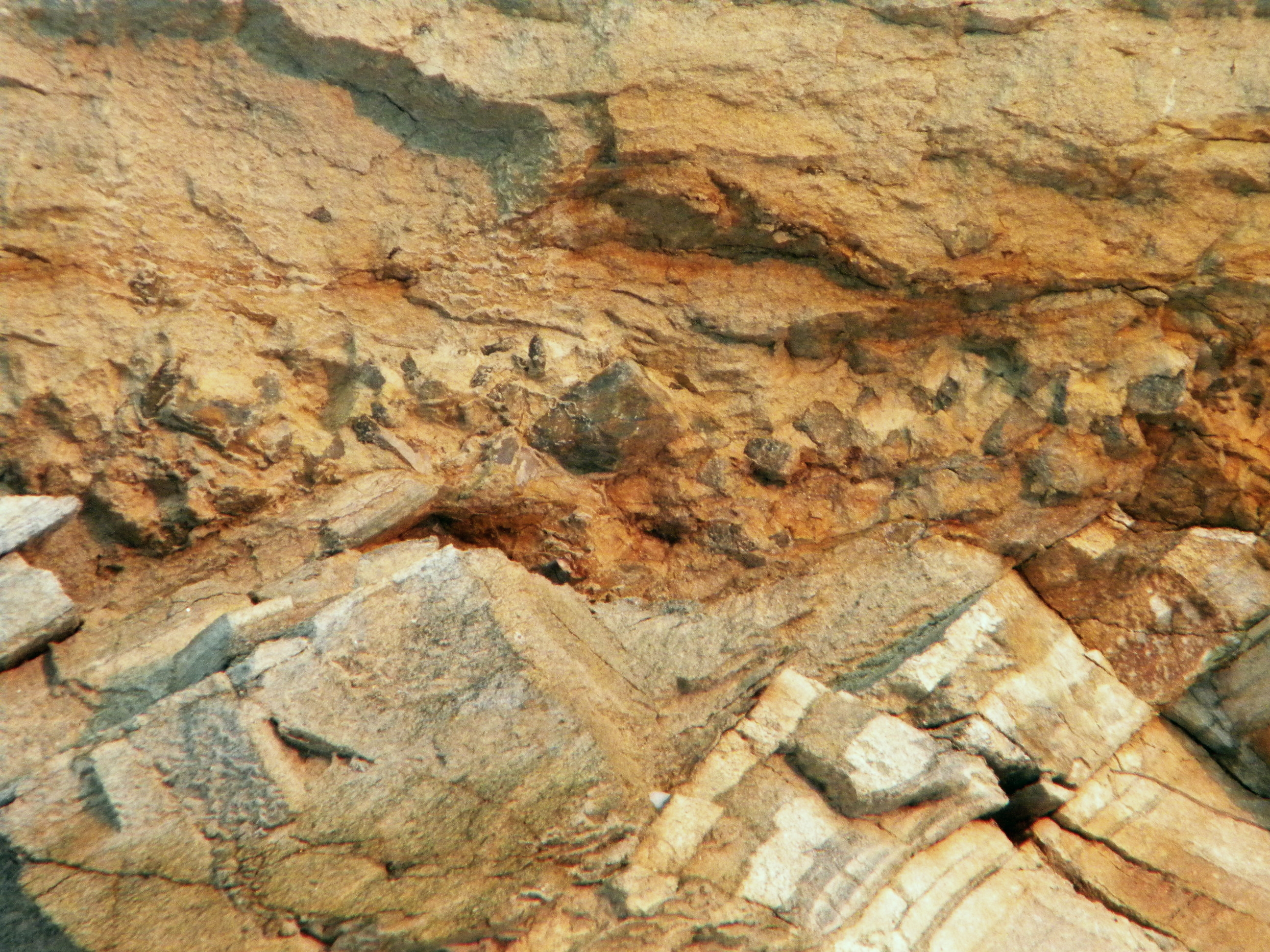
English: Angular unconformity between Paleozoic paragneiss and Cretaceous sediments (sandstone, conglomerate) in the Prachovna Quarry, Kutna Hora, Czech Republic.
Čeština: Úhlová diskordance mezi prvohorními vrstvami pararuly a křídovými usazeninami (pískovec) v lomu Práchovna, Kutná Hora-Žižkov. Na spodině křídových vrstev je zřetelná vrstva slepence, svědčící pro transgresi (počátek nového zalití pevniny mořem). |
| Date | |
| Source | Own work |
| Author | Lamprus |
| Camera location | | View this and other nearby images on: OpenStreetMap |
|---|
Licensing[edit]
| I, the copyright holder of this work, release this work into the public domain. This applies worldwide. In some countries this may not be legally possible; if so: I grant anyone the right to use this work for any purpose, without any conditions, unless such conditions are required by law. |
File history
Click on a date/time to view the file as it appeared at that time.
| Date/Time | Thumbnail | Dimensions | User | Comment | |
|---|---|---|---|---|---|
| current | 22:17, 18 December 2010 | | 2,592 × 1,944 (3.11 MB) | Lamprus (talk | contribs) | {{Information |Description={{en|1=Angular unconformity between Paleozoic paragneiss and Cretaceous sediments (sandstone, coglomerate) in the Prachovna Quarry, Kutna Hora, CZ.}} {{cs|1=Úhlová diskordance mezi prvohorními vrstvami pararuly a křídovými |
You cannot overwrite this file.
File usage on Commons
There are no pages that use this file.
File usage on other wikis
The following other wikis use this file:
- Usage on en.wikipedia.org