File:Andrews 1927 Portolan Charts Plate 2.jpg
Jump to navigation
Jump to search
Size of this preview: 448 × 599 pixels. Other resolutions: 179 × 240 pixels | 359 × 480 pixels | 574 × 768 pixels | 766 × 1,024 pixels | 1,532 × 2,048 pixels | 2,806 × 3,752 pixels.
Original file (2,806 × 3,752 pixels, file size: 1.5 MB, MIME type: image/jpeg)
Captions
Captions
Portolan Charts
Summary[edit]
| Description |
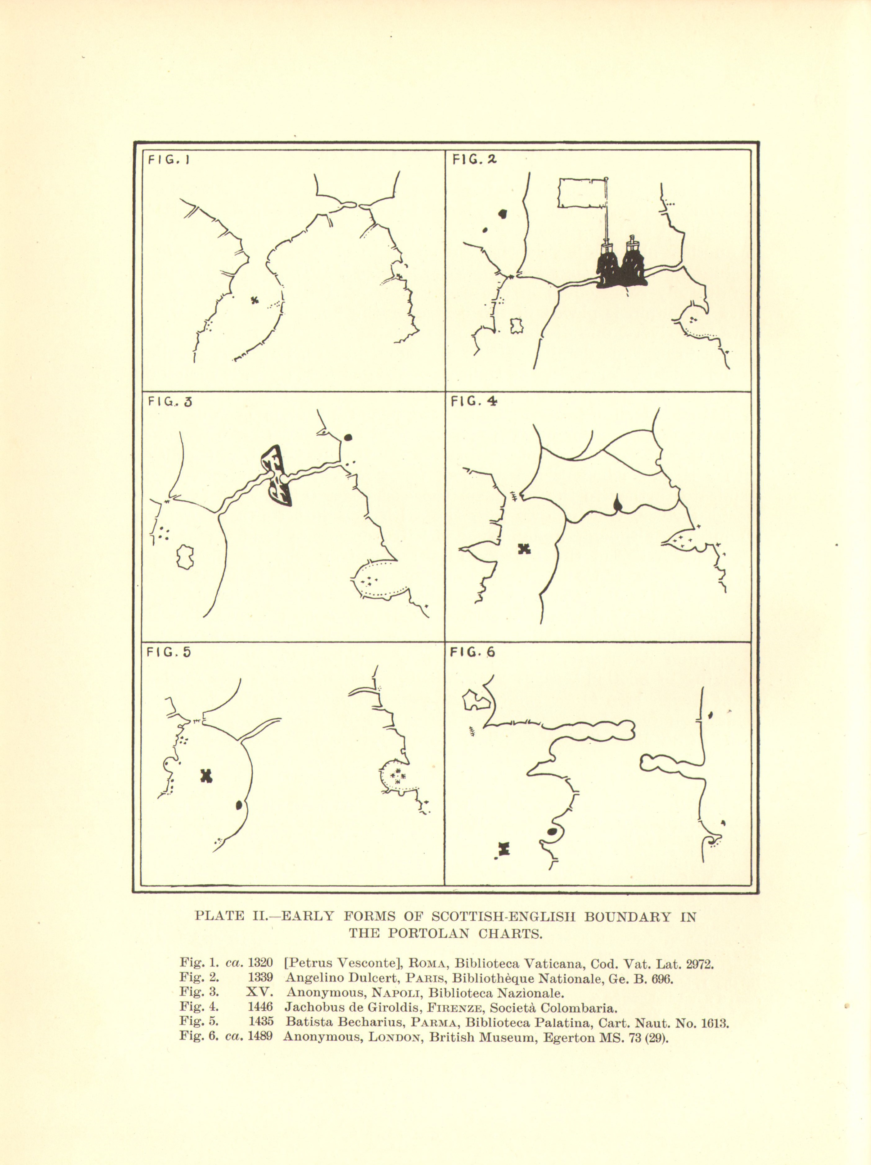
English: Plate from: Andrews, Michael C. (1927). "The boundary between Scotland and England in the portolan charts". Proceedings of the Society of Antiquaries of Scotland 60: 36-66. |
| Date | |
| Source | https://archive.org/details/andrews-1927-portolan |
| Author | Andrews, Michael C. (Michael Corbet) 1874-1934 |
Licensing[edit]
|
This work is in the public domain in its country of origin and other countries and areas where the copyright term is the author's life plus 70 years or fewer. This work is in the public domain in the United States because it was published (or registered with the U.S. Copyright Office) before January 1, 1929. | |
| This file has been identified as being free of known restrictions under copyright law, including all related and neighboring rights. | |
File history
Click on a date/time to view the file as it appeared at that time.
| Date/Time | Thumbnail | Dimensions | User | Comment | |
|---|---|---|---|---|---|
| current | 17:55, 20 November 2023 | | 2,806 × 3,752 (1.5 MB) | Kognos (talk | contribs) | Uploaded a work by Andrews, Michael C. (Michael Corbet) 1874-1934 from https://archive.org/details/andrews-1927-portolan with UploadWizard |
You cannot overwrite this file.
File usage on Commons
There are no pages that use this file.