File:Andes 15to23S 2 65to71W Topo Rainbow Zebra 2040.jpg
Jump to navigation
Jump to search

Size of this preview: 450 × 600 pixels. Other resolutions: 180 × 240 pixels | 360 × 480 pixels | 576 × 768 pixels | 768 × 1,024 pixels | 1,536 × 2,048 pixels | 7,200 × 9,600 pixels.
Original file (7,200 × 9,600 pixels, file size: 51.42 MB, MIME type: image/jpeg)
Captions
Captions
Add a one-line explanation of what this file represents
Summary[edit]
| Description |
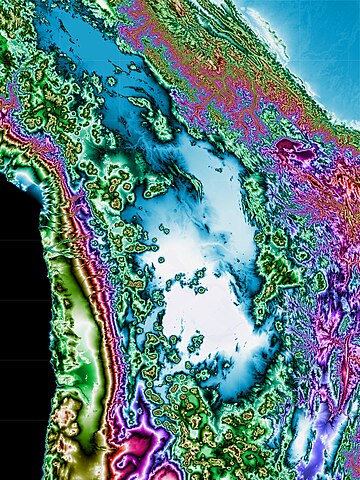
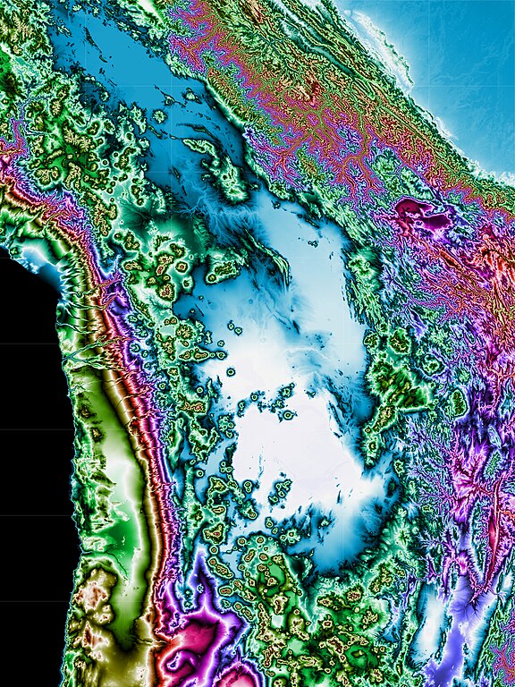
English: This topographic map shows the Andes in southwestern Bolivia and northern Chile. Map coverage extends from 15 to 23 degrees south latitude and from 65 to 71 degrees west longitude. Produced with Map Render 3D from GHz Limited. Then used IrfanView to stitch together multiple maps. |
| Date | |
| Source |
[3 arc second Digital Elevation Models obtained from the website http://www.viewfinderpanoramas.org/dem3.html] |
| Author | Jonathan de Ferranti |
Licensing[edit]
| This file is in the public domain in the United States because it was solely created by NASA. NASA copyright policy states that "NASA material is not protected by copyright unless noted". (See Template:PD-USGov, NASA copyright policy page or JPL Image Use Policy.) | ||
 |
Warnings:
|
File history
Click on a date/time to view the file as it appeared at that time.
| Date/Time | Thumbnail | Dimensions | User | Comment | |
|---|---|---|---|---|---|
| current | 06:54, 7 January 2022 | | 7,200 × 9,600 (51.42 MB) | Rainbow Zebra 13 (talk | contribs) | Uploaded a work by Jonathan de Ferranti from [3 arc second Digital Elevation Models obtained from the website http://www.viewfinderpanoramas.org/dem3.html] with UploadWizard |
You cannot overwrite this file.
File usage on Commons
There are no pages that use this file.