File:Ancient monuments fort ancient map.gif
Jump to navigation
Jump to search
Size of this preview: 457 × 599 pixels. Other resolutions: 183 × 240 pixels | 366 × 480 pixels | 1,000 × 1,311 pixels.
Original file (1,000 × 1,311 pixels, file size: 177 KB, MIME type: image/gif)
Captions
Captions
Add a one-line explanation of what this file represents
Summary[edit]
| Description |
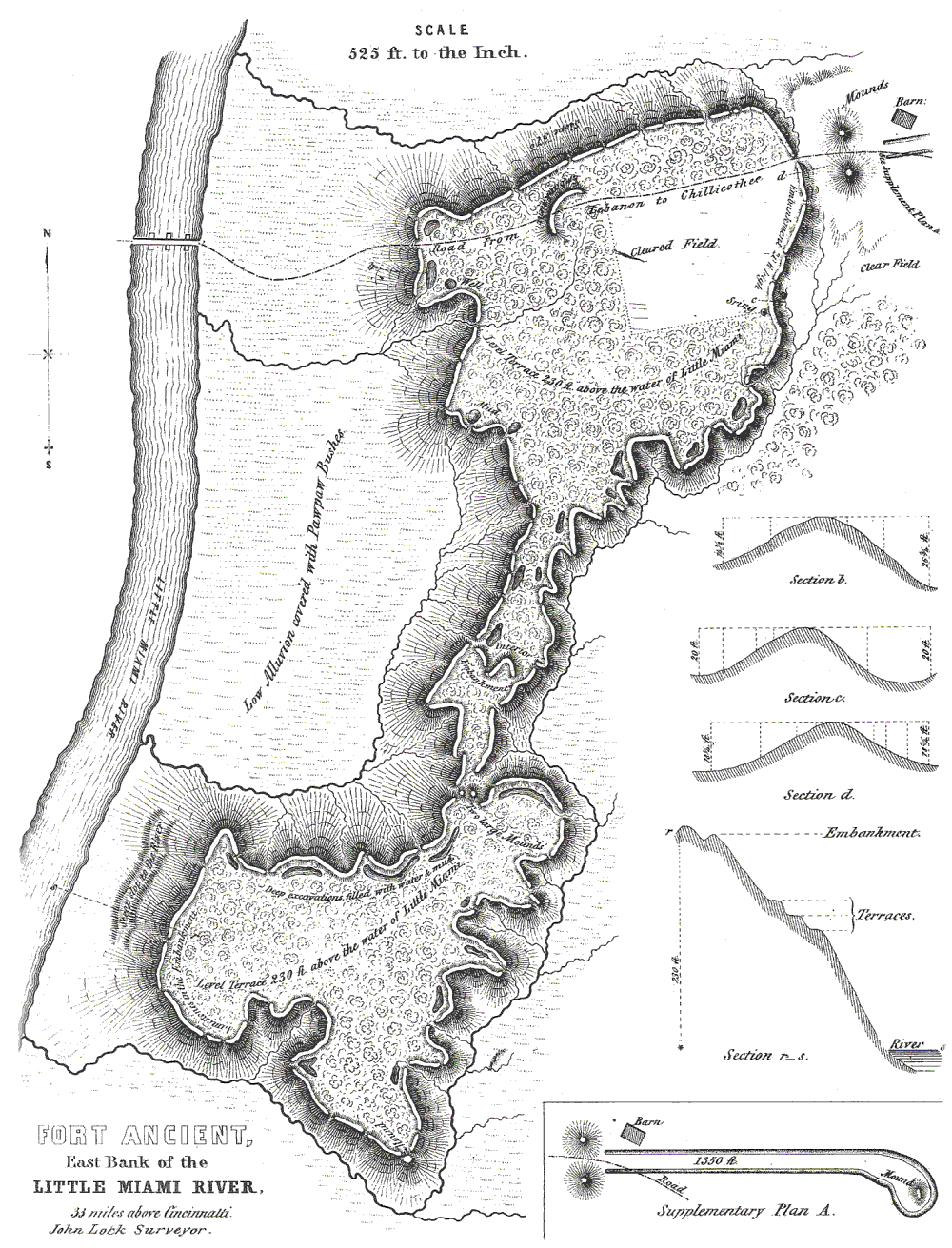
English: Map of Fort Ancient, Warren County. Surveyed by John Lock, 1843. Published in Ancient Monuments of the Mississippi Valley, Ephraim G. Squier and Edwin H. Davis, 1848. |
| Source | see above |
| Author | see above |
|
This is an image of a place or building that is listed on the National Register of Historic Places in the United States of America. Its reference number is 66000625. |
Licensing[edit]
|
This work is in the public domain in its country of origin and other countries and areas where the copyright term is the author's life plus 100 years or fewer. | |
| This file has been identified as being free of known restrictions under copyright law, including all related and neighboring rights. | |
Original upload log[edit]
The original description page was here. All following user names refer to en.wikipedia.
| Date/Time | Dimensions | User | Comment |
|---|---|---|---|
| 2006-06-28 23:52 | 1000×1311× (181175 bytes) | RickDikeman | Map of [[Fort Ancient, Ohio|Fort Ancient]], [[Warren County, Ohio]]. Surveyed by John Lock, 1843. Published in ''[[Ancient Monuments of the Mississippi Valley]]'', Ephraim G. Squier and Edwin H. Davis, 1848. |
File history
Click on a date/time to view the file as it appeared at that time.
| Date/Time | Thumbnail | Dimensions | User | Comment | |
|---|---|---|---|---|---|
| current | 03:50, 8 July 2016 | | 1,000 × 1,311 (177 KB) | TheCatalyst31 (talk | contribs) | Transferred from en.wikipedia |
You cannot overwrite this file.
File usage on Commons
There are no pages that use this file.
File usage on other wikis
The following other wikis use this file:
- Usage on de.wikipedia.org
- Usage on en.wikipedia.org
- Usage on fr.wikipedia.org
- Usage on he.wikipedia.org
- Usage on uz.wikipedia.org