File:Americas topographic map.jpg
Jump to navigation
Jump to search

No higher resolution available.
Americas_topographic_map.jpg (320 × 320 pixels, file size: 14 KB, MIME type: image/jpeg)
Captions
Captions
Add a one-line explanation of what this file represents
Summary[edit]
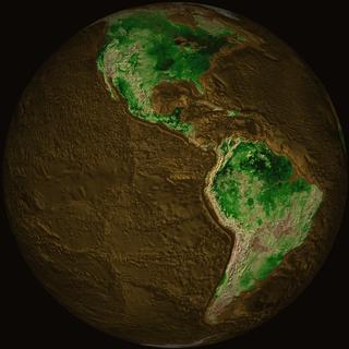
| Description | Topographical map of the Earth showing North America and South America. |
| Date | |
| Source | http://svs.gsfc.nasa.gov/vis/a000000/a001400/a001402/f10_drained_web.jpg |
| Author | NASA |
Licensing[edit]
| This file is in the public domain in the United States because it was solely created by NASA. NASA copyright policy states that "NASA material is not protected by copyright unless noted". (See Template:PD-USGov, NASA copyright policy page or JPL Image Use Policy.) | ||
 |
Warnings:
|
File history
Click on a date/time to view the file as it appeared at that time.
| Date/Time | Thumbnail | Dimensions | User | Comment | |
|---|---|---|---|---|---|
| current | 21:04, 30 April 2010 | | 320 × 320 (14 KB) | Adrignola (talk | contribs) | {{Information |Description=Topographical map of the Earth showing North America and South America. |Source=http://svs.gsfc.nasa.gov/vis/a000000/a001400/a001402/f10_drained_web.jpg |Author=w:NASA |Permission= |other_versions= }} [[Category:Topographi |
You cannot overwrite this file.
File usage on Commons
There are no pages that use this file.
File usage on other wikis
The following other wikis use this file:
- Usage on en.wikibooks.org