File:Americana Civil War in America - Map 2.jpg
Jump to navigation
Jump to search
Size of this preview: 800 × 493 pixels. Other resolutions: 320 × 197 pixels | 640 × 395 pixels | 1,024 × 632 pixels | 1,280 × 790 pixels | 1,665 × 1,027 pixels.
Original file (1,665 × 1,027 pixels, file size: 193 KB, MIME type: image/jpeg)
Captions
Captions
Add a one-line explanation of what this file represents
| Description |
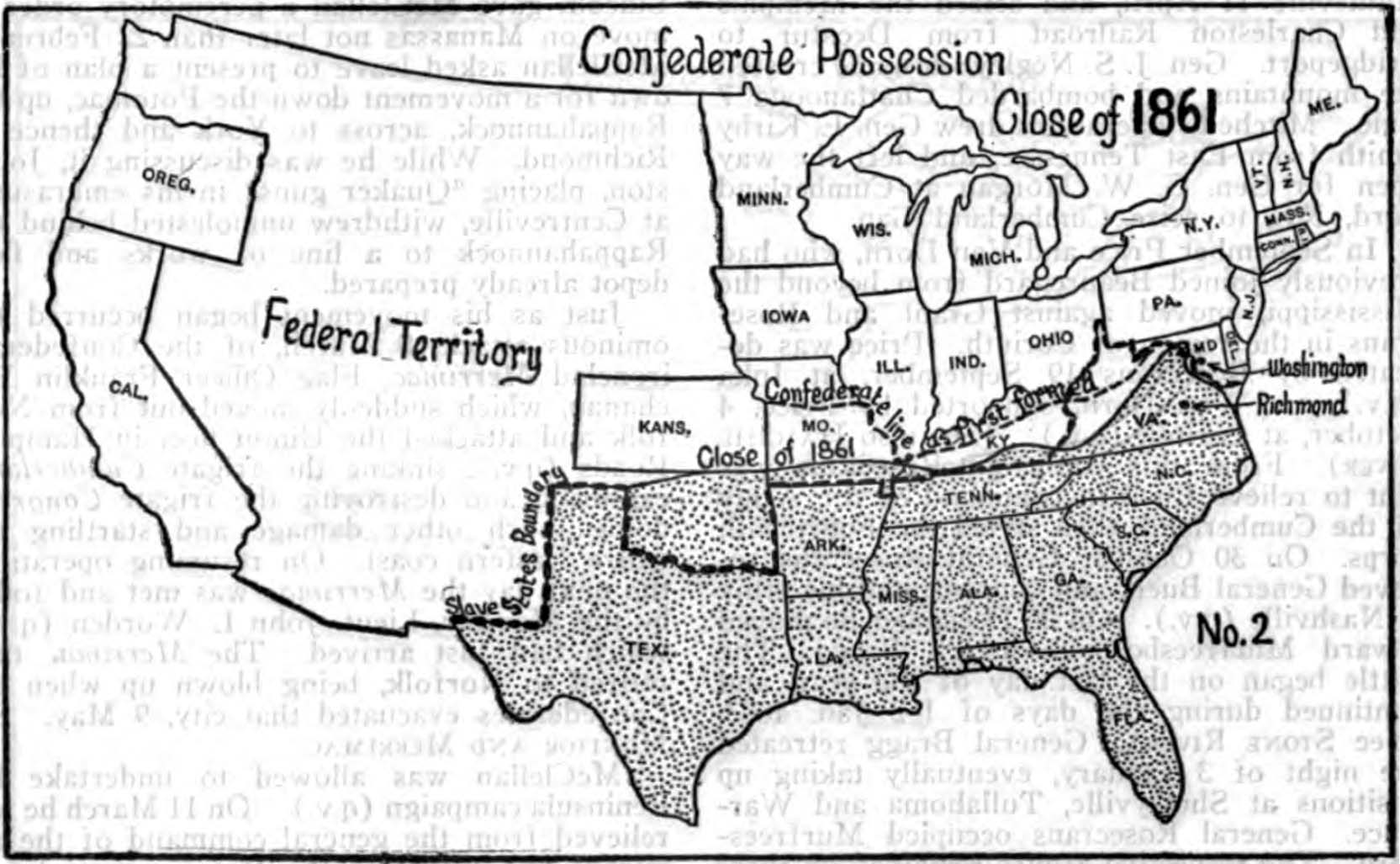
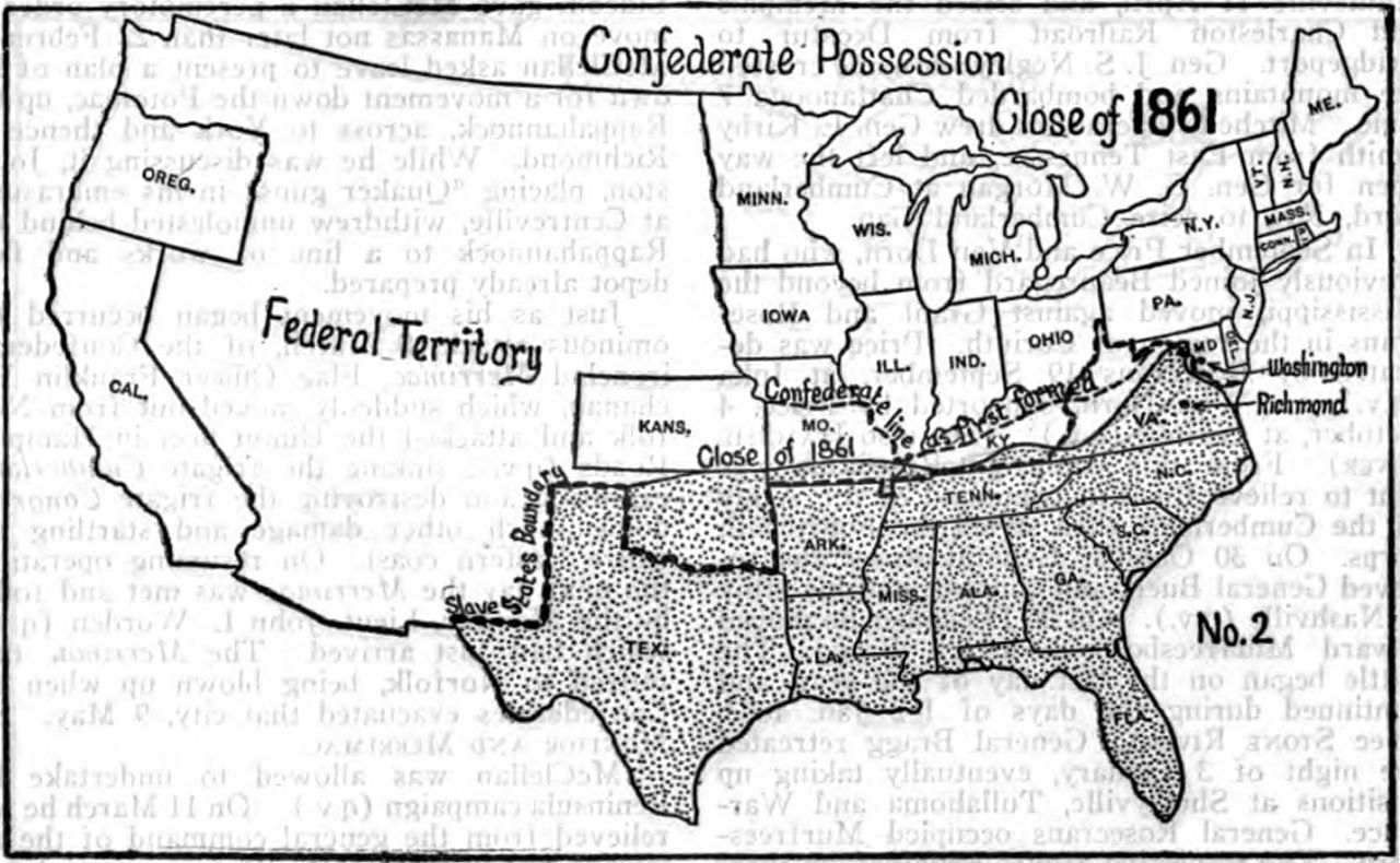
English: Map showing the possessions of the Union and Confederate sides during the American Civil War at the close of 1861. |
||
| Date | published 1918 | ||
| Source | Encyclopedia Americana, 1920, v. 7, p. 9 | ||
| Author | Unknown author | ||
| Permission (Reusing this file) |
|
File history
Click on a date/time to view the file as it appeared at that time.
| Date/Time | Thumbnail | Dimensions | User | Comment | |
|---|---|---|---|---|---|
| current | 19:26, 20 August 2010 | | 1,665 × 1,027 (193 KB) | Bob Burkhardt (talk | contribs) | {{Information |Description={{en|1=Map showing the possessions of the Union and Confederate sides during the American Civil War at the close of 1861.}} |Source=''Encyclopedia Americana'', 1920, v. 7, p. 9 |Author=unknown |Date=published 1918 |Permission={{ |
You cannot overwrite this file.
File usage on Commons
There are no pages that use this file.
File usage on other wikis
The following other wikis use this file:
- Usage on en.wikisource.org