File:Amarapura - U-Bein Bridge.jpg
Jump to navigation
Jump to search

Size of this preview: 800 × 501 pixels. Other resolutions: 320 × 200 pixels | 640 × 401 pixels | 1,200 × 751 pixels.
Original file (1,200 × 751 pixels, file size: 233 KB, MIME type: image/jpeg)
Captions
Captions
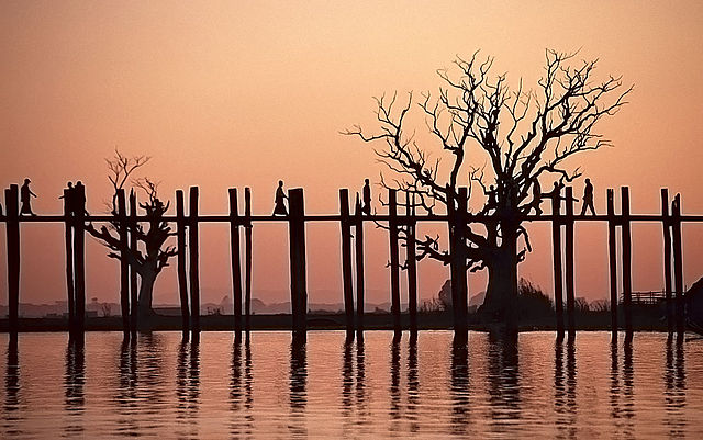
U-Bridge, Taungthaman Lake, Amarapura, Mandalay Region, Myanmar
| Description |
Deutsch: U-Bridge, Taungthaman-See, Amarapura, Mandalay Region, Myanmar
English: U-Bridge, Taungthaman Lake, Amarapura, Mandalay Region, Myanmar |
|||||||||||||||||
| Date | ||||||||||||||||||
| Source |
Flickr: Amarapura - U-Bein Bridge Own work - This image is a scanned slide |
|||||||||||||||||
| Author |
|
|||||||||||||||||
| Permission (Reusing this file) |
This file is licensed under the Creative Commons Attribution-Share Alike 2.0 Generic license.
|
|||||||||||||||||

| Camera location | | View this and other nearby images on: OpenStreetMap |
|---|
| Camera Model | Pentax MZ-Series (MZ3 or MZ50) |
|---|

| OpenMyanmar Photo Project
|
|
| Help • Discuss • Facebook Page |
If you want to upload a new revision of this file, please use the possibility to upload a new version under a new name. Please don't forget to tag it as a derivate or extract.
I. Licence
The author of this picture, Stefan Fussan, published this file under the Creative Commons Licence Attribution-ShareAlike 3.0 (other licences and more on this below). The image can
- Freely use and distribute it for non-commercial or for commercial purposes
- Create derivative works of it
It is also necessary to provide a copy of the license or at least its full Internet address (https://creativecommons.org/licenses/by-sa/3.0/legalcode). When used in online media in addition to the a forementioned copyright and license specifying a reference (link) to the original image - so this page with descriptions and license conditions - would be nice. See also: re-use. From printed materials and other tangible products that use that work, the user is asked to send a copy to the author. The mailing address can be requested via the contact options.
For all further usages (Print, Collagen ...) click on the following button. You will get all necessary information.
Furthermore, if you
- want to use this work under other conditions,
- want me to rework this file out of the original RAW file, or get the RAW file, or
- search for a similar picture,
In the case of a breach of the license conditions, the rights granted hereunder will expire automatically. The author reserves the right in this case to assert injunctive relief and damages.
II. Disclaimer
It is possible that third parties are to be considered for example in case of trademark, design or personality rights. You are responsible to check and respect these rights in the publication in the respective medium or country. Please note the General disclaimer.
III. Contact
 |
Do not upload new revisions over my file without my explicit permission. Please upload it under a new file name and mark it as a derivate or extract. You can use the template {{Derived from|My file name.jpg}} or {{Extracted from|My file name.jpg}}. |
File history
Click on a date/time to view the file as it appeared at that time.
| Date/Time | Thumbnail | Dimensions | User | Comment | |
|---|---|---|---|---|---|
| current | 19:21, 25 December 2011 | | 1,200 × 751 (233 KB) | Flickr upload bot (talk | contribs) | Uploaded from http://flickr.com/photo/48235122@N03/5943989156 using Flickr upload bot |
You cannot overwrite this file.
File usage on Commons
There are no pages that use this file.
File usage on other wikis
The following other wikis use this file:
- Usage on my.wikipedia.org