File:Alvechurch railway station, geograph-4750062-by-Nigel-Thompson.jpg
Jump to navigation
Jump to search
Size of this preview: 800 × 600 pixels. Other resolutions: 320 × 240 pixels | 640 × 480 pixels | 1,024 × 768 pixels | 1,280 × 960 pixels | 1,600 × 1,200 pixels.
Original file (1,600 × 1,200 pixels, file size: 397 KB, MIME type: image/jpeg)
Captions
Captions
Add a one-line explanation of what this file represents
| Description |
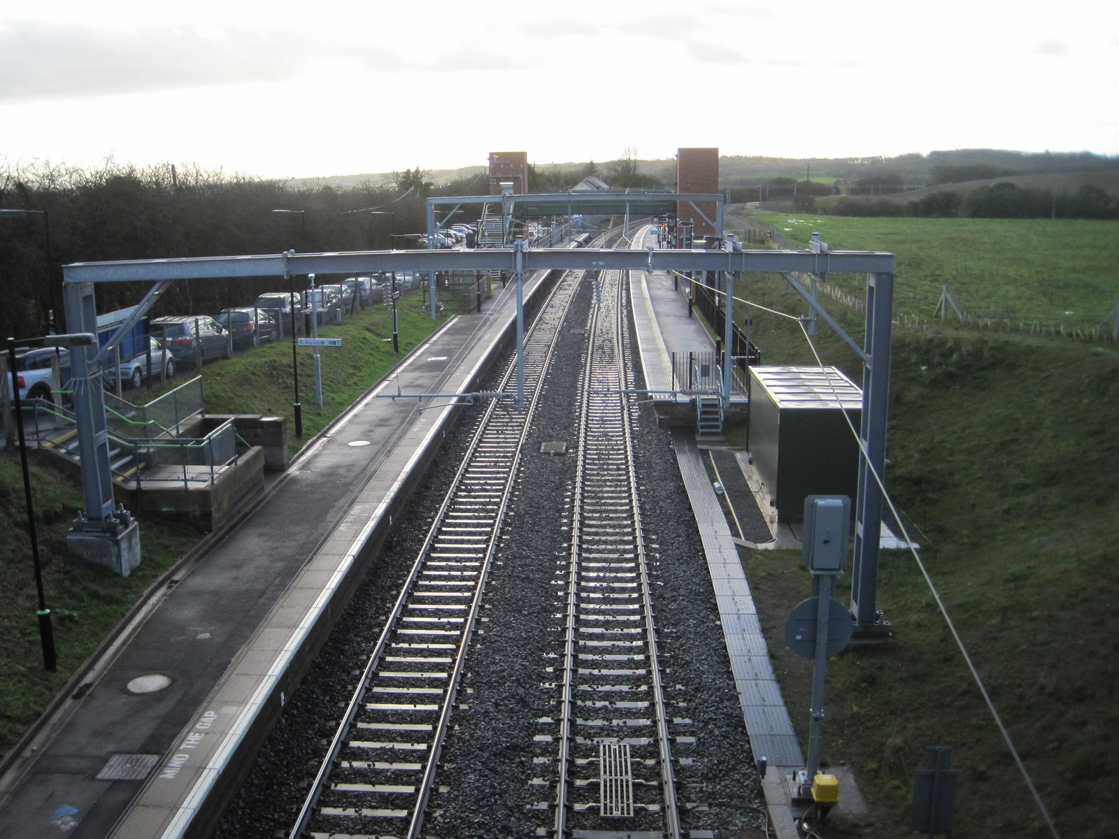
English: Alvechurch railway station, Worcestershire
Opened in 1859 by the Midland Railway on the "Gloucester Loop" line from Birmingham to Gloucester via Redditch and Alcester. Redditch became the terminus when the southern part of the loop was severed to passengers in 1962. View south towards Redditch. The original platform was adjacent to the white buildings in the distance. It was relocated closer to the camera position in 1993. A second platform was added in 2014. |
||
| Date | |||
| Source | geograph.org.uk | ||
| Author | Nigel Thompson | ||
| Permission (Reusing this file) |
This file is licensed under the Creative Commons Attribution-Share Alike 2.0 Generic license. Attribution: Nigel Thompson
|
||
| Attribution (required by the license) | Nigel Thompson / Alvechurch railway station, Worcestershire / | ||

| Camera location | | View this and other nearby images on: OpenStreetMap |
|---|
_heading:180.00&language=en)
| Object location | | View this and other nearby images on: OpenStreetMap |
|---|
_heading:180.00&language=en)
File history
Click on a date/time to view the file as it appeared at that time.
| Date/Time | Thumbnail | Dimensions | User | Comment | |
|---|---|---|---|---|---|
| current | 22:43, 15 December 2015 | | 1,600 × 1,200 (397 KB) | G-13114 (talk | contribs) | {{Information |description={{en|1=Alvechurch railway station, Worcestershire Opened in 1859 by the Midland Railway on the "Gloucester Loop" line from Birmingham to Gloucester via Redditch and Alcester. Redditch became the terminus when the southern pa... |
You cannot overwrite this file.
File usage on Commons
The following page uses this file:
File usage on other wikis
The following other wikis use this file:
- Usage on en.wikipedia.org