File:Alps location map (Salzburger Kalkalpen, PWN).png
Jump to navigation
Jump to search
Size of this preview: 800 × 552 pixels. Other resolutions: 320 × 221 pixels | 640 × 442 pixels | 1,024 × 707 pixels | 1,280 × 884 pixels | 2,000 × 1,381 pixels.
Original file (2,000 × 1,381 pixels, file size: 5.09 MB, MIME type: image/png)
Captions
Captions
Add a one-line explanation of what this file represents
Summary[edit]
.png&action=edit§ion=1)
| Description |
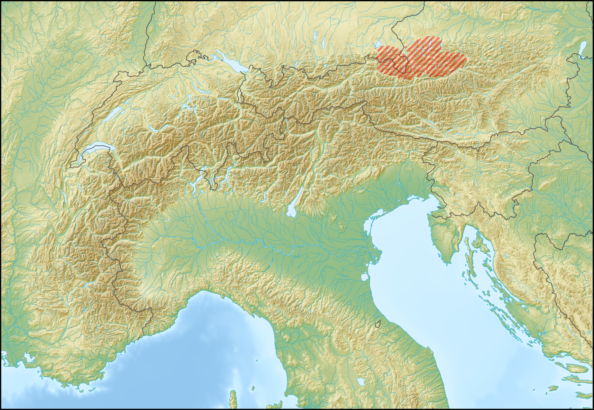
Polski: Położenie na mapie Alp i przybliżony zasięg Alp Salzburskich, na podstawie informacji (o leżących w ich obrębie lub na obrzeżach: masywach, jeziorach i miejscowościach) dostępnych w Encyklopedii PWN – Portalu Wiedzy PWN (online).
English: The location of the Salzburger Kalkalpen (their approximate geographic range; red stripes) in the Alps. |
| Date | |
| Source |
This file was derived from: Alps location map.png: by Lencer |
| Author | RRady |
Licensing[edit]
.png&action=edit§ion=2)
The map has been created with the Generic Mapping Tools: https://www.generic-mapping-tools.org/ using one or more of these public-domain datasets for the relief:
|

|
Permission is granted to copy, distribute and/or modify this document under the terms of the GNU Free Documentation License, Version 1.2 or any later version published by the Free Software Foundation; with no Invariant Sections, no Front-Cover Texts, and no Back-Cover Texts. A copy of the license is included in the section entitled GNU Free Documentation License. |
| This file is licensed under the Creative Commons Attribution-Share Alike 3.0 Unported license. | ||
| ||
| This licensing tag was added to this file as part of the GFDL licensing update. |
File history
Click on a date/time to view the file as it appeared at that time.
| Date/Time | Thumbnail | Dimensions | User | Comment | |
|---|---|---|---|---|---|
| current | 01:35, 30 April 2015 | | 2,000 × 1,381 (5.09 MB) | RRady (talk | contribs) | Wg Encyklopedii PWN jezioro Chiemsee leży u północnego podnóża Alp Salzburskich, a zachodnią granicę pasma wyznacza przełom rzeki Tiroler Ache (Kössener Ache, Großache). |
| 22:33, 29 April 2015 |  | 2,000 × 1,381 (5.09 MB) | RRady (talk | contribs) | User created page with UploadWizard |
You cannot overwrite this file.
File usage on Commons
There are no pages that use this file.
File usage on other wikis
The following other wikis use this file:
- Usage on pl.wikipedia.org
- Usage on pl.wikivoyage.org
- Usage on pl.wiktionary.org
.png&oldid=789675963)