File:Albania location map.svg
Jump to navigation
Jump to search

Size of this PNG preview of this SVG file: 411 × 599 pixels. Other resolutions: 165 × 240 pixels | 329 × 480 pixels | 527 × 768 pixels | 703 × 1,024 pixels | 1,406 × 2,048 pixels | 688 × 1,002 pixels.
Original file (SVG file, nominally 688 × 1,002 pixels, file size: 168 KB)
Captions
Captions
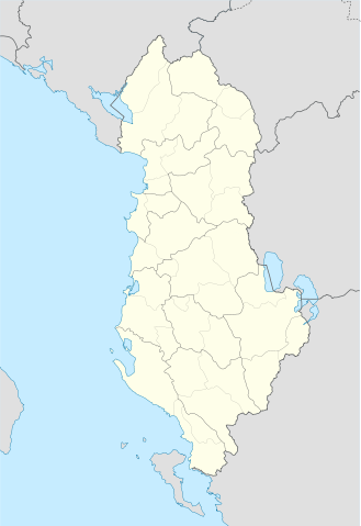
Map of Albania
Summary[edit]
| Description |
Deutsch: Positionskarte von Albanien
Quadratische Plattkarte, N-S-Streckung 130 %. Geographische Begrenzung der Karte:
English: Location map of Albania
Equirectangular projection, N/S stretching 130 %. Geographic limits of the map:
|
||
| Date | |||
| Source | Own work using: United States National Imagery and Mapping Agency data | ||
| Author | Lencer | ||
| SVG development | This locator map was created with Adobe Illustrator.
|

Licensing[edit]
I, the copyright holder of this work, hereby publish it under the following licenses:

|
Permission is granted to copy, distribute and/or modify this document under the terms of the GNU Free Documentation License, Version 1.2 or any later version published by the Free Software Foundation; with no Invariant Sections, no Front-Cover Texts, and no Back-Cover Texts. A copy of the license is included in the section entitled GNU Free Documentation License. |
This file is licensed under the Creative Commons Attribution-Share Alike 3.0 Unported license.
- You are free:
- to share – to copy, distribute and transmit the work
- to remix – to adapt the work
- Under the following conditions:
- attribution – You must give appropriate credit, provide a link to the license, and indicate if changes were made. You may do so in any reasonable manner, but not in any way that suggests the licensor endorses you or your use.
- share alike – If you remix, transform, or build upon the material, you must distribute your contributions under the same or compatible license as the original.
You may select the license of your choice.
File history
Click on a date/time to view the file as it appeared at that time.
| Date/Time | Thumbnail | Dimensions | User | Comment | |
|---|---|---|---|---|---|
| current | 19:16, 20 June 2011 | | 688 × 1,002 (168 KB) | Vinie007 (talk | contribs) | fix districts |
| 20:56, 22 March 2010 |  | 685 × 1,002 (152 KB) | NordNordWest (talk | contribs) | counties | |
| 20:06, 22 March 2010 |  | 685 × 1,002 (162 KB) | NordNordWest (talk | contribs) | update | |
| 16:27, 11 September 2008 |  | 685 × 1,002 (278 KB) | Lencer (talk | contribs) | {{Information |Description= |Source= |Date= |Author= |Permission= |other_versions= }} | |
| 18:36, 9 September 2008 |  | 685 × 1,002 (278 KB) | Lencer (talk | contribs) | {{Information |Description= |Source= |Date= |Author= |Permission= |other_versions= }} | |
| 12:14, 16 August 2008 |  | 685 × 1,002 (279 KB) | Lencer (talk | contribs) | {{Information |Description= |Source= |Date= |Author= |Permission= |other_versions= }} | |
| 17:00, 21 July 2008 |  | 258 × 377 (254 KB) | Lencer (talk | contribs) | {{Information |Description= |Source= |Date= |Author= |Permission= |other_versions= }} | |
| 16:42, 21 July 2008 |  | 258 × 377 (254 KB) | Lencer (talk | contribs) | {{Information |Description= {{de|Positionskarte von Albanien}} Quadratische Plattkarte, N-S-Streckung 130 %. Geographische Begrenzung der Karte: * N: 42.9° N * S: 39.3° N * W: 18.3° O * O: 21.5° O {{en|Location map of [[:en:Al |
You cannot overwrite this file.
File usage on Commons
The following 58 pages use this file:
- User talk:NordNordWest/Archive12
- File:Administratura Apostolike e Shqiperisë së Jugut.svg
- File:Berat County in Albania.svg
- File:Berat in Albania.svg
- File:Bulqize in Albania.svg
- File:Delvine in Albania.svg
- File:Devoll in Albania.svg
- File:Diber County in Albania.svg
- File:Diber in Albania.svg
- File:Dioqeza e Lezhës.svg
- File:Dioqeza e Rrëshenit.svg
- File:Dioqeza e Sapës.svg
- File:Durres County in Albania.svg
- File:Durres in Albania.svg
- File:Elbasan County in Albania.svg
- File:Elbasan in Albania.svg
- File:Fier County in Albania.svg
- File:Fier in Albania.svg
- File:Gjirokaster County in Albania.svg
- File:Gjirokaster in Albania.svg
- File:Gramsh in Albania.svg
- File:Has in Albania.svg
- File:Kavaje in Albania.svg
- File:Kolonje in Albania.svg
- File:Korce County in Albania.svg
- File:Korce in Albania.svg
- File:Kruje in Albania.svg
- File:Kryedioqeza e Shkodrës–Pult.svg
- File:Kryedioqeza e Tiranë-Durrës.svg
- File:Kucove in Albania.svg
- File:Kukes County in Albania.svg
- File:Kukes in Albania.svg
- File:Kurbin in Albania.svg
- File:Lezhe County in Albania.svg
- File:Lezhe in Albania.svg
- File:Librazhd in Albania.svg
- File:LocationmapAlbania.png
- File:Lushnje in Albania.svg
- File:Malesi e Madhe in Albania.svg
- File:Mallakaster in Albania.svg
- File:Map of the Catholic dioceses in Albania.svg
- File:Map of the Catholic dioceses in Albania (sq).svg
- File:Mat in Albania.svg
- File:Mirdite in Albania.svg
- File:Pemet in Albania.svg
- File:Peqin in Albania.svg
- File:Pogradec in Albania.svg
- File:Puke in Albania.svg
- File:Sarande in Albania.svg
- File:Shkoder County in Albania.svg
- File:Shkoder in Albania.svg
- File:Skrapar in Albania.svg
- File:Tepelene in Albania.svg
- File:Tirana County in Albania.svg
- File:Tirana in Albania.svg
- File:Tropoje in Albania.svg
- File:Vlore County in Albania.svg
- File:Vlore in Albania.svg
.svg)
File usage on other wikis
The following other wikis use this file:
- Usage on ar.wikipedia.org
- Usage on bn.wikipedia.org
- Usage on bs.wikipedia.org
- Usage on ca.wikipedia.org
- Usage on ceb.wikipedia.org
- Albanya
- Plantilya:Location map Albania
- Puka
- Krabi
- Komsi
- Kalja
- Kala
- Golo
- Kusha
- Tok
- Raba
- Paula
- Kota
- Korab
- Orle
- Bistrica
- Tumba
- Mali i Zi
- Guri i Zi
- Veternik
- Selce
- Propas
- Petran
- Dibra
- Osoj
- Ostrovica
- Miras
- Mali Grad
- Mala Reka
- Lofka
- Lisec
- Lipec
- Leska
- Lomnica
- Kraste
- Krasta
- Kovacica
- Gorica
- Maja e Kodres
- Klisura
- Belica
View more global usage of this file.