File:Alb-Pfinz-Plateau Satellitenfoto.jpg
Jump to navigation
Jump to search

Size of this preview: 563 × 600 pixels. Other resolutions: 225 × 240 pixels | 450 × 480 pixels | 657 × 700 pixels.
Original file (657 × 700 pixels, file size: 148 KB, MIME type: image/jpeg)
Captions
Captions
Add a one-line explanation of what this file represents
Summary[edit]
| Description |
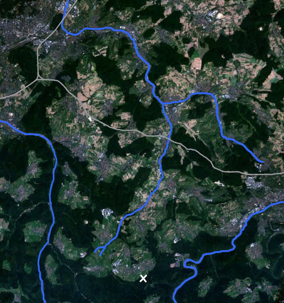
Deutsch: Satellitenfoto des Alb-Pfinz-Plateaus. Links oben befindet sich Karlsruhe, südöstlich davon verläuft die Grenze zur Oberrheinischen Tiefebene. Folgende Details sind hervorgehoben:
|
| Date | 28 May 2006 (original upload date) |
| Source | NASA World Wind |
| Author | NASA |
Licensing[edit]
| This image is in the public domain because it is a screenshot from NASA’s globe software World Wind using a public domain layer, such as Blue Marble, MODIS, Landsat, SRTM, USGS or GLOBE.
|
 |
Original upload log[edit]
The original description page was here. All following user names refer to de.wikipedia.
- 2006-05-28 19:36 Bilderhochladungs-Akkont 657×700× (151507 bytes) * Bildbeschreibung: Satellitenfoto des Alb-Pfinz-Plateaus. Links oben befindet sich [[Karlsruhe]], südöstlich davon verläuft die Grenze zur [[Oberrheinische Tiefebene|Oberrheinischen Tiefebene]]. Folgende Details sind hervorgehoben: **[[Bundesautobahn
File history
Click on a date/time to view the file as it appeared at that time.
| Date/Time | Thumbnail | Dimensions | User | Comment | |
|---|---|---|---|---|---|
| current | 21:58, 29 September 2011 | | 657 × 700 (148 KB) | File Upload Bot (Magnus Manske) (talk | contribs) | {{BotMoveToCommons|de.wikipedia|year={{subst:CURRENTYEAR}}|month={{subst:CURRENTMONTHNAME}}|day={{subst:CURRENTDAY}}}} {{Information |Description={{de|Satellitenfoto des de:Alb-Pfinz-Plateaus. Links oben befindet sich de:Karlsruhe, südöstli |
You cannot overwrite this file.
File usage on Commons
There are no pages that use this file.
File usage on other wikis
The following other wikis use this file:
- Usage on de.wikipedia.org