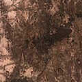
File:Ahaggar Landsat 8 surface reflectance composite.jpg

Original file (3,929 × 3,929 pixels, file size: 4.75 MB, MIME type: image/jpeg)
Captions
Captions
Summary[edit]
| DescriptionAhaggar Landsat 8 surface reflectance composite.jpg |
Deutsch: Das Ahaggar, auch bekannt als Hoggar, ein vulkanisches Gebirge in der zentralen Sahara.
Das Bild ist gemittelt aus 34 Landsat 8-Aufnahmen, bereitgestellt von der NASA. Grundlage sind die surface reflectance-Daten vom USGS. Verwendet wurden die Kanäle 4, 3 und 2 um ein RGB-Bild zu erzeugen. Die Aufnahmen wurden in R mit dem Paket RStoolbox koregistriert, gewichtet gemittelt, und auf die Extrema skaliert. JPEG-enkodiert mit Guetzli. Aufnahmen aus dem Zeitraum 16 June 2013 – 7 December 2018, jeweils im Mittel um 10:04, Bereich 10:03–10:06. Der Sonnenstand rangiert im Bereich Azimuth 85°–155°, im Mittel 124°; Höhe 39°–69°, im Mittel 56°. Auflösung: 30m. Projektion: UTM 31 N, WGS84. Bildmitte: 769590, 2574870; südwestliche Ecke: 710655, 2515935; südöstliche Ecke: 828525, 2515935; nordwestliche Ecke: 710655, 2633805; nordöstliche Ecke: 828525, 2633805. Aus WRS-2 Path 192 Row 044.English: The Ahaggar, also known as the Hoggar, a volcanic mountain range in the central Sahara.
The image is averaged from 34 Landsat 8-scenes, provided by NASA. Input data are surface reflectance values calculated by USGS. Bands 4, 3 and 2 were combined into an RGB image. Co-registration, weighted averaging, and rescaling to extrema of the scenes was done in R with the package RStoolbox. JPEG-encoded with Guetzli. Images acquired in the range 16 June 2013 – 7 December 2018, each at mean 10:04, range 10:03–10:06. The sun position range: azimuth 85°–155°, average 124°; elevation 39°–69°, average 56°. resolution: 30m. projection UTM 31 N, WGS84. Center: 769590, 2574870; south-west corner: 710655, 2515935; south-east corner: 828525, 2515935; north-west corner: 710655, 2633805; north-east corner: 828525, 2633805. From WRS-2 Path 192 Row 044. |
| Date | |
| Source | NASA, USGS, Own work |
| Author | Linus Wolf |
| Other versions |
|
| Object location | 23° 15′ 39.85″ N, 5° 38′ 06.26″ E | View this and other nearby images on: OpenStreetMap |
|---|

|
This file may be updated to reflect new information. If you wish to use a specific version of the file without new updates being mirrored, please upload the required version as a separate file. |
Licensing[edit]
| This file is made available under the Creative Commons CC0 1.0 Universal Public Domain Dedication. | |
| The person who associated a work with this deed has dedicated the work to the public domain by waiving all of their rights to the work worldwide under copyright law, including all related and neighboring rights, to the extent allowed by law. You can copy, modify, distribute and perform the work, even for commercial purposes, all without asking permission.
http://creativecommons.org/publicdomain/zero/1.0/deed.enCC0Creative Commons Zero, Public Domain Dedicationfalsefalse |
| Annotations InfoField | This image is annotated: View the annotations at Commons |
File history
Click on a date/time to view the file as it appeared at that time.
| Date/Time | Thumbnail | Dimensions | User | Comment | |
|---|---|---|---|---|---|
| current | 03:23, 5 October 2019 |  | 3,929 × 3,929 (4.75 MB) | Linus Wolf (talk | contribs) | + 2 input rasters |
| 23:42, 15 March 2019 |  | 3,929 × 3,929 (4.77 MB) | Linus Wolf (talk | contribs) | Discarded image manipulation. | |
| 14:24, 15 March 2019 |  | 3,926 × 3,926 (5.45 MB) | Linus Wolf (talk | contribs) | User created page with UploadWizard |
You cannot overwrite this file.
